

Overlapping Swells Maintain Wave Heights

Image: James Grenz
Alerts (as of 1:00 a.m.)
A Small Craft Advisory is posted through 6 a.m. Tuesday for the Alenuihaha channel and leeward coastal waters.
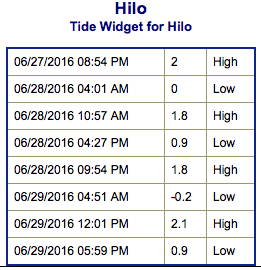
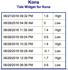
**Click directly on the images below to make them larger. Charts include: Big Island projected winds, tides, swell direction & period and expected wave heights.**
 Big Island Surf Forecast
Hilo side: Wave heights for spots exposed to the trade swell are expected to be around knee/waist/chest high today and easing into Sunday.
Kona side: Wave heights are expected to be waist high today with the best breaks getting chest high on the sets.
South: Wave heights are expected to be waist high today with the best breaks up to chest high on the sets. Strongest around South Point.
 An overlapping pair of southerly swells are maintaining wave heights through Tuesday. These swells will fade from midweek through the weekend. We may get some small overlapping swells for the first week of July.
Trade swell will bring surf to northeast exposures but onshore breeze will pick up quickly during the day to chop it up.
Quiet in the North Pacific at this time with nothing of note generating swell energy for the foreseeable future.
Keep in mind, surf heights are measured on the face of the wave from trough to crest. Heights vary from beach to beach, and at the same beach, from break to break.
**Click here for your detailed Big Island weather report.**
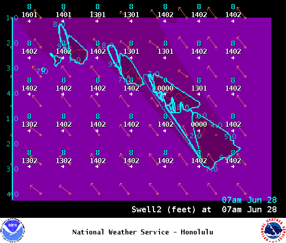
Image: NOAA / NWS
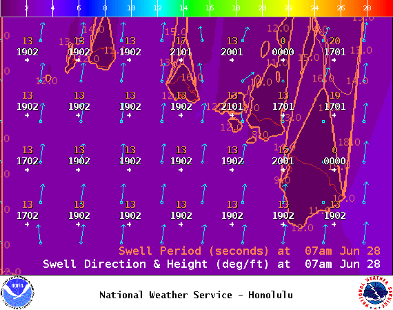
Image: NOAA / NWS
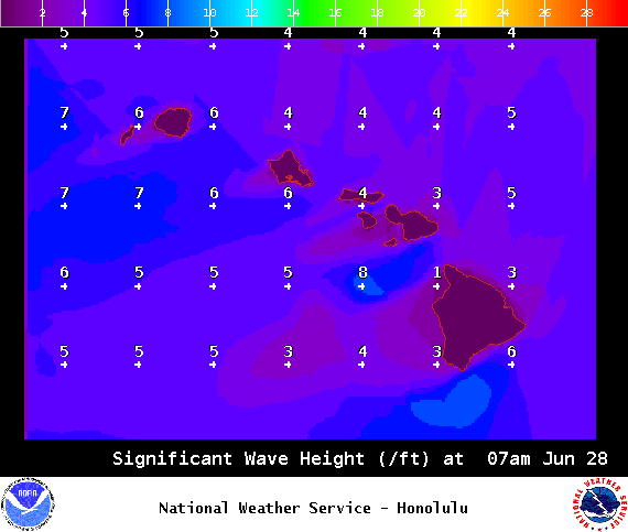
Image: NOAA / NWS
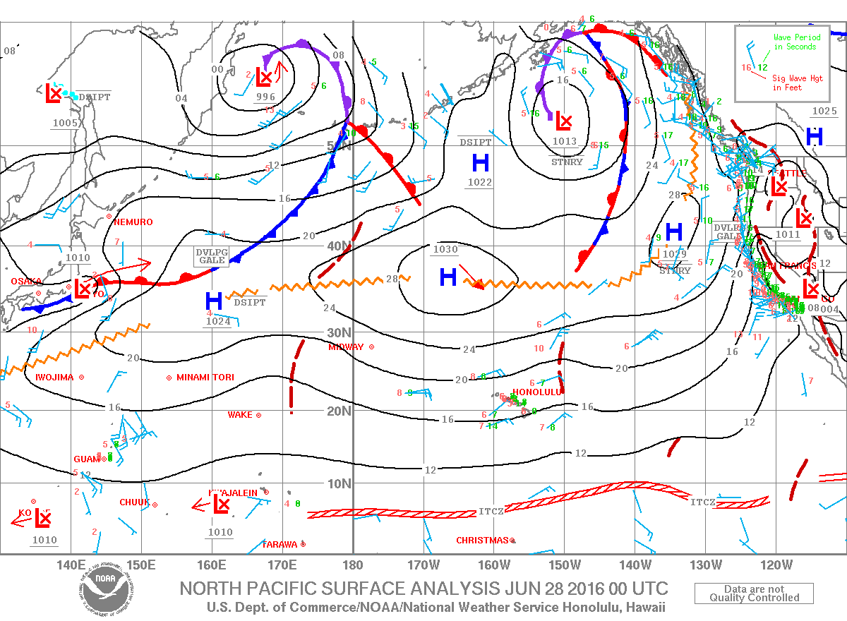
Image: NOAA / NWS
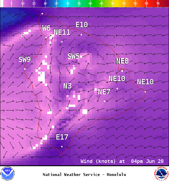
Image: NOAA / NWS
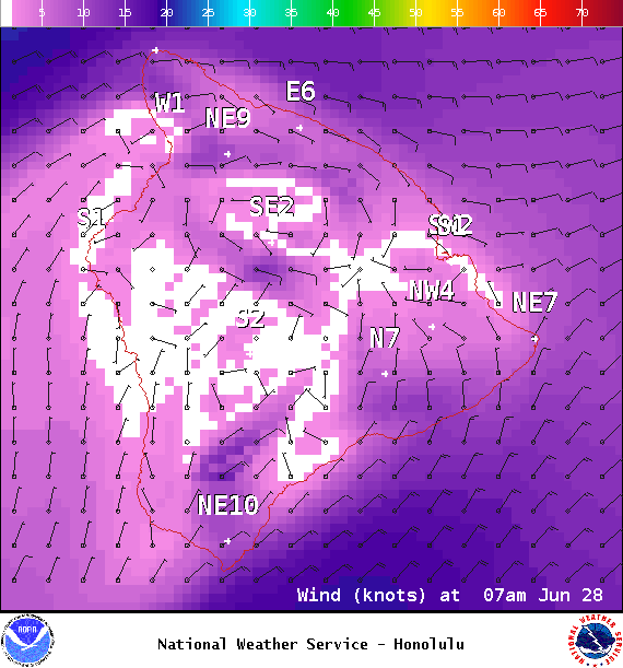
Image: NOAA / NWS
Sponsored Content


