

Trade Swell Continues, WNW Fills in Today
Alerts
A Small Craft Advisory is posted for all Big Island coastal waters and the ʻAlenuihāhā channel through 6 p.m. Thursday for east winds up to 20 knots and seas up to 10 feet.
Check our breaking news section for any urgent weather alerts.
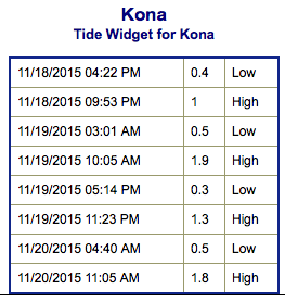
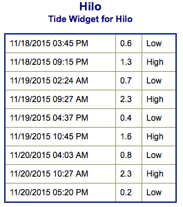
**Click directly on the images below to make them larger. Charts include: Big Island projected winds, tides, swell direction & period and expected wave heights.**
 Big Island Surf Forecast
Hilo side: Wave heights are expected head high today with the best breaks getting up to a few feet overhead from time to time on the sets. Onshore wind will chop it up.
Kona side: Wave heights waist high and up to occasionally chest high. Below waist high for spots catching the south-southwest.
South: Most breaks are knee/waist high. Breaks open to the trade swell could still get up to head high or even overhead.
 A west-northwest continues to fill in today showing best for the Kona side initially but dropping off by the end of the week. Thursday and Friday the swell will shift more out of the northwest and affect the northeast coast of the Big Island with waist/head high waves. The swell fades over the weekend. Aside from a small northwest swell over the weekend, little in the way of northwest swell is expected for the next week.
Trade swell holds through the week with head high to overhead surf.
Mostly tiny swells from the S are expected over the next week, except for a slightly large batch of swell expected Friday and Saturday.
Keep in mind, surf heights are measured on the face of the wave from trough to crest. Heights vary from beach to beach, and at the same beach, from break to break.
**Click here for your detailed Big Island weather report.**
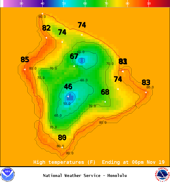
Image: NOAA / NWS
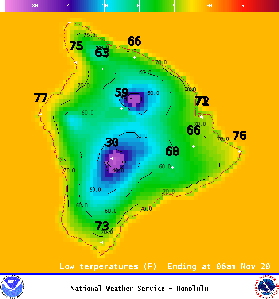
Image: NOAA / NWS
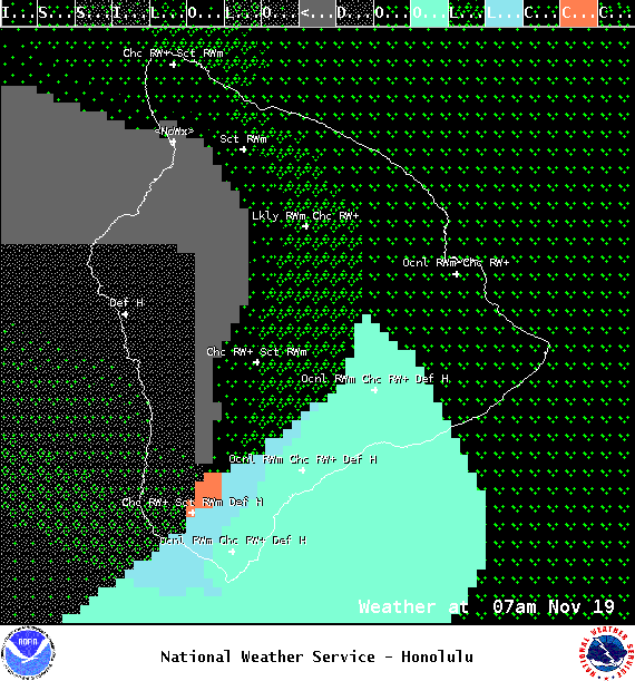
Image: NOAA / NWS
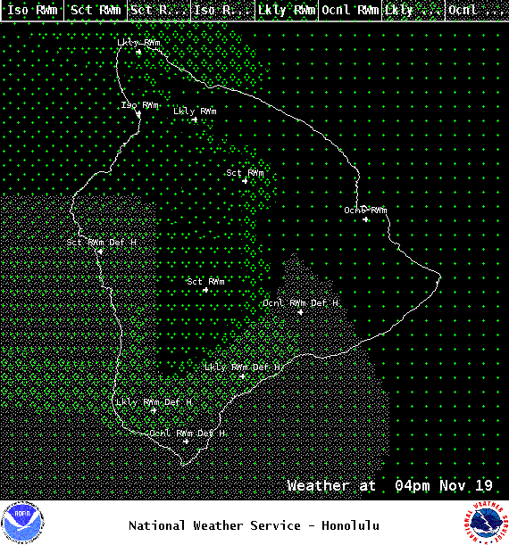
Image: NOAA / NWS
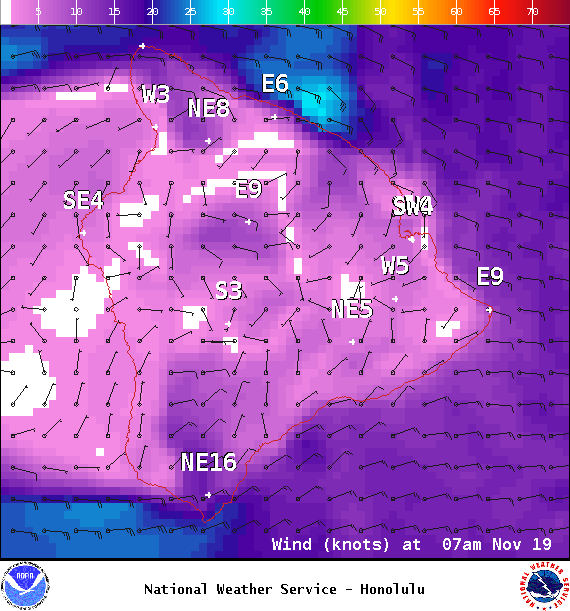
Image: NOAA / NWS
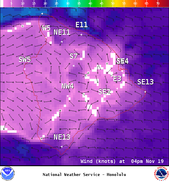
Image: NOAA / NWS
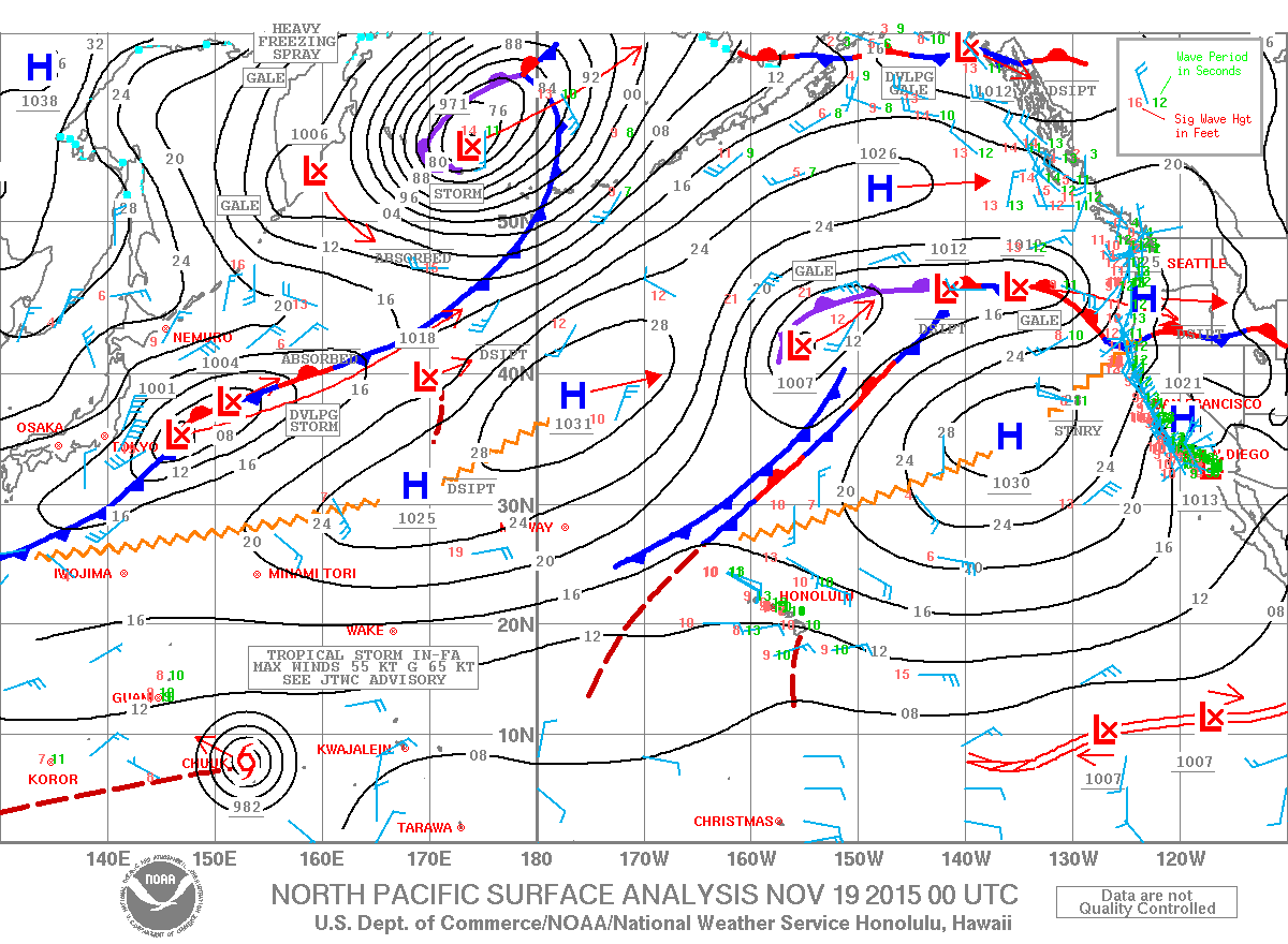
Image: NOAA / NWS
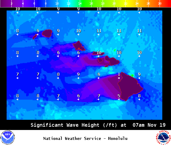
Image: NOAA / NWS
Sponsored Content


