A Flash Flood Watch is posted through Thursday night for an area of moisture moving over the Big Island. Locally heavy rainfall could lead to flash flooding. The highest threat of flooding exists for the Puna, Ka’u and Hilo districts. Flood Advisories and Warnings could pop up if conditions warrant.
A Winter Weather Advisory is posted through noon Friday for the summits of Mauna Kea and Mauna Loa. Freezing rain is expected to create hazardous driving conditions.
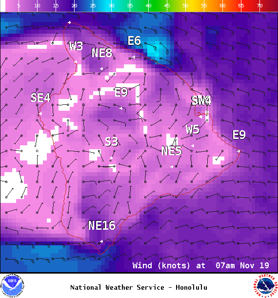
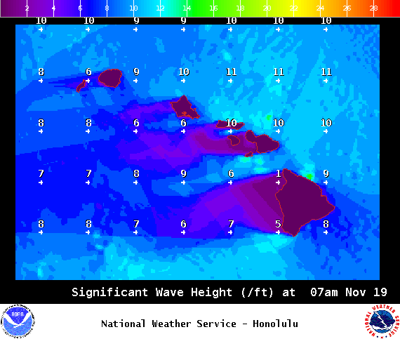
A Small Craft Advisory is posted for all Big Island coastal waters and the ʻAlenuihāhā channel through 6 p.m. Thursday for east winds up to 20 knots and seas up to 10 feet.
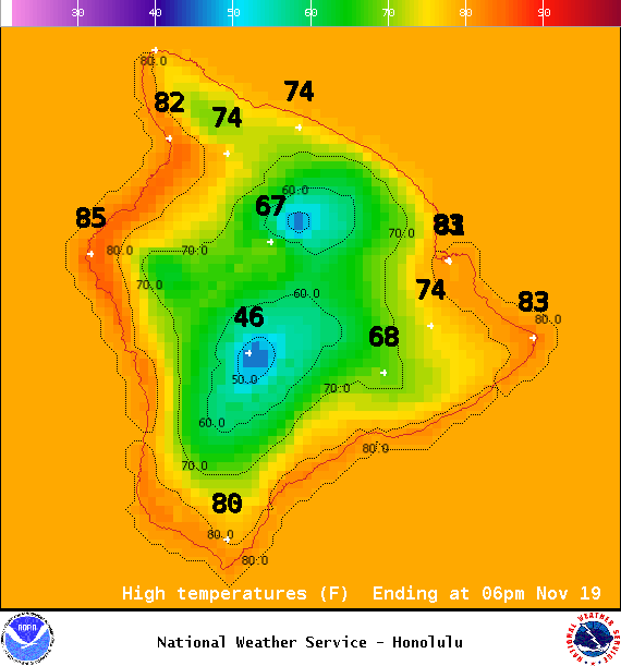
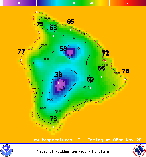
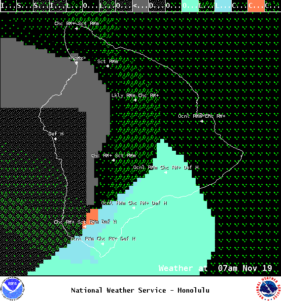
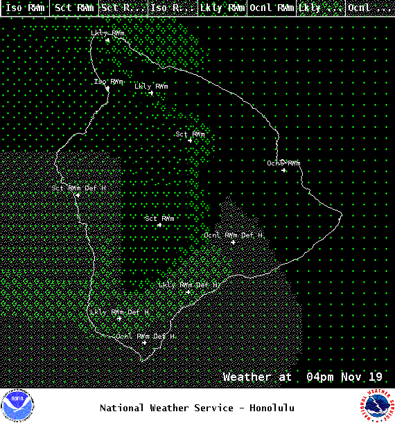
**Click directly on the images below to make them larger. Charts include: Big Island high/low forecasted temperatures, projected winds, chance of cloud cover, projected localized weather conditions, vog/SO2 forecast and expected wave heights.**
+
SWIPE LEFT OR RIGHT
ARTICLE CONTINUES BELOW AD
ARTICLE CONTINUES BELOW AD
Looking Ahead
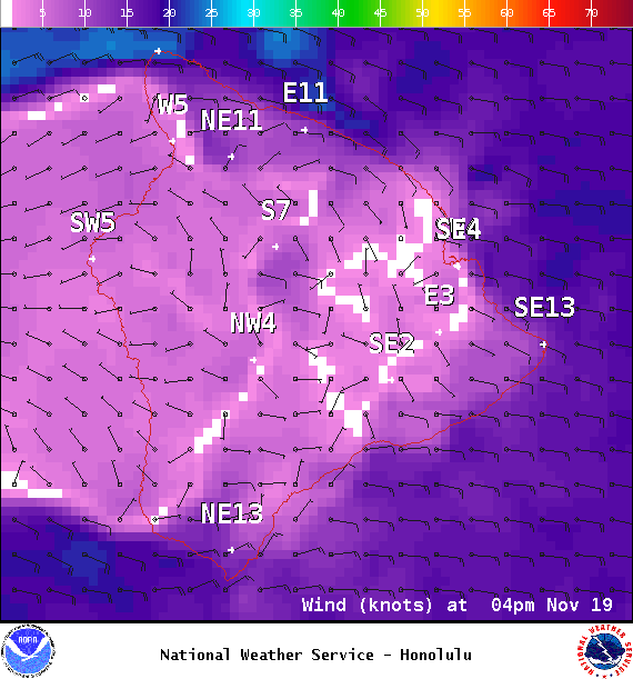
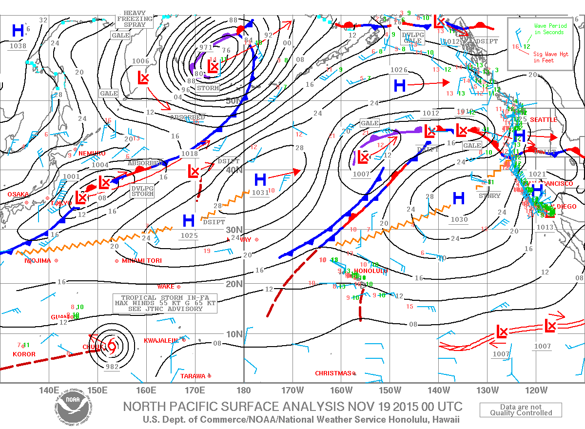
Increasing trades will keep showers focused over windward and mauka areas during the Increased moisture is forecast to move over the islands from the southeast over the next couple of days. The threat of heavy rainfall will also increase. At first, heavy showers will favor windward areas of the islands, affecting the Big Island and Maui into Thursday. As a weak low develops northwest of Kauai this weekend, winds will shift to the south, and showers, some locally heavy, will also affect leeward areas. The unsettled weather pattern may continue over portions of the state through early next week.
Today
ARTICLE CONTINUES BELOW AD
Today mostly cloudy skies are expected. Showers are likely for windward spots. Leeward spots will be partly sunny to start with mostly cloudy skies and scattered showers in the afternoon. Locally heavy rainfall is possible and freezing rain is expected on our highest summits. High temperatures from 82° to 87°. East winds are forecast around 10 to 20 mph.
UV index at 6 (“high” exposure level)
Tonight
East winds are expected in the evening from 10 to 20 mph. Low temperatures from 70° to 75°. Mostly cloudy skies are expected in the evening with showers likely for windward spots. Leeward spots should be partly to mostly cloudy with scattered showers.
This comments section is a public community forum for the purpose of free expression. Although Big Island Now encourages respectful communication only, some content may be considered offensive. Please view at your own discretion. View Comments