

Small Craft Advisory Extended, Large NW Swell Fades
Alerts
The Small Craft Advisory issued by the National Weather Service has been extended to include all Big Island waters through 6 p.m. Thursday. Northeast winds of 20 to 25 knots are expected along with rough seas of 10 to 15 feet.
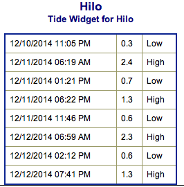
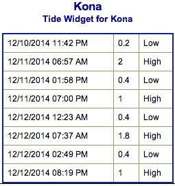
**Click directly on the images below to make them larger. Charts include: Big Island projected winds, tides, swell direction & period and expected wave heights.**
 Big Island Surf Forecast, Thursday December 11, 2014
Hilo side: NW wrapping into select spots on the Hilo side. Surf is expected well overhead to possibly double overhead or more at the best breaks exposed to the swell.
Kona side: Surf is expected knee to maybe head high for the best exposures.
South: Southeast shores open to the trade swell could see waves knee to shoulder high, though moderately choppy conditions are expected. Minimal surf out of the southern hemisphere – knee high or less.
Our current northwest swell (305°-345°) is expected to hold through the morning Thursday. Swell begins to fade late Thursday into Friday. The Kona side is heavily shadowed from this swell.
 A series of swells are expected over the weekend and into next week as well. Next on tap an advisory level swell out of the northwest for Saturday / Sunday. Another northwest swell is expected late next week with another large northwest swell due for next weekend. All dependent on how the storms actually end up developing. Will keep an eye on it.
Super small trace amounts of swell expected out of the SPAC. Not much to get excited about. Late in the weekend or early next week we could see a fun little boost.
Keep in mind, surf heights are measured on the face of the wave from trough to crest. Heights vary from beach to beach, and at the same beach, from break to break.
**Click here for your detailed Big Island weather report.**
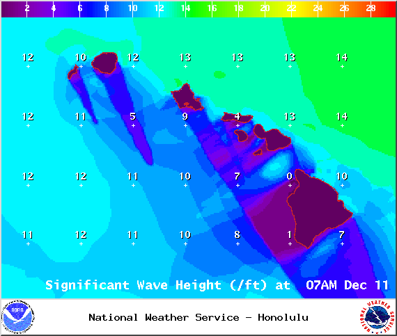
Image: NOAA / NWS
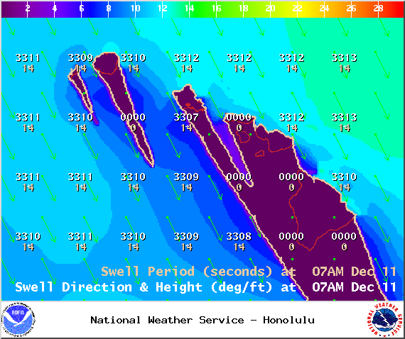
Image: NOAA / NWS
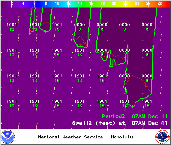
Image: NOAA / NWS
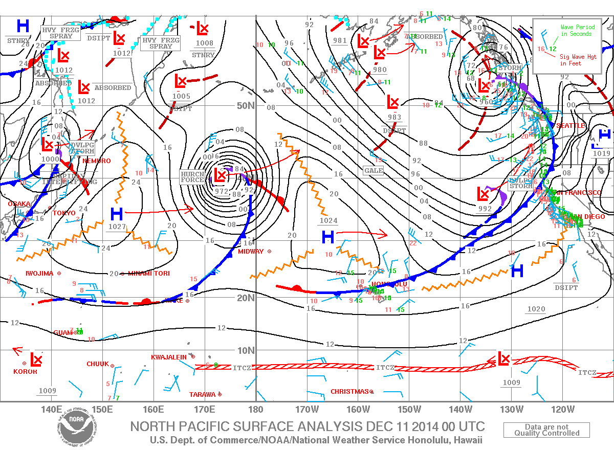
Image: NOAA / NWS
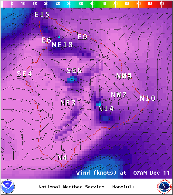
Image: NOAA / NWS
Image: NOAA / NWS
Sponsored Content


