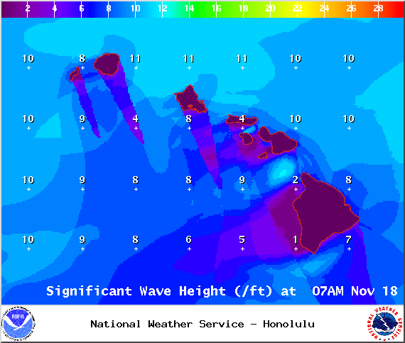
The Small Craft Advisory has been extended. This alert is expected to expire on Wednesday at 6 p.m. for all Big Island waters. We can expect east winds up to 25 knots with rough seas to 12 feet. Inexperienced mariners should avoid navigating in these conditions.
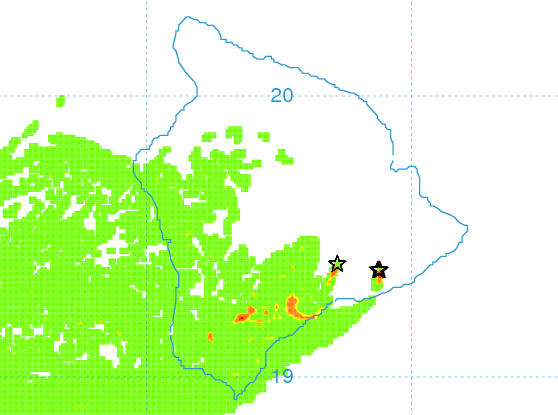
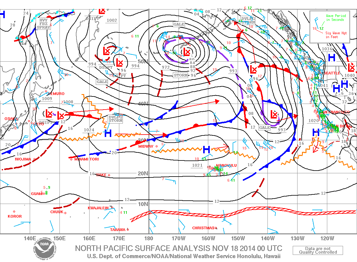
**Click directly on the images below to make them larger. Charts include: Big Island high/low forecasted temperatures, projected winds, chance of cloud cover, projected localized weather conditions, vog/SO2 forecast and expected wave heights.**
+
SWIPE LEFT OR RIGHT
Today, Tuesday November 18, 2014
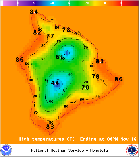
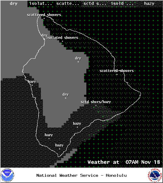
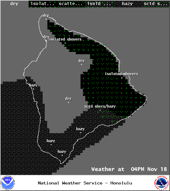
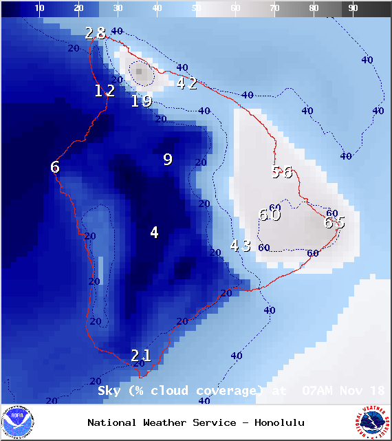
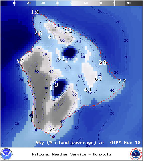
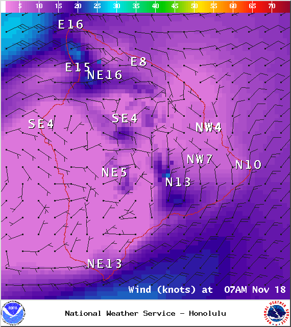
We expect typical trade wind weather. Windward and mauka areas can expect on and off scattered showers and partly cloudy skies during the day. While the Kona side and coastline should have a mostly clear morning before clouds begin to build in the afternoon. The UHSOEST vog model is predicting voggy conditions in Kona and through the area to South Point in the afternoon as the sea breeze pushes the haze back up onto the leeward side. High temperatures should fall in the range of 81° to 86° and around 71° at 5000 feet. In general, trade winds up to 10 to 25 mph are expected.
ARTICLE CONTINUES BELOW AD
ARTICLE CONTINUES BELOW AD
Sunrise: 6:31 a.m.
Sunset: 5:40 p.m.
UV index at 6 (“high” exposure level)
Tonight
ARTICLE CONTINUES BELOW AD
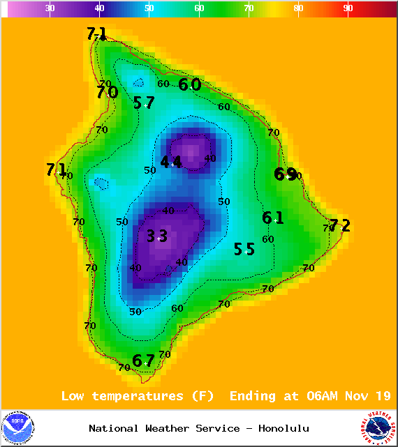
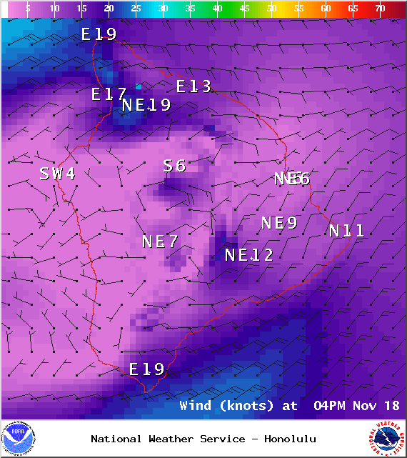
We expect mostly cloudy skies tonight with scattered showers for windward and mauka areas and mostly clear skies in leeward spots. Our natural air conditioning is expected to blow out of the northeast from 10 to 25 mph with higher gusts. Low temperatures should fall in the range of 68° to 73° with a low of about 55° at 5000 feet.
Our current cool, dry trade wind weather conditions are expected to hold through tomorrow. Trade winds are expected to remain breezy through the week with lighter winds currently forecasted for the weekend. Thursday unstable conditions could spawn enhanced showers for Hawaii County. Friday into the weekend there’s the possibility for isolated thunderstorms. Will keep an eye on it and bring you the latest model consensus.
This comments section is a public community forum for the purpose of free expression. Although Big Island Now encourages respectful communication only, some content may be considered offensive. Please view at your own discretion. View Comments