

Ocean Advisories Extended for Large NNW Swell
Alerts
The Small Craft Advisory has been extended. This alert is expected to expire on Wednesday at 6 p.m. for all Big Island waters. We can expect east winds up to 25 knots with rough seas to 12 feet. Inexperienced mariners should avoid navigating in these conditions.
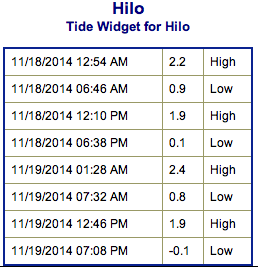
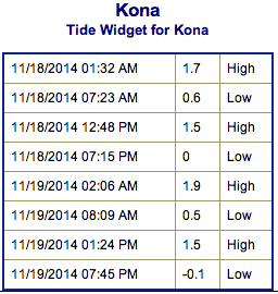
**Click directly on the images below to make them larger. Charts include: Big Island projected winds, tides, swell direction & period and expected wave heights.**
 Big Island Surf Forecast, Tuesday November 18, 2014
Hilo side: Surf is expected overhead to double overhead at the best breaks especially early in the day.
Kona side: Breaks not exposed to the swells will be flat today. Spots that catch some of the new north-northwest wrap could see a slight bump in wave heights possibly up to waist high.
South: Waves expected waist high at best. Southeast shores open to the trade swell could see waves up to shoulder high though sloppy and choppy conditions are expected.
 Our current north-northwest swell (330-350°) is expected to peak overnight then gradually lower Tuesday and Wednesday. The best breaks along the Hamakua coast will be biggest early in the day as surf heights will steadily fade through the day.
Another, but slightly smaller northwest swell is expected to slowly build Wednesday afternoon and peak through the day on Thursday before gradually fading on Friday.
A small bump (220-190°) building on Tuesday and waist high at the best breaks Wednesday through Friday. Otherwise, super small trace amounts of swell expected out of the SPAC. There isn’t much on the horizon to get excited about.
Keep in mind, surf heights are measured on the face of the wave from trough to crest. Heights vary from beach to beach, and at the same beach, from break to break.
**Click here for your detailed Big Island weather report.**
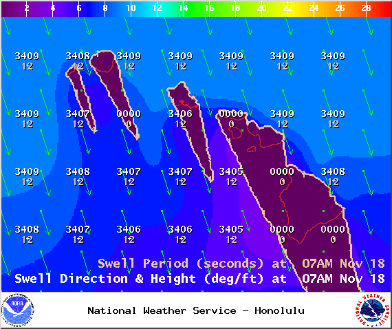
Image: NOAA / NWS
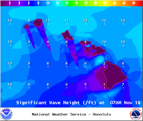
Image: NOAA / NWS
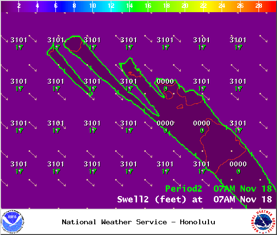
Image: NOAA / NWS
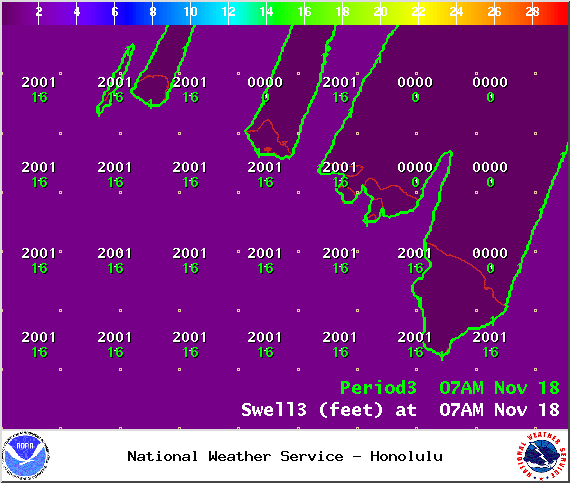
Image: NOAA / NWS
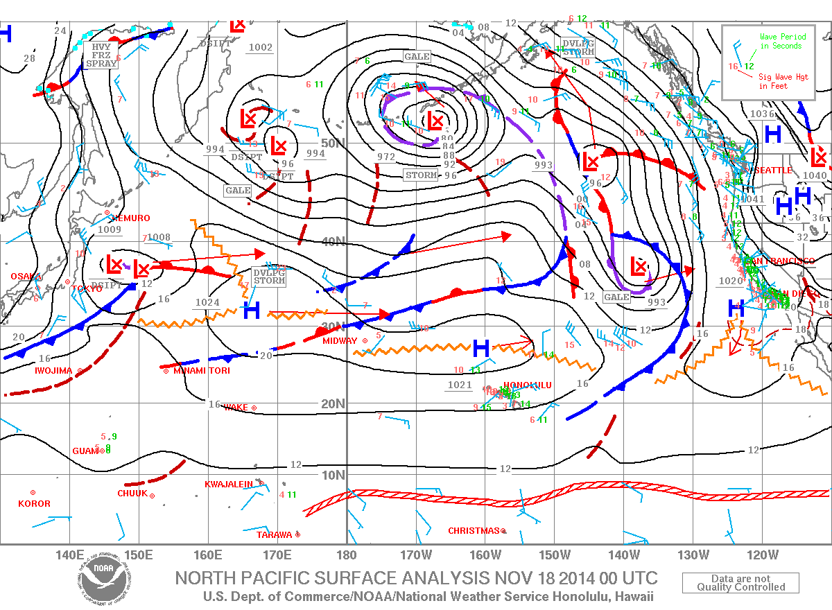
Image: NOAA / NWS
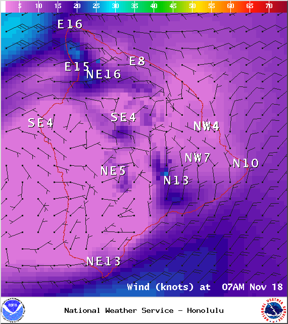
Image: NOAA / NWS
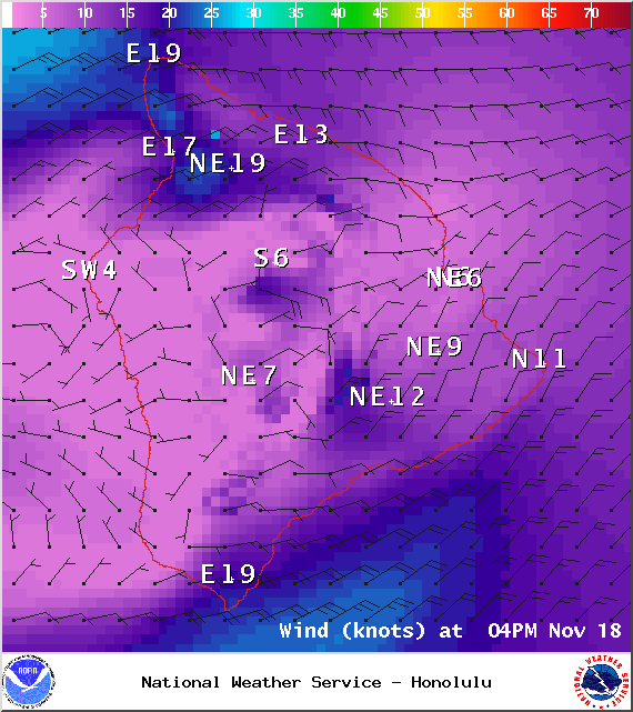
Image: NOAA / NWS
Sponsored Content


