


Nolo stationary south of Big Island; tropical storm conditions, large swells start to impact some areas
Outer rain bands from the storm were already reaching the island by 5 p.m. Friday; hurricane conditions remain possible Saturday morning, along with bands of intense rain and thunderstorms, storm surge and even possible tornadoes or water spouts.
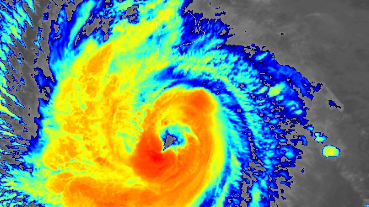
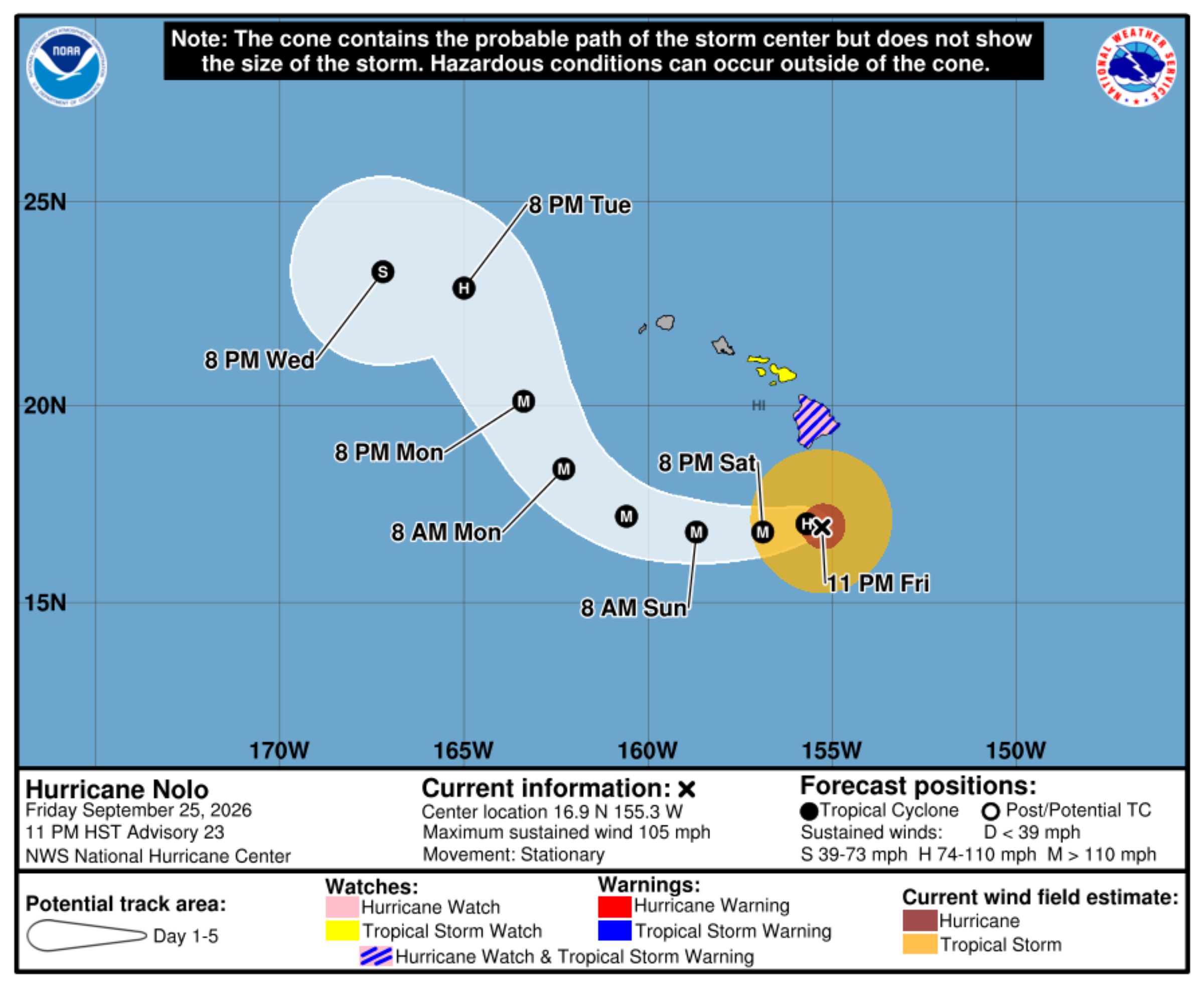
Still a Category 2 hurricane as of the 11 p.m. Friday advisory update from national hurricane forecasters, Nolo remains stationary south of the Big Island.
Maximum wind speeds also are still at 105 mph, with higher gusts, and the storm remains about 145 miles south of South Point. Hurricane force winds extend outward up to 45 miles from Nolo’s center, with tropical storm force winds extending outward up to 140 miles.
A hurricane watch, tropical storm warning, flood watch and high surf advisory for south and east shorelines remain in effect.
Tropical storm conditions and higher gusts are happening now in portions of the Big Island, especially in areas of steep terrain. Hurricane conditions also remain possible Saturday morning, especially over complex terrain.
Several miles of Kohala Mountain Road in the northern part of the Big Island, between Waimea and Hāwī, were closed by authorities Friday night because of dangerous driving conditions caused by high winds.
Large swells generated by Nolo — which are likely to cause life-threatening surf and rip current conditions — also already are affecting exposed east- and south-facing shores of the Big Island.
Outer rain bands of the storm also were starting to reach the island by 5 p.m. Friday.
Nolo is still forecast to strengthen into a major hurricane Saturday and peak in intensity by late Sunday, with weakening expected to begin Monday.
A general westward motion with increasing forward speed is forecast Saturday and Sunday. Nolo is then forecast to make a turn to the northwest and north-northwest Monday.
The center of the storm also is still expected to remain well south and southwest of the main Hawaiian Islands.
Hazards expected to affect land
Wind:
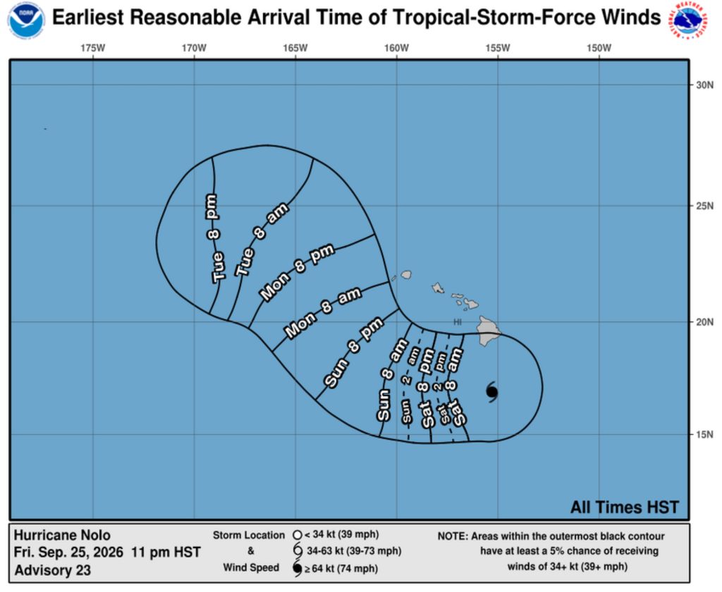
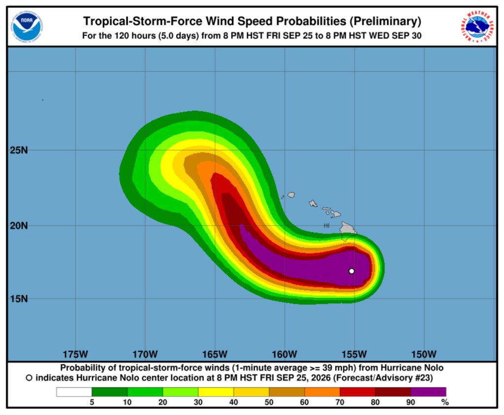
- Tropical storm force winds and gusts already are happening in portions of the Big Island, especially in areas of steep terrain.
- Hurricane conditions also remain possible Saturday morning.
- Regardless of Nolo’s exact track, however, strong and gusty winds are possible through the weekend.
- Tornadoes and waterspouts also remain possible near and over the Big Island, primarily to the right of Nolo’s track.
 Courtesy Graphic: National Hurricane Center and Central Pacific Hurricane Center website
- Courtesy Graphic: National Hurricane Center and Central Pacific Hurricane Center website
Rainfall:
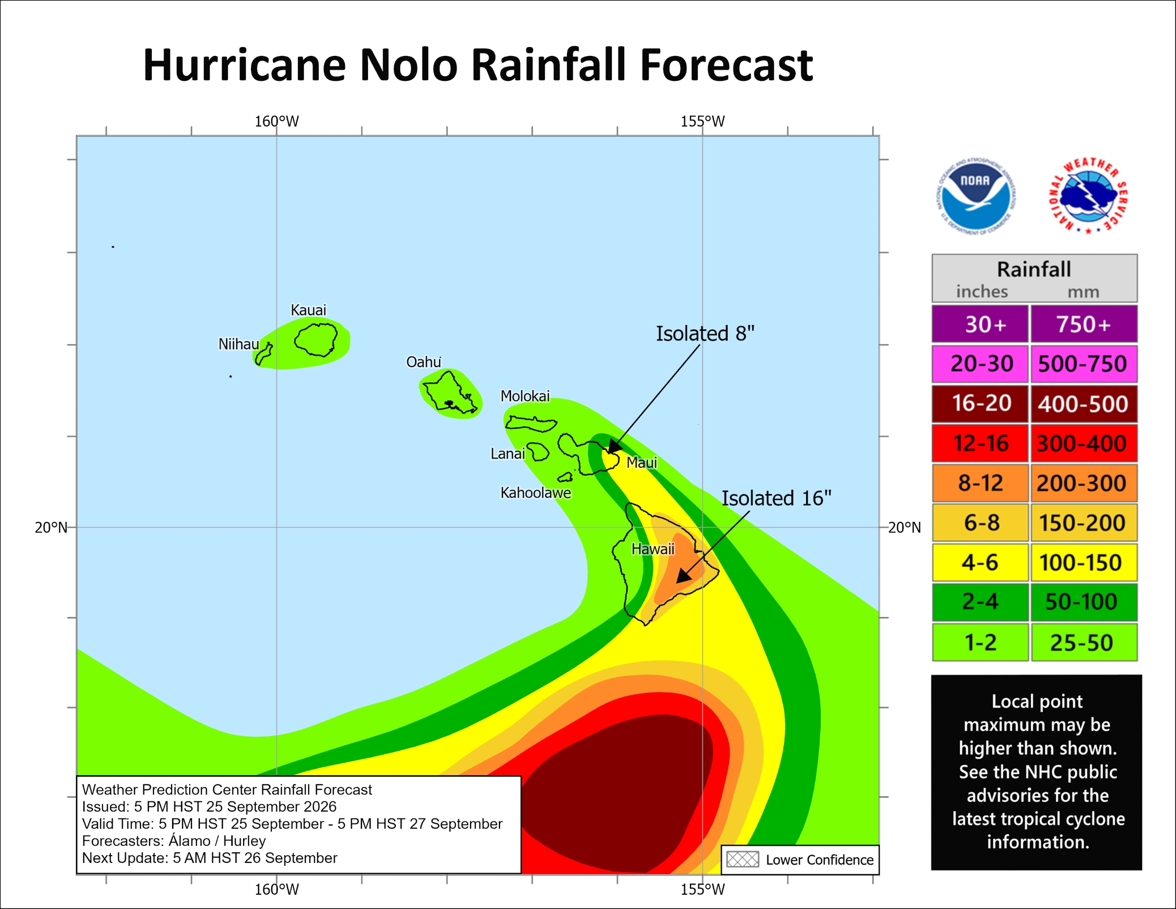
- Bands of intense showers and thunderstorms associated with Nolo over eastern and southern portions of the Big Island will produce rain totals of 8 to 12 inches, with maximum amounts of 16 inches.
- This rainfall could produce significant, life-threatening flooding and mudslides, especially in areas of steep terrain.
- For the western portions of the island, rainfall totals of 1 to 3 inches, with maximum amounts of 6 inches, are expected.
- Periods of heavy rain are expected to expand across the Big Island tonight and continue through the weekend.
Storm surge:
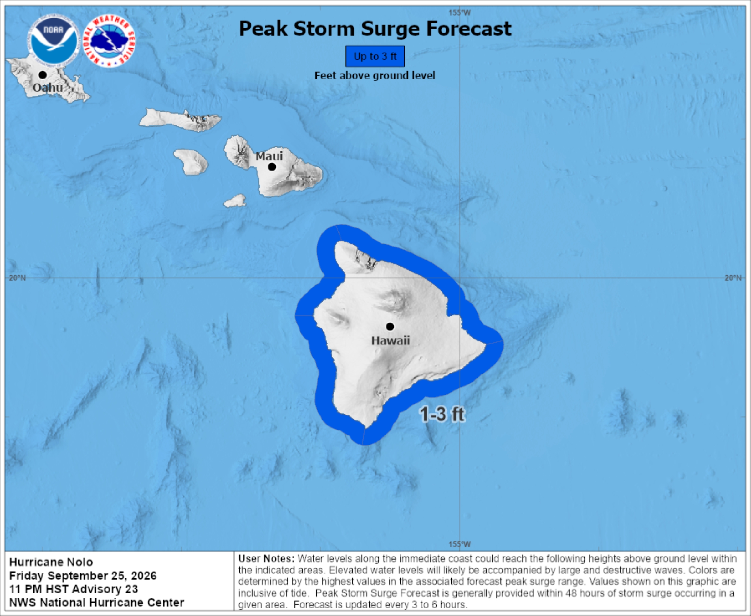
- A combination of dangerous storm surge and tide will cause normally dry areas near the coast to be flooded by rising waters moving inland from the shoreline.
- The water could reach 1 to 3 feet above ground in some areas if peak surge occurs at the same time as high tide.
- The deepest water will occur along the immediate coast and be accompanied by large and dangerous waves.
- Surge-related flooding depends on relative timing of surge and tidal cycle, and can vary greatly over short distances.
Surf:
- Swells generated by Nolo are affecting exposed east- and south-facing shores of the Big Island and expected to spread westward and build through the weekend.
- These swells are likely to cause life-threatening surf and rip current conditions.
Additional forecast discussion
Mid-level high pressure is building north of the islands, which is expected to force Nolo to begin moving slowly westward Saturday morning and then gradually increase in speed during the next couple of days.
A mid-level trough that was steering Nolo northward is forecast to re-amplify west of the main Hawaiian Islands by the end of the weekend, which should cause Nolo to turn northwestward and north-northwestward by Monday and Tuesday.
Nolo’s interaction with the mid-level trough/low could then cause the storm to turn westward again by the early or middle of next week.
Wind shear that has been affecting Nolo is expected to diminish within the next couple of days, allowing the hurricane to strengthen with Nolo likely becoming a major hurricane Saturday and reaching peak intensity by late Sunday.
Deep-layer shear is expected to increase substantially throughout the next 3 days when Nolo begins to interact with the trough, and that should cause the hurricane to weaken and potentially become a tropical storm by the early or middle of next week.
Additional resources
- Disaster preparedness information: American Red Cross.
- Appropriate preparations: Ready.gov.
For storm information specific to your area, including possible inland watches and warnings, monitor products issued by the National Weather Service Honolulu forecast office.
Also be sure to check out “What Big Island residents need to know about Hurricane Nolo” at Big Island Now for information about shelters, closures and other storm-related items that will help keep you safe.








