


Wind advisory remains in effect through 6 p.m. Sunday for the Big Island
A wind advisory will be in effect until 6 p.m. Sunday for the east- northeast of the Big Island, as there is a potential for impacts in those areas from strong trade winds enhanced by terrain as Tropical Storm Moke passes to the south of the state.
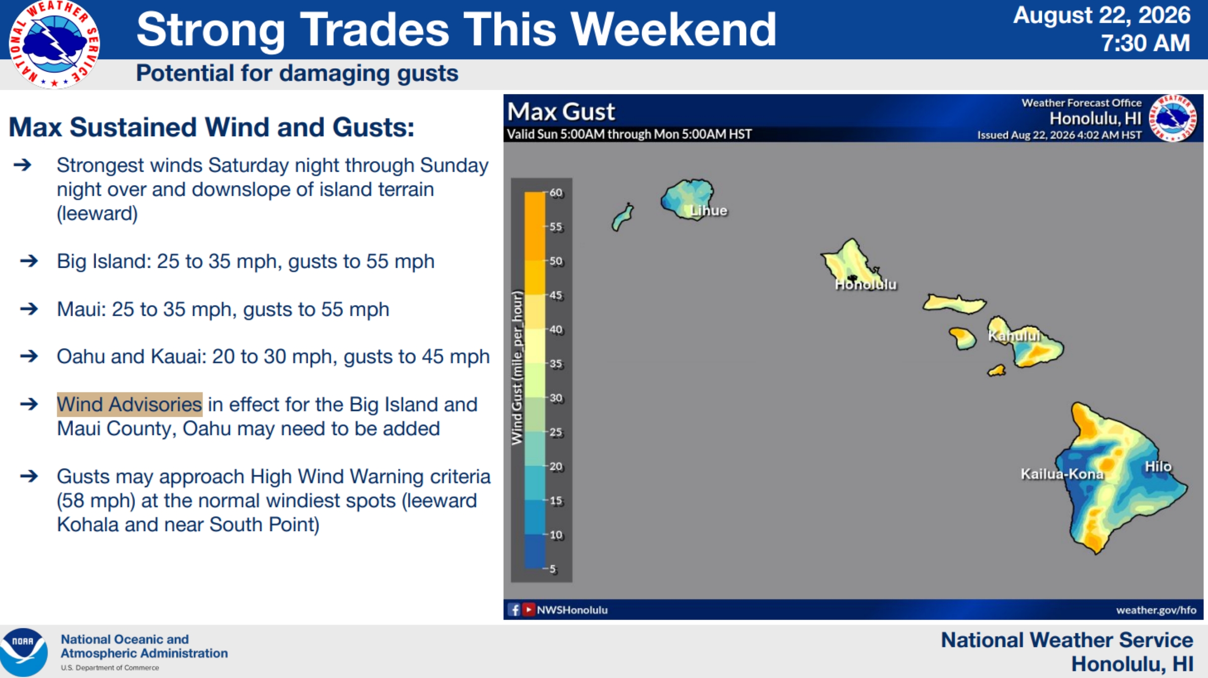
The strongest winds are expected tonight and through Sunday night over and downslope of leeward areas of the island, including over mountain ridges, gaps and where winds blow downslope from higher terrain.
National Weather Service forecasters in Honolulu expect east-northeast winds 25 to 30 mph with gusts up to 50 mph.
Gusts could even approach high wind warning criteria — at 58 mph or stronger — in the normal windiest locations of the island. Strongest sustained winds will occur over and downslope of
mountain ridges and gaps.
Winds this strong can tear off shingles, knock down tree branches, blow away tents and awnings and make it difficult to steer, especially for drivers of high profile vehicles.
Forecasters advise the public to:
- Watch out for falling tree branches when walking or driving.
- Make sure tents and awnings are secure or taken them down.
- Be prepared for power outages.
- Secure trash cans, lawn furniture and other loose outdoor objects that can be easily blown around by strong winds.






