

New Hawaiʻi Island Kingʻs Trail helps hiker traverse 300 miles of coastal pathways
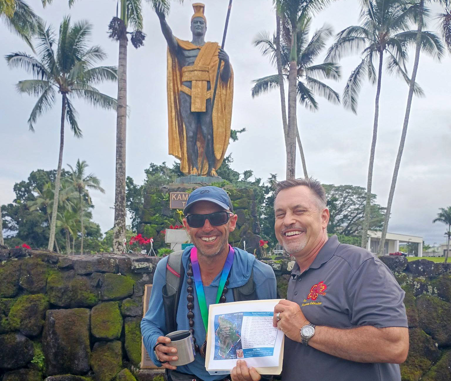
Avid hiker Asa Aue explored his home in a way he never dreamed possible, traversing more than 300 miles along the coastline of Hawaiʻi Island in 12 days.
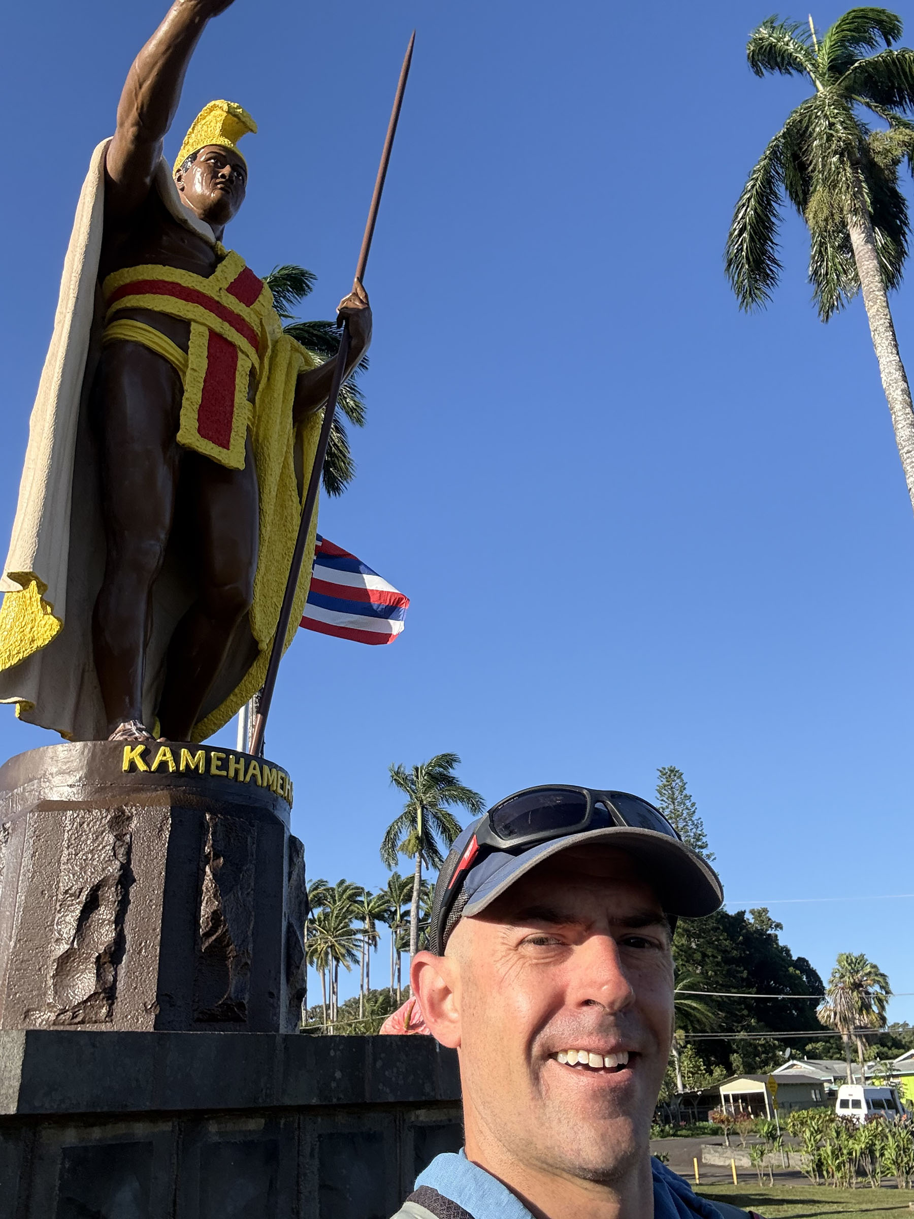
Aue embarked on the challenge of following the Hawaiʻi Island King’s Trail from the King Kamehameha I statue in Kapaʻau to the corresponding statue in Hilo. This trail, also known as the Way of Kamehameha, posed a formidable challenge.
“Growing up here, it was always a goal of mine to walk around the island, but I knew it would be difficult due to private property and dangerous terrain,” Aue said. “But I found that there was this new trail that utilized only public access routes and had been mapped out using GPS.”
The King’s Trail began as a project by Dr. Chad Walker, an avid hiker who was seeking a long, continuous trail on the Big Island. What began as a curiosity resulted in a documented 300-mile coastal route linking the King Kamehameha statue near his birthplace in Kapaʻau to the one in Hilo, the island’s seat of government.
“When I started to put the trail together, I realized that this was the perfect way to honor King Kamehameha I and to bring awareness to the great history and raw beauty of Hawaiʻi,” Walker said. “There is no other place that I know of where you can walk 300 miles of coastline.”
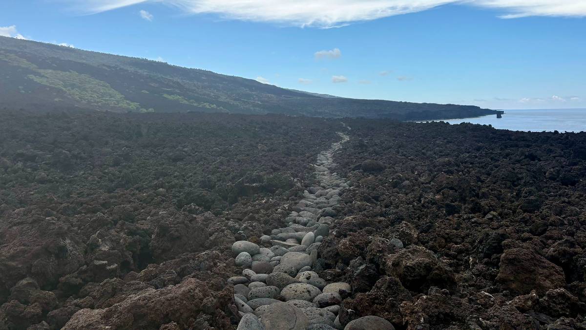
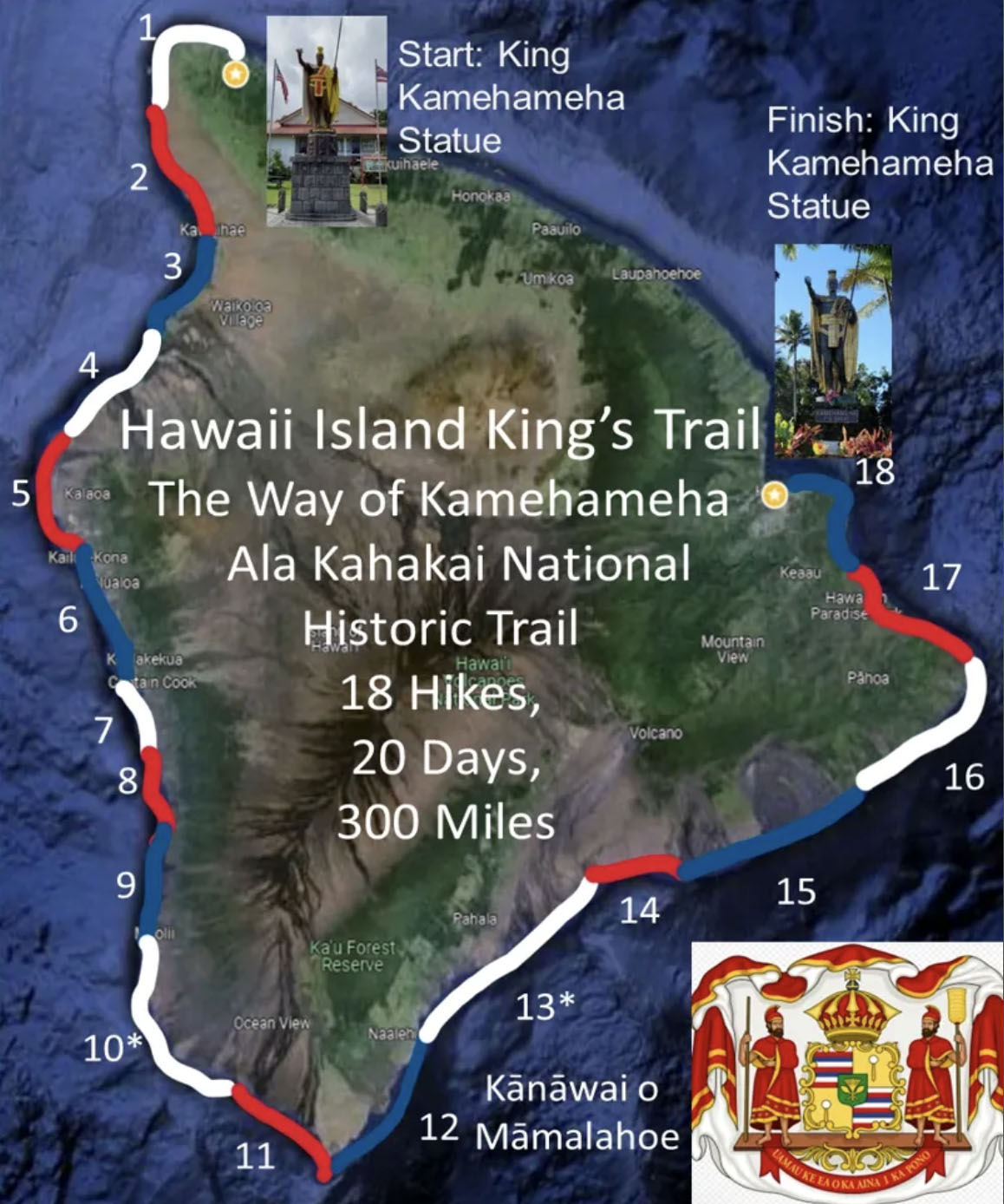
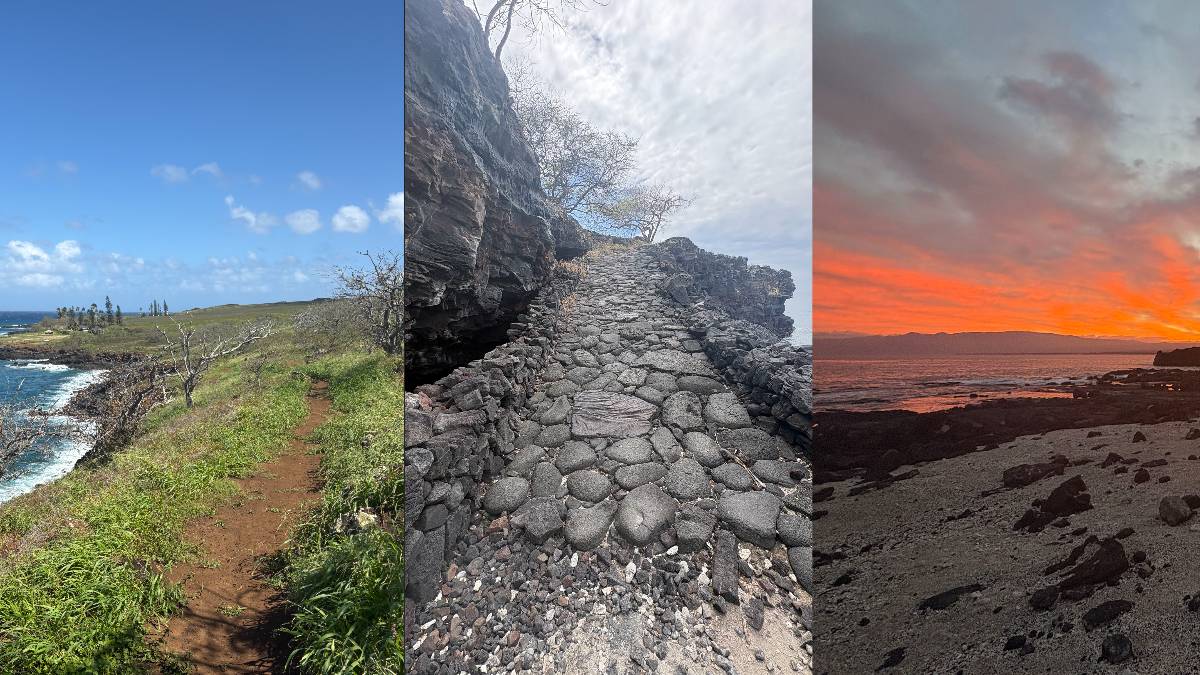
The trail follows ancestral coastal pathways once used by fishermen, families, aliʻi and warriors. It is an advanced hike without transportation, lodging or supply support. The route comprises 18 hike segments intended to be completed in 20 days, though these segments are usually not done consecutively.
There are 16 single-day hike segments and two 2-day overnight segments that traverse National Park, state and county land, along with private property where there are access easements.
The hike segments average about 15 miles each, but the terrain rather than the distance is the primary challenge. Each hike takes between 8 and 10 hours, covering distances that range from 10 to 20 miles depending on the terrain and access points.
Aue is the first person to complete the hike consecutively.
“You definitely could not do this hike without support from someone who could meet you with supplies,” he said. “I had three people meet me with supplies throughout my walk.”
He said there were difficult moments, the hardest being a six-mile section of barren lava fields between Miloliʻi and Manukā.
“The sun beats down on you,” he said. “You’ve got gallons of water on your back, and the ocean can’t help you. It was difficult.”
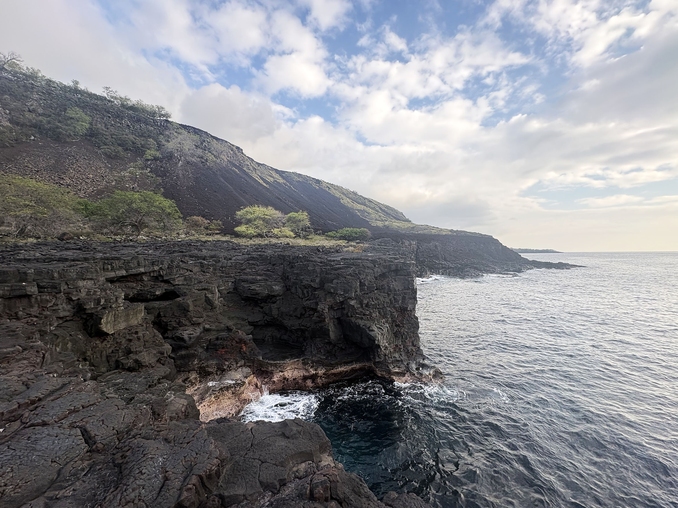
Aue made sure he respected landowners’ boundaries to avoid trespassing, even when navigating the cliffs of Kona.
“One thing that surprised me was that there is always public access to the coast, no matter where you are,” he said. “I know that is the law, but it was cool to see that in action.”
Aue’s favorite part came when he passed Kalae (South Point) in Kaʻū and viewed Kīlauea from a new perspective.
“On these long hikes, the real satisfaction for me comes in the middle of the journey when it becomes difficult or even lonely, but you are reminded in some way of why you are doing it,” Aue said. “When I looked up and saw Kīlauea in a completely new way, that was really satisfying for me.”
He was able to complete this hike due to Walker’s release this year of an official guide to the Hawaiʻi Island King’s Trail. It includes detailed route guidance, practical logistics, and cultural and historical information.
“You just need your smartphone as a navigational device, and it works without service,” Walker said. “It gives you all the information you need to know, which is important since a lot of this hike is dangerous and should be done only by advanced hikers.”
Of the 300-mile route, approximately 250 miles are on coastal trails with only 50 miles on paved roads. Hāmākua is the only district not included due to the lack of coastal trails available and the difficulty and sacred nature of the steep valleys.
A significant portion of the trail is the Ala Kahakai National Historical Trail Corridor, which covers 175 miles. It represents a coastal network of ancient, historic and modern trails from Hawaiʻi Island’s north to the eastern boundary of Hawaiʻi Volcanoes National Park.
Initially, Hawaiʻi Island trails followed the natural contours of the land, connecting communities via a diverse network of coastal and mountain-ocean trails.
Although undocumented at first, in 1892, Queen Liliʻuokalani declared all existing trails to be public highways. The Ala Kahakai Trail Association has been dedicated to reconnecting Native Hawaiians with these ancient trails. Walker helped document them on a map for easier navigation.
The HIKT Hiker Guide to the Big Island, Hawai’i is mandatory for those interested in experiencing the trail. The guide includes a calendar of group hikes and allows anyone to join at any time.
“I became passionate about this project because I am dedicated to honoring Hawaiʻi history by physically perpetuating it,” Walker said. “The challenge has created a space for healing, connecting and growth.”
Aue is now the 11th person to complete the Hawaiʻi Island King’s Trail. For more information, visit the Hawaiʻi Island King’s Trail website.
Editor’s note: An earlier version of this story misspelled Dr. Chad Walker’s name. We apologize for the error.
Sponsored Content


