New Map Shows Lava Flow Thickness in Lower East Rift Zone
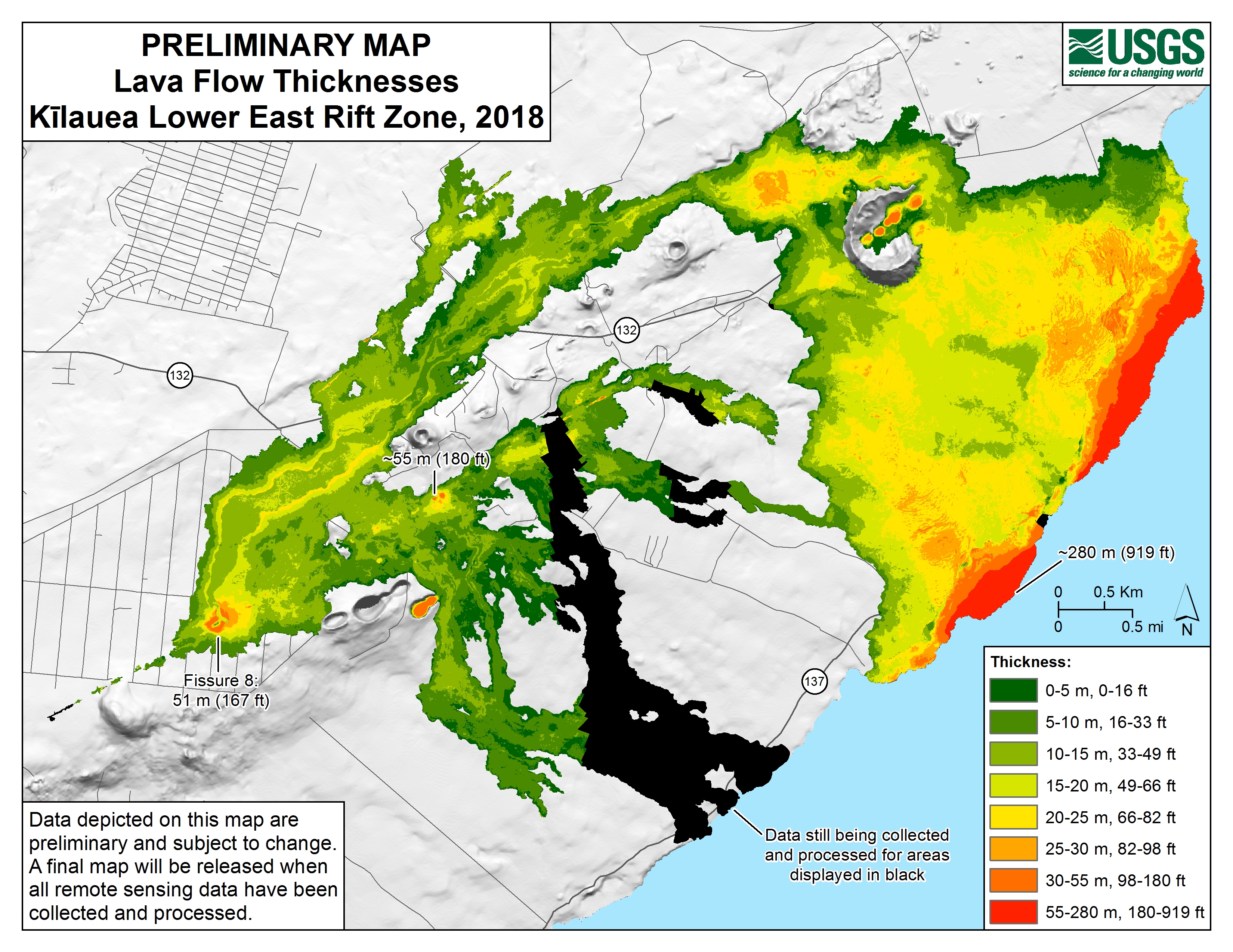
Data depicted on this preliminary map of Kīlauea lower East Rift Zone lava flow thicknesses are subject to change. A final map will be released when all remote sensing data have been collected and processed.
Lava flows erupted from fissures 1-24 in 2018, which buried an area of about 13.7 square miles and added about 875 acres of new land to the island, vary in thickness across the flow field. The greatest thickness on land, at fissure 22, is approximately 180 feet, and the greatest thickness in the lava delta (new land created where lava entered the ocean) is approximately 919 feet. These values could change when data are finalized.
Sponsored Content
Comments


