

New Map Shows Where Lava Flow Crossed Pohoiki Road
The U.S. Geological Survey released this map and these pictures of the East Rift Zone on Monday, May 28, 2018.
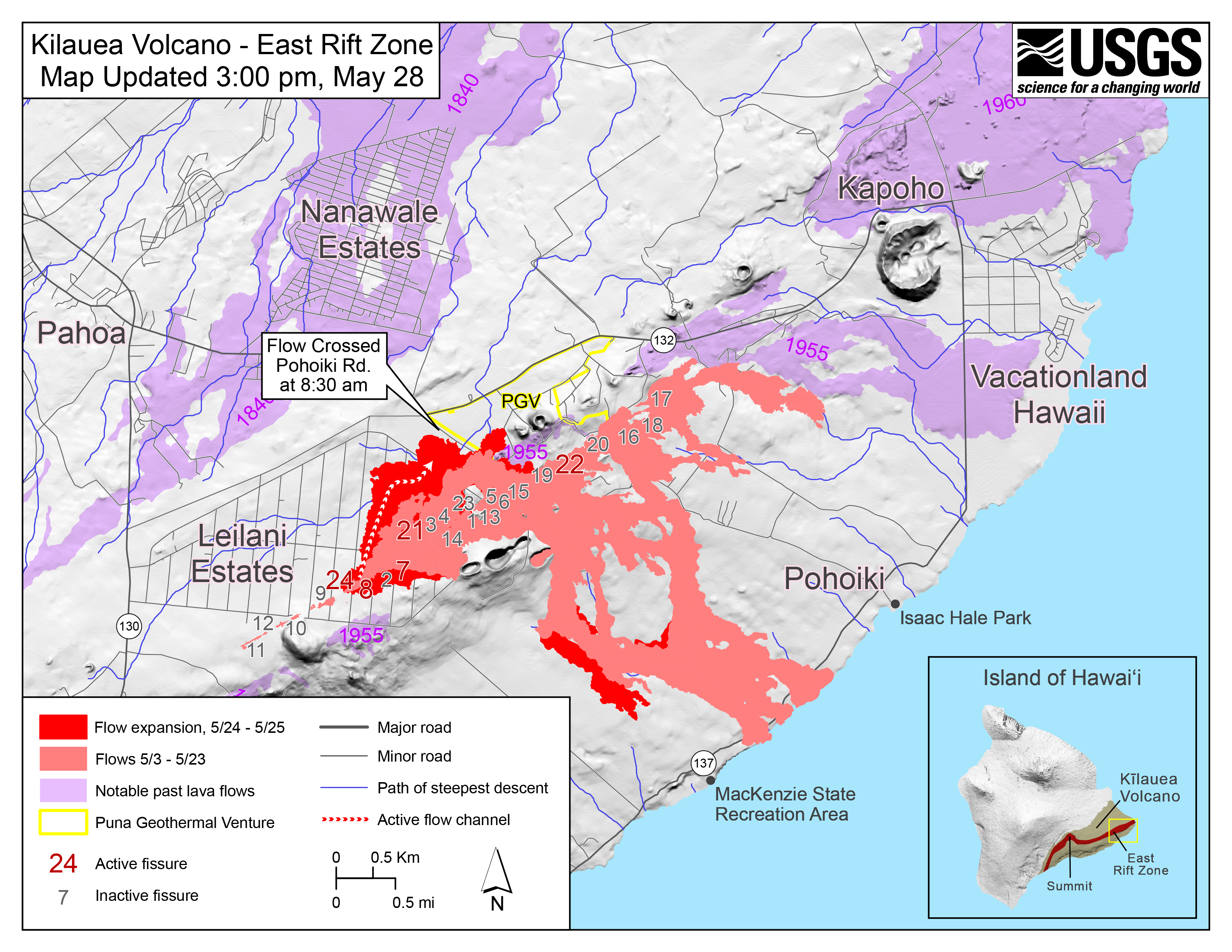
Map as of 3:00 p.m. HST, May 28, 2018. Shaded purple areas indicate lava flows erupted in 1840, 1955, 1960 and 2014-2015. (Click to enlarge)
View of the fissure complex looking toward the southwest (uprift) during Monday, May 28, 2018 overflight at about 1:15 p.m.

The channelized lava flow in upper left originates from fissure 22. Click to enlarge
The small lava flows spreading to the southeast from the fissure complex (lower middle) originate in the area of between fissures 16 and 18.
View of the fissure complex is toward the southeast during this afternoon’s overflight of the lower East Rift Zone at about 1:15 p.m. HST.

Click to enlarge
The lava channel in middle of photograph is filling with lava erupted from fissure 22.
View of the now-sluggish lava flow that crossed Pohoiki Road earlier today; the flow originated from fissure 8. This fissure was very active overnight, slowed this morning, and stopped by about noon.

This photo was taken at about 1:45 p.m. Compare with photo above. (Click to enlarge)
During the close of an overflight this afternoon, lava began erupting downrift of fissure 8 in the area between about fissure 7 and 21 (low fountains in upper right). This photo was taken at about 1:45 p.m. HST. Compare with photo above.
Close view of weak ocean entry at about 1:05 p.m. Monday, May 28.

Only small and intermittent “laze” plumes have been observed Monday, May 28. The vents that supplied lava to the flow and sea stopped erupting overnight, and only residual lava still hot within the flow occasionally spilled into the sea today.
Sponsored Content


