


New Map Shows Location of Lava Flow Spreading
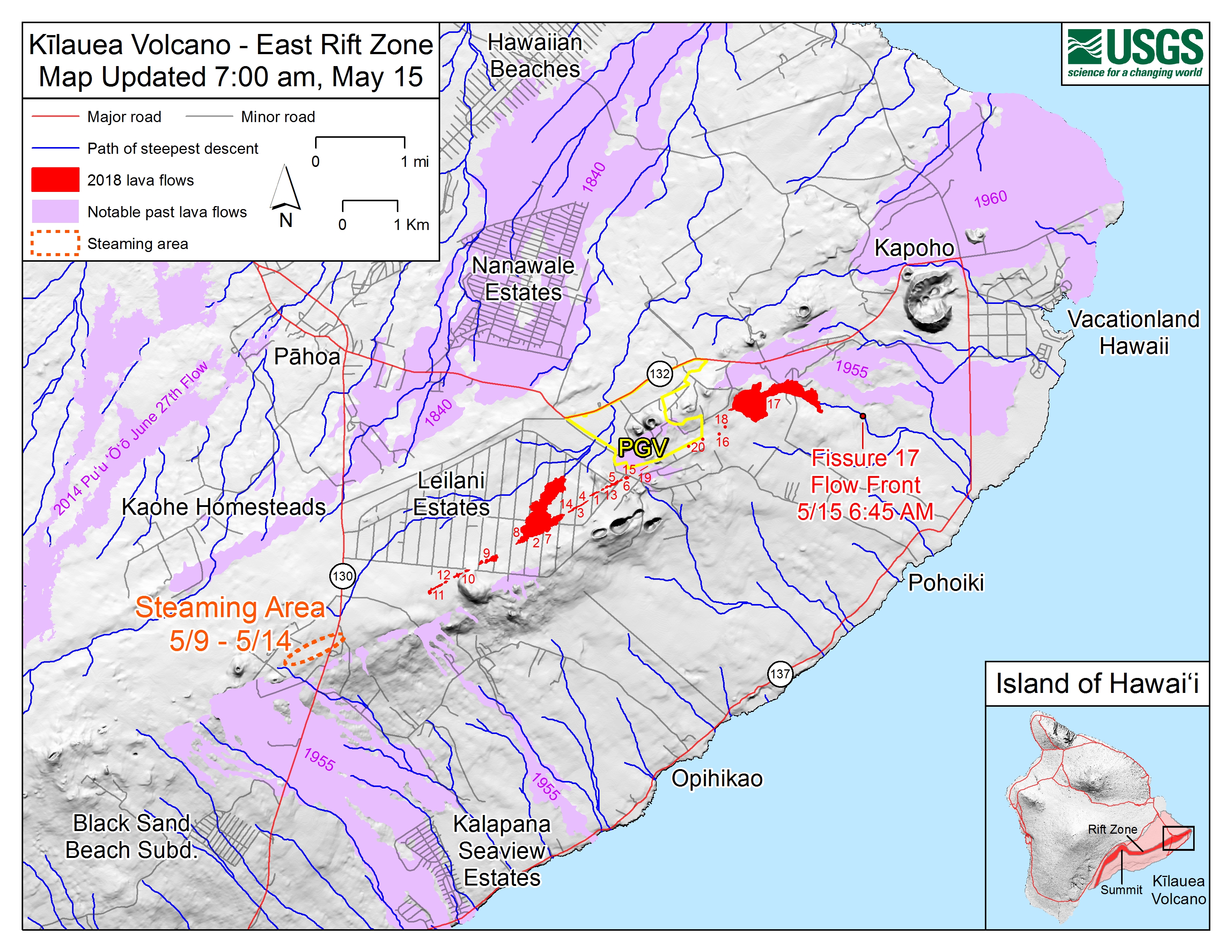
The U.S. Geological Survey released this map of the East Rift Zone as of 6:45 a.m. May 15, 2018, shows the location of the ‘a‘ā lava flow spreading from fissure 17.
Click to enlarge
The flow front at the time is shown by the small red circle with label. The flow is following well a path of steepest descent (blue line), immediately south of the 1955 ‘a‘ā flow boundary. Shaded purple areas indicate lava flows erupted in 1840, 1955, 1960, and 2014 – 2015.
ADVERTISEMENT






