

Light East Winds Today, Possible Wet Weekend

Image; James Grenz
Alerts (as of 1:00 a.m.)
Small Craft Advisory: Alenuihaha through 6 a.m. Thursday.
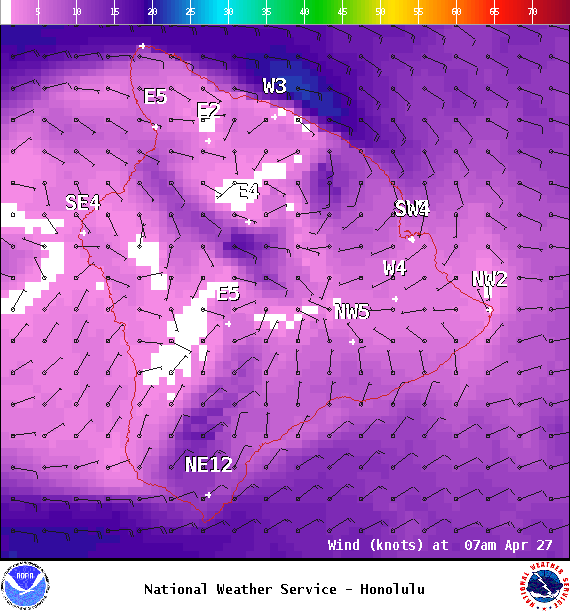
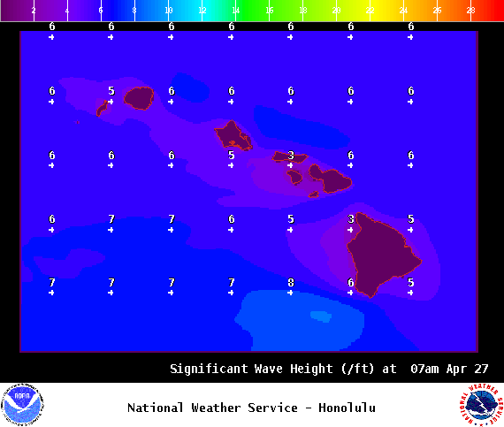
**Click directly on the images below to make them larger. Charts include: Big Island high/low forecasted temperatures, projected winds, chance of cloud cover, projected localized weather conditions, vog/SO2 forecast and expected wave heights.**
Looking Ahead
Winds are forecast to ease and shift out of the southeast Thursday as a front approaches. That means our weather pattern will also shift to spotty afternoon showers for interior and leeward areas instead of our usual windward and mauka showers. Friday, the front is forecast to bring increasing clouds and rain to Kauai, with prefrontal showers (some heavy) for the rest of the state. Wet and unstable conditions are expected over portions of the state over the weekend and into next week.
Today
We expect east winds today around 15 mph. High temperatures are forecast from 82° to 87°. Partly sunny skies with scattered windward showers and scattered afternoon showers for leeward areas as clouds build.
UV index at 12 (“extreme” exposure level)
Tonight
East winds are forecast around 15 mph. Mostly cloudy skies with windward scattered showers and isolated showers for the Kona side. Low temperatures from 69° to 74°.
Our Big Island Now Weather homepage always includes daily: Sunrise | Sunset | Moonrise | Moonset | Moon Phase | Live Weather Cams | 5-day Forecast | Current Temperature & Conditions
**Click here for your detailed Big Island surf report.**

Image; NOAA

Image; NOAA

Image; NOAA

Image; NOAA

Image; NOAA
Image; NOAA
Image; NOAA
Image; NOAA
Sponsored Content


