

UPDATE: No Tsunami Threat From 4.5 Kawaihae Quake
The National Weather Service Pacific Tsunami Warning Center in Ewa Beach reports that no tsunami has been generated from a 4.5 earthquake that occurred offshore from Kawaihae on the Big Island (20.1 north, 156.1 west) at 5:34 a.m., HST, Feb. 17, 2017.
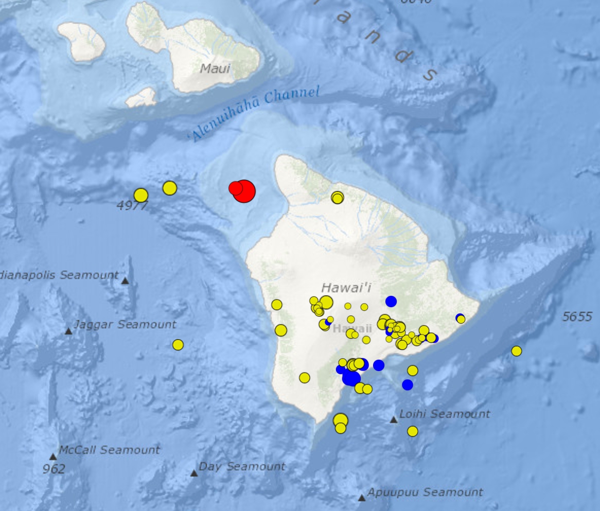
UPDATE: The U.S. Geological Survey’s Hawaiian Volcano Observatory (HVO) recorded a magnitude-4.6 earthquake between the Islands of Hawaiʻi and Maui on Friday, Feb. 17, at 5:33 a.m., HST.
According to Brian Shiro, HVO’s Seismic Network Manager, this earthquake was centered about 15 miles northwest of Kawaihae, Hawaiʻi, at a depth of 26 miles
The earthquake was felt throughout the island chain, from Hawaiʻi to O‘ahu, with the USGS “Did you feel it?” website receiving 1,300 felt reports within two hours of the earthquake.
Light shaking, with maximum Intensity of IV, has been reported across the islands. At that intensity, damage to buildings or structures is not expected.
The depth, location, and recorded seismic waves of today’s earthquake suggest a source due to bending of the oceanic plate from the weight of the Hawaiian Island chain, a common source for earthquakes in this area. Aftershocks are possible and could be felt.
The earthquake caused no detectable changes in Kīlauea Volcano’s ongoing eruptions, on Mauna Loa, or at other active volcanoes on the Island of Hawaiʻi.

Location with respect to nearby cities:
14 miles NW (313 degrees) of Puako, HI
17 miles SW (224 degrees) of Hawi, HI
17 miles WNW (300 degrees) of Waikoloa Village, HI
66 miles WNW (292 degrees) of Hilo, HI
145 miles SE (126 degrees) of Honolulu, HI
Sponsored Content


