

New SSW, NE, and NW Swells Build Today

Image: James Grenz
Alerts (as of 1:00 a.m.)
There are no marine alerts posted at this time.
**Click directly on the images below to make them larger. Charts include: Big Island projected winds, tides, swell direction & period and expected wave heights.**
 Big Island Surf Forecast
Hilo side: Wave heights are forecast to be shoulder/head high today for the best breaks with sets getting overhead.
Kona side: Wave heights are expected to be knee/waist high today. Wrap from the northwest swell is also mixing in today.
South: Wave heights are expected to be knee/waist high today.
 North-northeast swell lingers and eases as a slightly longer pulse of north-northeast builds Tuesday, then peaks Tuesday night and Wednesday morning.
A new northwest swell is expected for Thursday and Friday.
A new south-southwest swell is expected to build today for the 11th through the 13th. No significant swells are on the horizon after this swell.
Keep in mind, surf heights are measured on the face of the wave from trough to crest. Heights vary from beach to beach, and at the same beach, from break to break.
**Click here for your detailed Big Island weather report.**

Image: NOAA

Image: NOAA

Image: NOAA
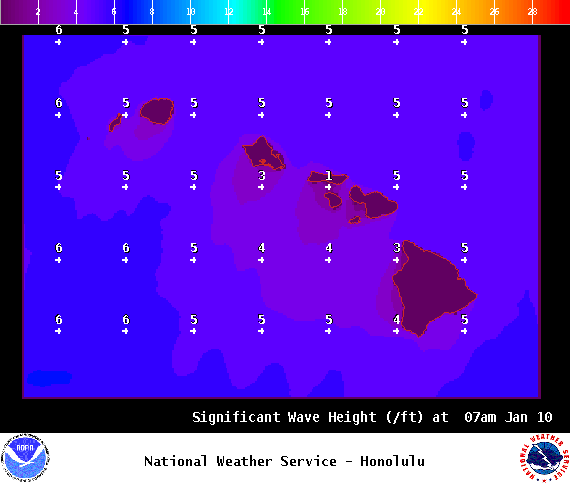
Image: NOAA

Image: NOAA
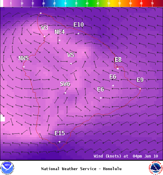
Image: NOAA
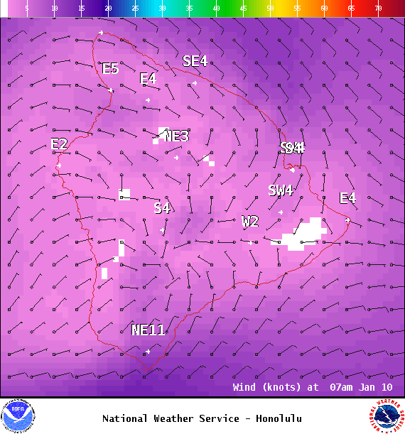
Image: NOAA
Sponsored Content


