

SLIDESHOW UPDATE: Crusin’ with Tita Nui: Laupāhoehoe
While the scenic overlook on the highway gives you a beautiful view of Laupāhoehoe Point, it is worth the drive down to take a closer look and get a better feel of the area.
It’s a perfect location for anyone wanting to escape the bustle and noise of more popular and crowded beach parks on the island.
Exercise caution while descending the narrow, curvy paved road that leads down to the “point” as it is known to the area locals.
The drive down will leave you in awe as you see the gorgeous views of the spectacular sea cliffs and homes that are perched upon them.
Tragedy struck this little community when the 1946 April Fool’s Day tsunami killed 19 schoolchildren and five adults. You can find a memorial monument with engraved names and ages of the victims tucked in a little corner of the park.
Today, Laupāhoehoe is a beautiful grassy park lined with tall coconut trees and other lush vegetation.
The azure color of the ocean is nearly indescribable—especially on a beautiful sunny day.
This spot makes a perfect backdrop for pictures or just somewhere to relax and unwind.
The ocean, while beautiful to look at, can be very dangerous for swimming. Standing on the rocky peninsula, one can easily see how dangerous the waves are as they roll in and crash down on to the shore.
Sticking to exploring the tidepools near the shoreline is recommended instead.
After your visit to the point, make some time to stop by the Laupāhoehoe Train Museum, which honors the old Hawaii Consolidated Railway that transported passengers and their goods along the Hamakua Coastline.
Laupāhoehoe has a population of barely 600 people, based on the 2010 US Census.
The area has a rich history tied to the Hawai‘i sugarcane industry. Sugarcane fields have now been replaced with forest of eucalyptus trees..
It may appear as just a tiny pinpoint on the map, however Laupāhoehoe is a beautifully peaceful historical location, just waiting to be explored.
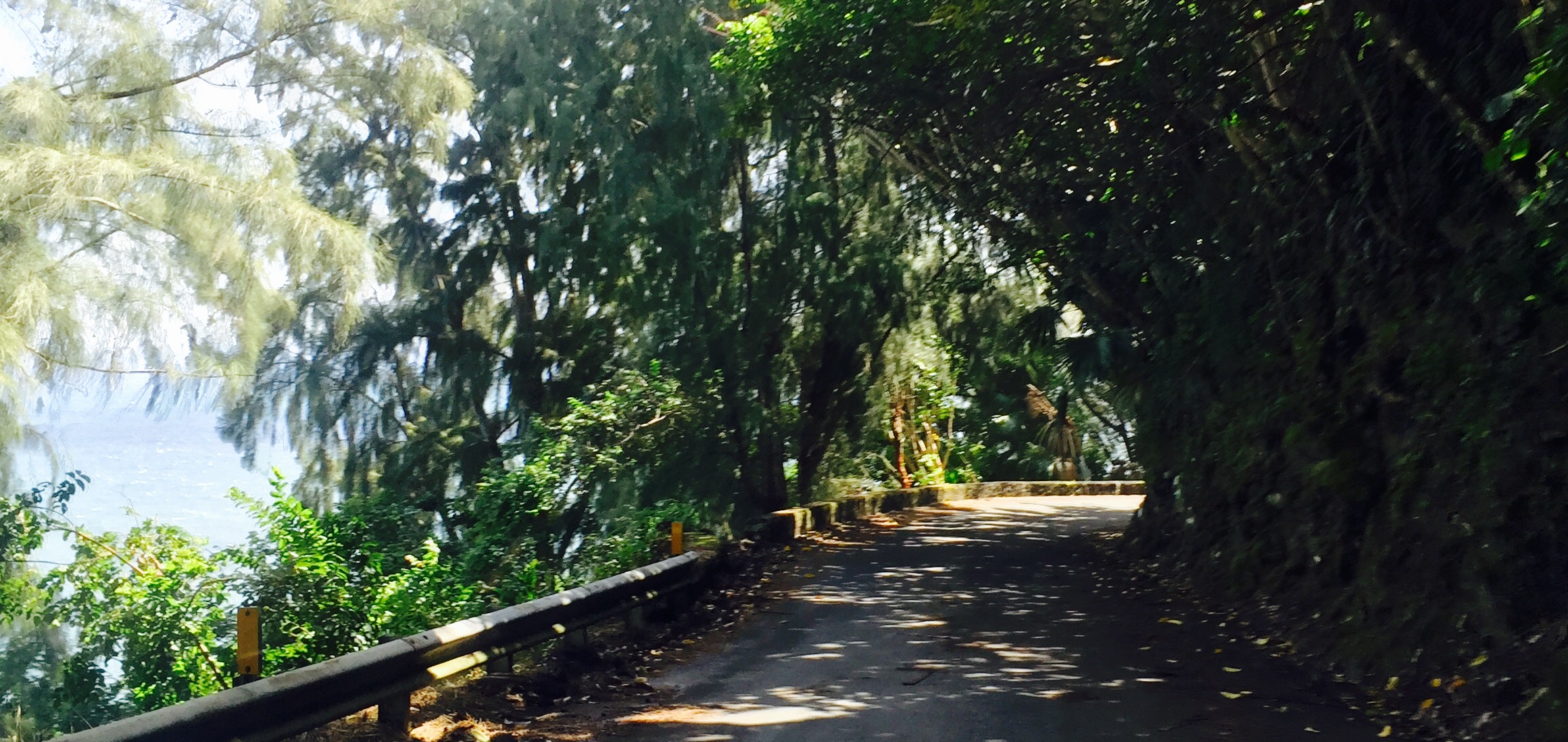
Narrow, windy road leading down to Laupāhoehoe Point. Photo: Darde Gamayo
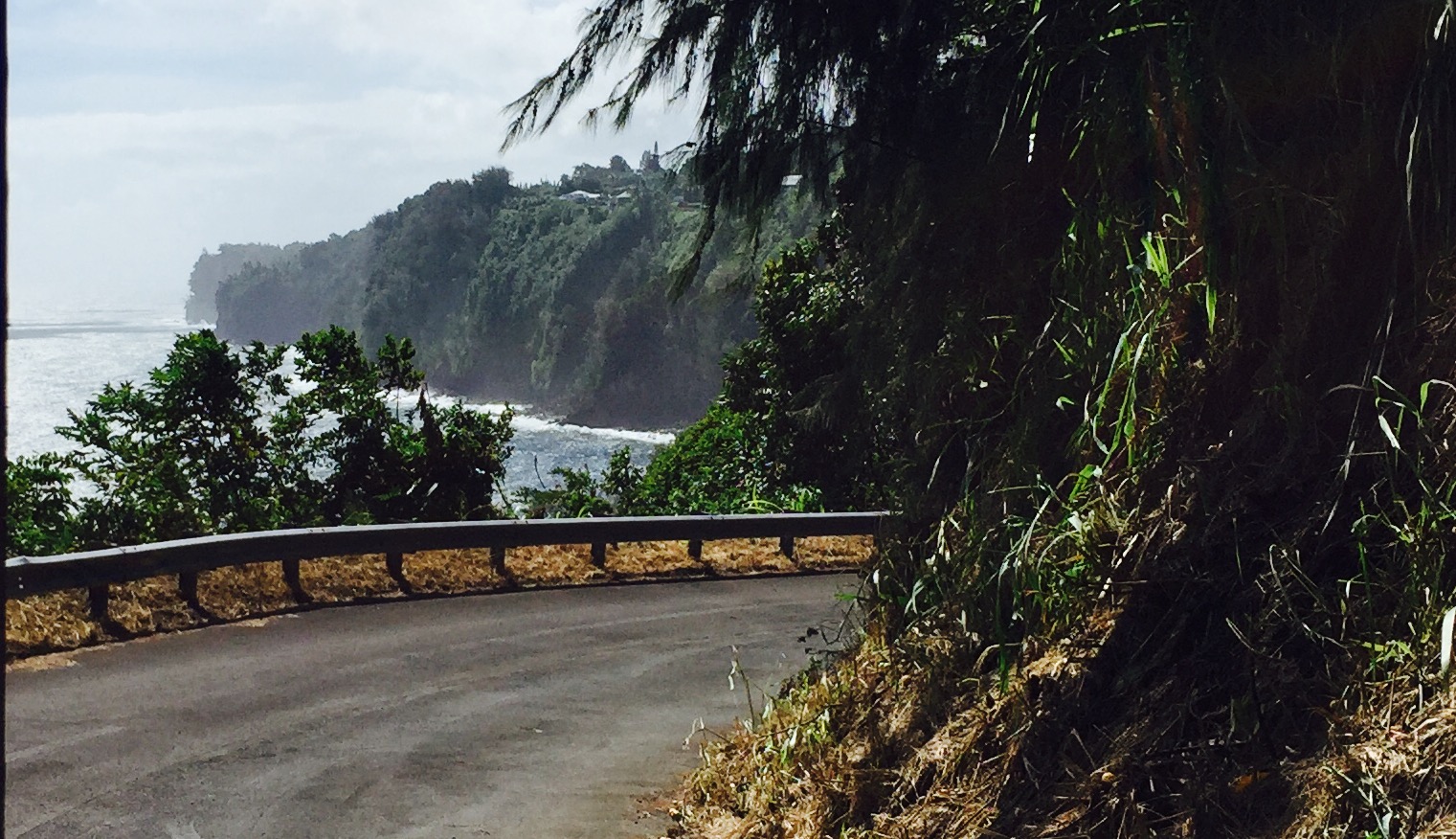
View of cliffs and homes perched above Laupāhoehoe Point. Photo: Darde Gamayo
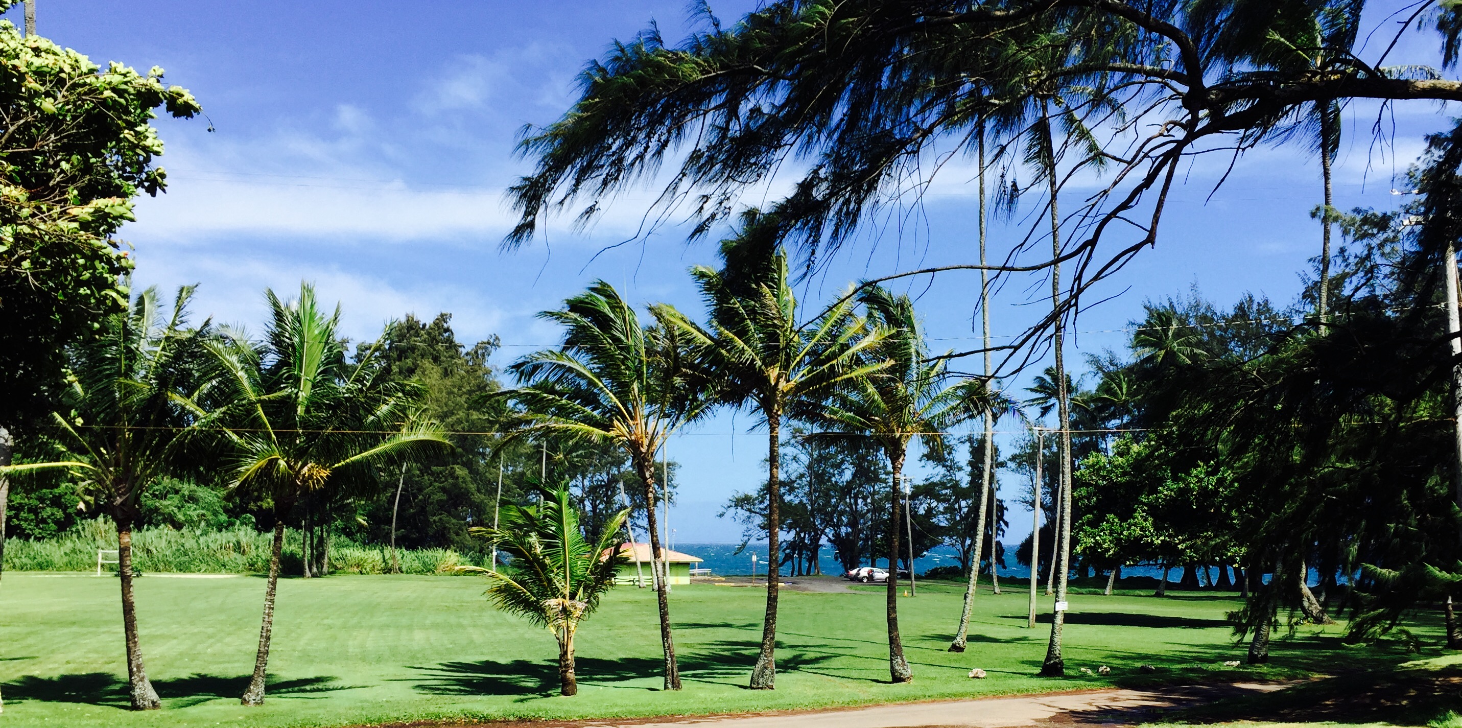
Grassy area and pavillion, Laupāhoehoe Point. Photo: Darde Gamayo
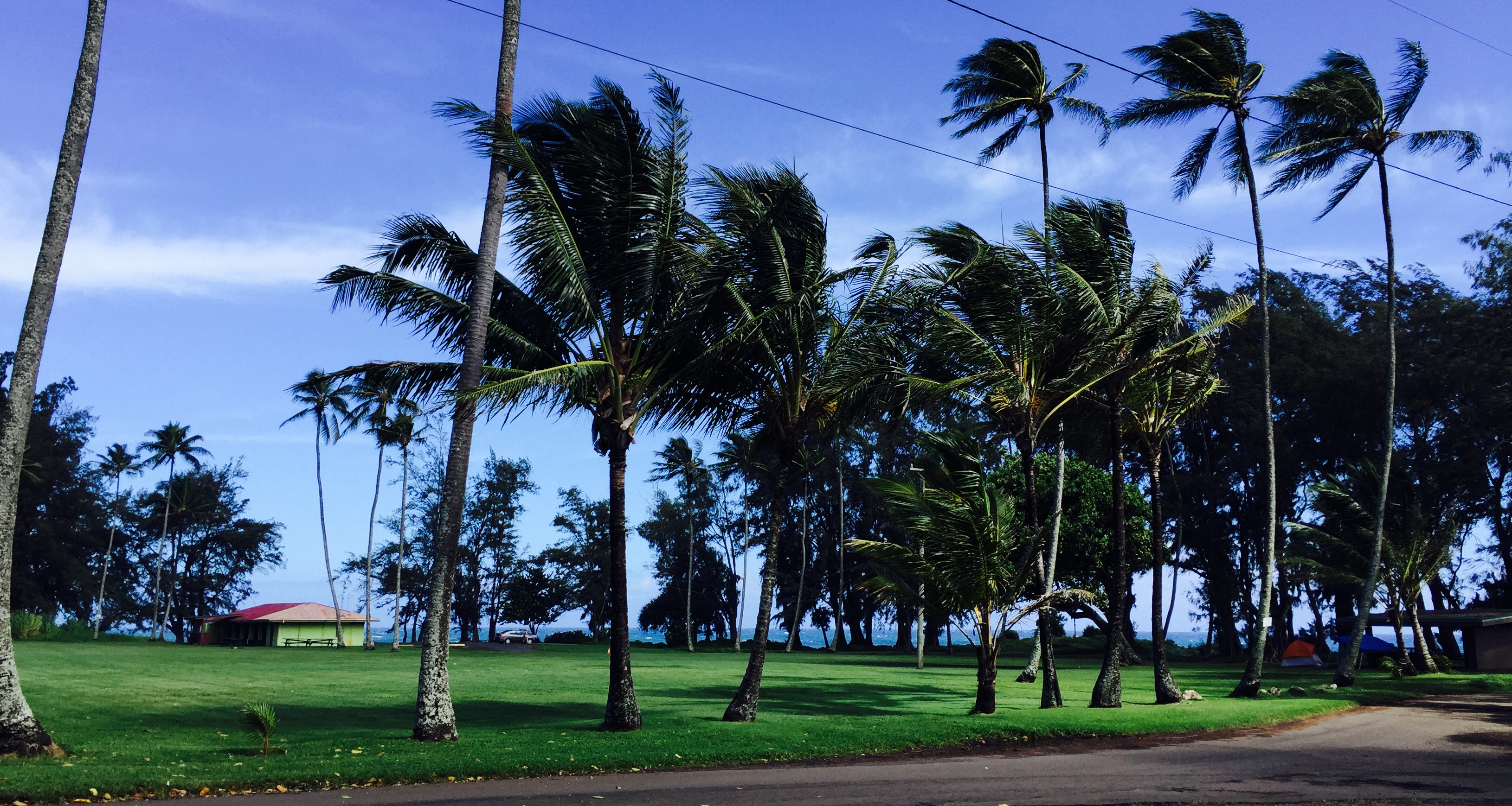
Grassy area and pavillion, Laupāhoehoe Point. Photo: Darde Gamayo

1946 tsunami monument, Laupāhoehoe. Photo: Darde Gamayo

Close up of 1946 tsunami monument, Laupāhoehoe. Photo: Darde Gamayo
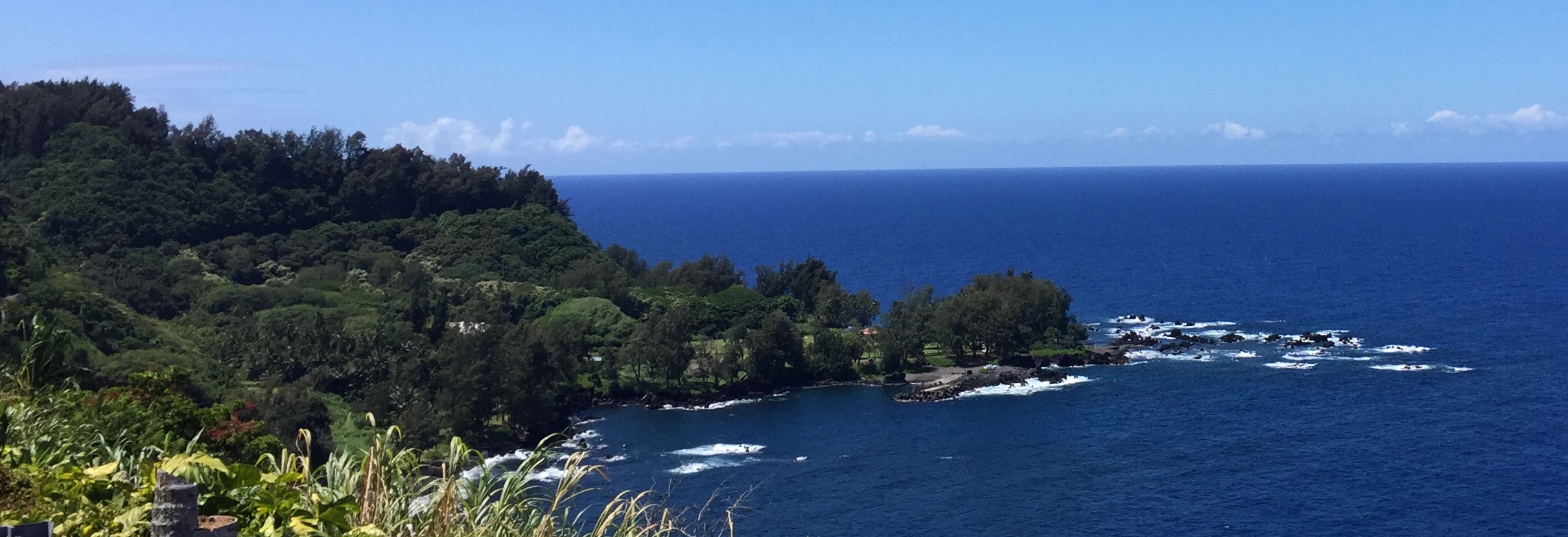
View of Laupāhoehoe from above. Photo: Darde Gamayo
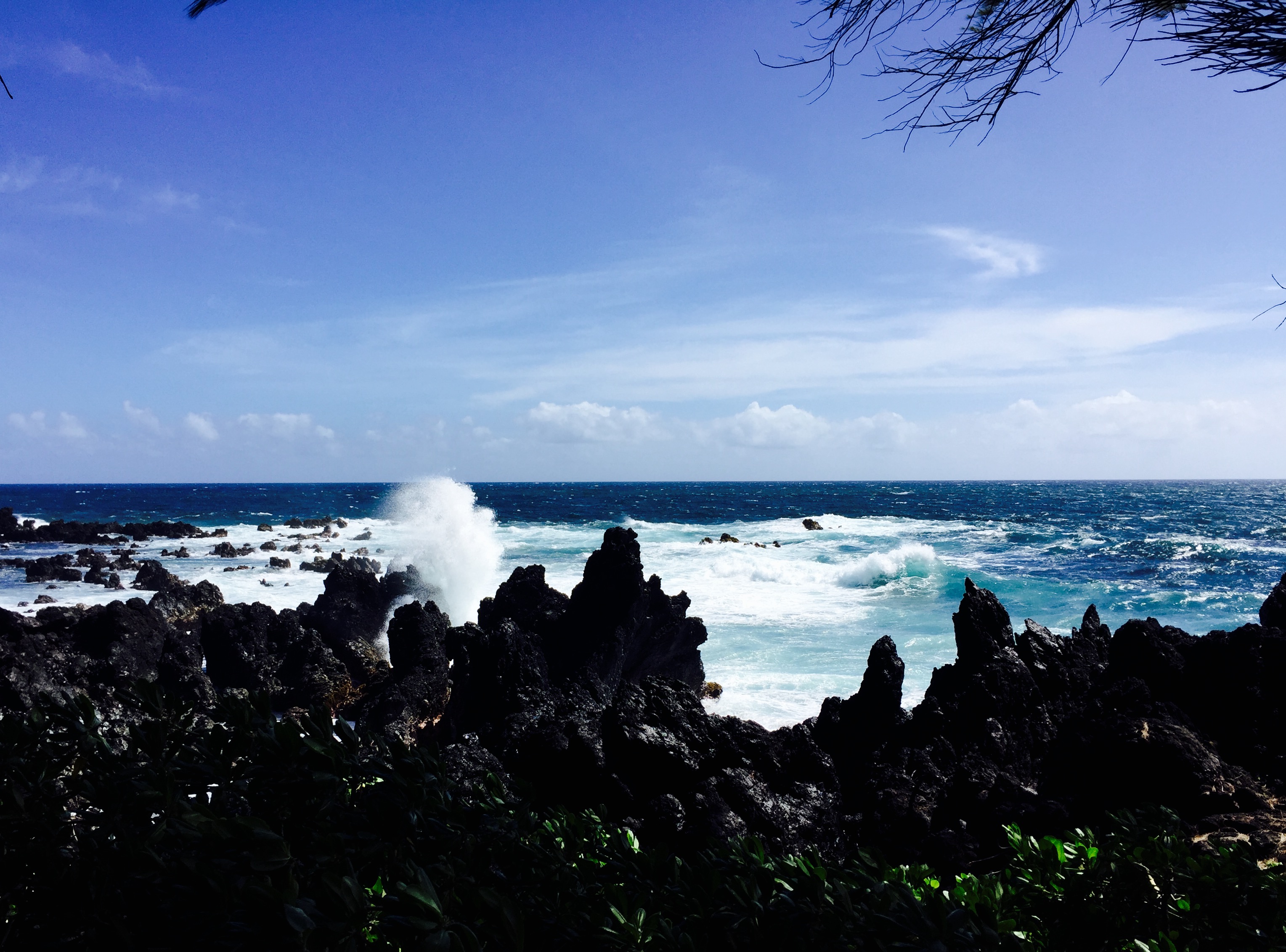
Waves crashing on to rocky shoreline at Laupāhoehoe. Photo: Darde Gamayo
Sponsored Content


