

Breezy Trade Winds Expected Today

Image: James Grenz
Alerts (as of 1:00 a.m.)
A Small Craft Advisory is posted for the Pailolo and ʻAlenuihāhā channels as well as Māʻalaea Bay through 6 p.m. Wednesday.
**Click directly on the images below to make them larger. Charts include: Big Island high/low forecasted temperatures, projected winds, chance of cloud cover, projected localized weather conditions, vog/SO2 forecast and expected wave heights.**
Looking Ahead
A trade wind weather pattern is expected over the next several days. Windward and mauka showers could pass over to leeward areas at times on our breezy trade winds.
Today
Partly sunny skies with scattered showers for windward areas. Hazy skies for the Kona side with isolated showers in the afternoon, otherwise mostly clear. High temperatures from 85° to 90°. Winds will be northeasterly around 15 to 20 mph with higher gusts.
UV index at 13 (“extreme” exposure level)
Tonight
Winds will be northeasterly around 15 to 20 mph. Partly cloudy with scattered showers for windward spots and gradual clearing as the night goes on for lee areas. Low temperatures from 70° to 75°.
Our Big Island Now Weather homepage always includes daily: Sunrise | Sunset | Moonrise | Moonset | Moon Phase | Live Weather Cams | 5-day Forecast | Current Temperature & Conditions
**Click here for your detailed Big Island surf report.**

Image: NOAA

Image: NOAA

Image: NOAA

Image: NOAA
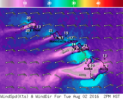
Image: NOAA
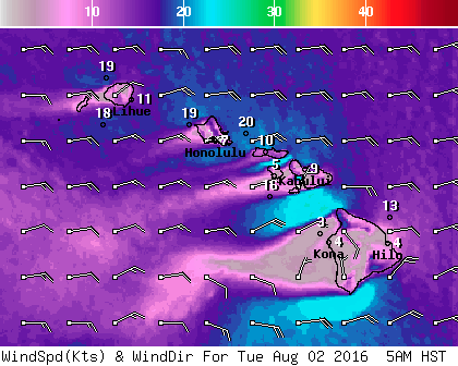
Image: NOAA
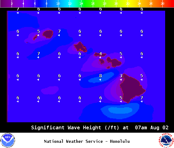
Image: NOAA
Image: NOAA
Sponsored Content


