

Moderate Trades Expected Today

Image: James Grenz
Alerts (as of 1:00 a.m.)
A High Surf Warning is posted for the north and west shore of the Big Island through 6 p.m. Friday.
A Small Craft Advisory is in effect through 6 a.m. Friday for all Big Island waters.
**Click directly on the images below to make them larger. Charts include: Big Island high/low forecasted temperatures, projected winds, chance of cloud cover, projected localized weather conditions, vog/SO2 forecast and expected wave heights.**
Looking Ahead
The moderate trades will gradually weaken and allow for sea breezes to take hold over the weekend. Expect a few afternoon showers over leeward and interior areas during that time. An approaching cold front may bring an increase in showers Sunday night and Monday. A very large northwest swell will gradually lower Friday and Saturday.
Today
Today we expect mostly sunny skies with clouds building in the afternoon. Isolated showers could also occur in the afternoon. East winds are forecast from 10 to 15 mph. High temperatures from 79° to 84°.
UV index at 9 (“very high” exposure level)
Tonight
East winds are expected from 10 to 15 mph. Low temperatures from 67° to 72° with partly cloudy skies and skies clearing as the night goes on.
Our Big Island Now Weather homepage always includes daily: Sunrise | Sunset | Moonrise | Moonset | Moon Phase | Live Weather Cams | 5-day Forecast | Current Temperature & Conditions
**Click here for your detailed Big Island surf report.**
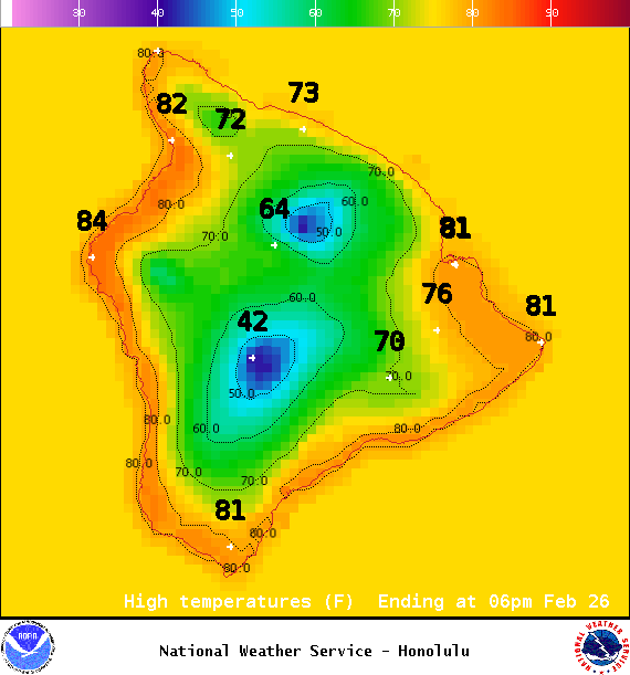
Image: NOAA /NWS
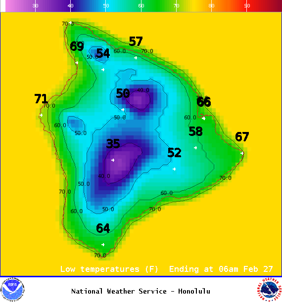
Image: NOAA /NWS
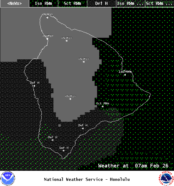
Image: NOAA /NWS

Image: NOAA /NWS
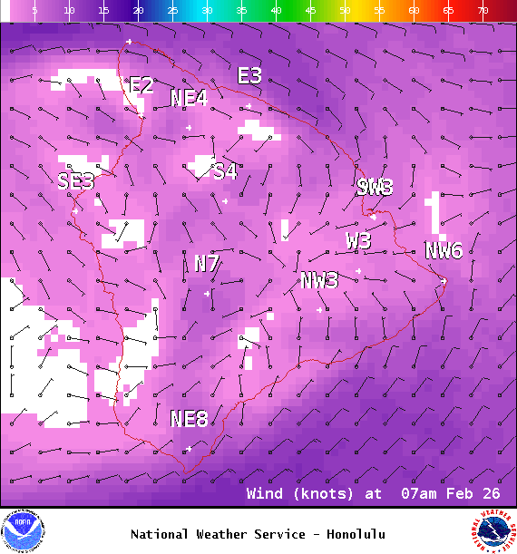
Image: NOAA /NWS

Image: NOAA /NWS
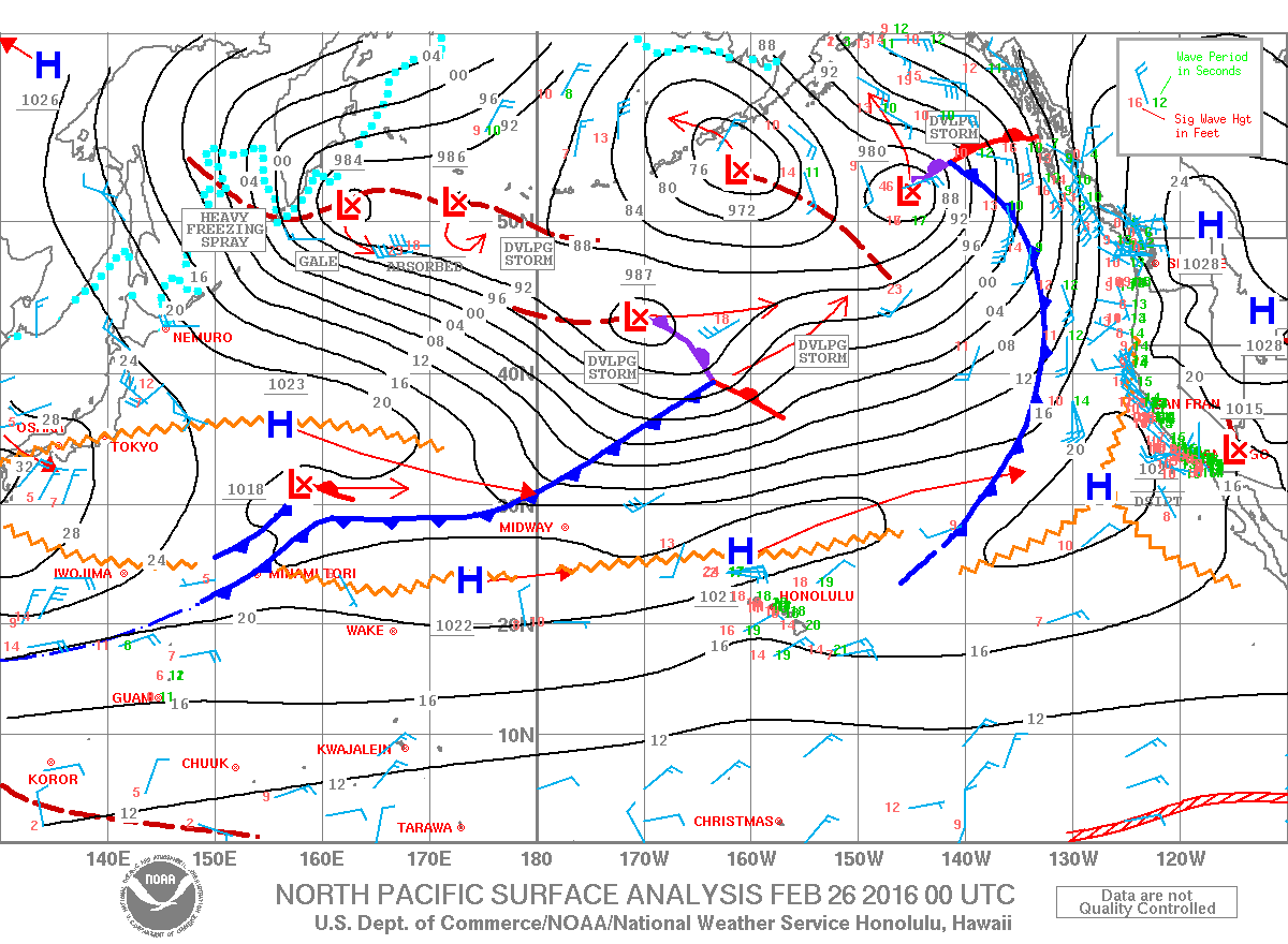
Image: NOAA /NWS
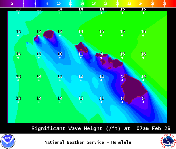
Image: NOAA /NWS
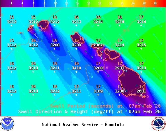
Image: NOAA /NWS
Sponsored Content


