

Windward Showers Expected Today, Lee Sun

Image: James Grenz
Alerts (as of 1:00 a.m.)
A Small Craft Advisory is posted through 6:00 a.m. Friday for the Alenuihaha channel and windward Big Island waters.
**Click directly on the images below to make them larger. Charts include: Big Island high/low forecasted temperatures, projected winds, chance of cloud cover, projected localized weather conditions, vog/SO2 forecast and expected wave heights.**
Looking Ahead
Moderate trade winds will focus showers over windward and mauka spots of mainly the Big Island into Friday as moisture from a dissipating front lingers nearby. The rest of the island chain will experience rather dry and stable conditions. Trade winds will weaken and shift out of the south on Saturday and become variable by Sunday, while somewhat dry conditions continue for much of the state. Another weak front will bring some light rainfall down the island chain on Sunday night and Monday. Northerly winds behind the front will quickly become variable, then likely shift out of the southwest by Tuesday.
Today
East winds are expected today around 15 mph. Mostly cloudy skies are forecast for windward spots with showers likely in those areas. Sunny skies in the morning for the Kona side with partly cloudy skies and isolated showers in the afternoon. High temperatures from 78° to 84°.
UV index at 7 (“high” exposure level)
Tonight
East winds are expected around 15 mph. Low temperatures from 68° to 74°. Skies are expected to clear overnight as the land breeze kicks in on the leeward side. Partly to mostly cloudy skies and scattered showers for windward areas.
Our Big Island Now Weather homepage always includes daily: Sunrise | Sunset | Moonrise | Moonset | Moon Phase | Live Weather Cams | 5-day Forecast | Current Temperature & Conditions
**Click here for your detailed Big Island surf report.**

Image: NOAA / NWS

Image: NOAA / NWS

Image: NOAA / NWS

Image: NOAA / NWS
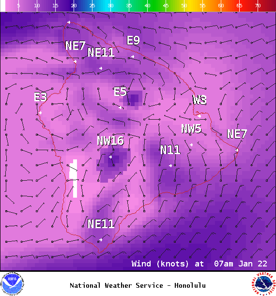
Image: NOAA / NWS
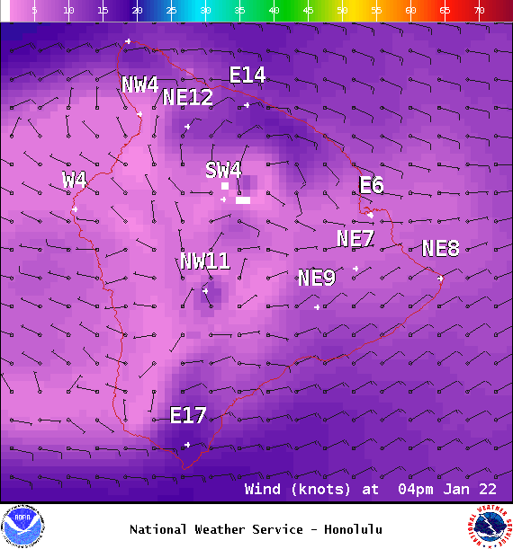
Image: NOAA / NWS
Image: NOAA / NWS
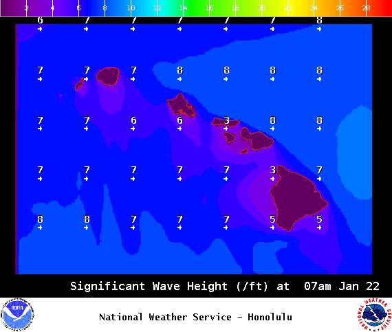
Image: NOAA / NWS
Sponsored Content


