

Winds Weaken, Land & Sea Breezes Expected
Alerts
A Small Craft Advisory is posted through Monday at 6 a.m. for winds up to 25 knots and seas up to 12 feet.
A High Surf Advisory is posted for east facing shores through 6 a.m. Monday.
**Click directly on the images below to make them larger. Charts include: Big Island high/low forecasted temperatures, projected winds, chance of cloud cover, projected localized weather conditions, vog/SO2 forecast and expected wave heights.**
Looking Ahead
Gusty trades will continue to weaken and are expected to veer east-southeasterly on Monday and will drop off much more by Tuesday. We should actually see a period of locally-driven land breezes as early as Monday night, with onshore sea breezes on Tuesday. This will be more of a dry convective pattern with some afternoon and evening clouds across interiors of the islands but limited shower coverage.
Today
Northeast winds are expected today around 15 mph. Mostly cloudy skies are forecast for windward and mauka areas with occasional morning showers and showers likely in the afternoon. Leeward side should be mostly clear with scattered afternoon showers as cloud cover builds. High temperatures from 79° to 84°.
UV index at 6 (“high” exposure level)
Tonight
Variable winds are expected up to 15 mph. Low temperatures from 69° to 74°. Mostly cloudy skies are expected in the evening with clearing expected. Scattered windward showers.
Our Big Island Now Weather homepage always includes daily: Sunrise | Sunset | Moonrise | Moonset | Moon Phase | Live Weather Cams | 5-day Forecast | Current Temperature & Conditions
**Click here for your detailed Big Island surf report.**

Image: NOAA / NWS

Image: NOAA / NWS

Image: NOAA / NWS

Image: NOAA / NWS
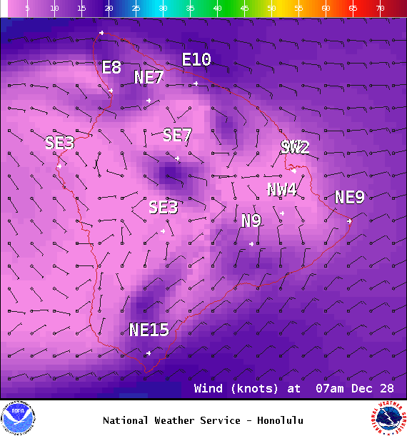
Image: NOAA / NWS
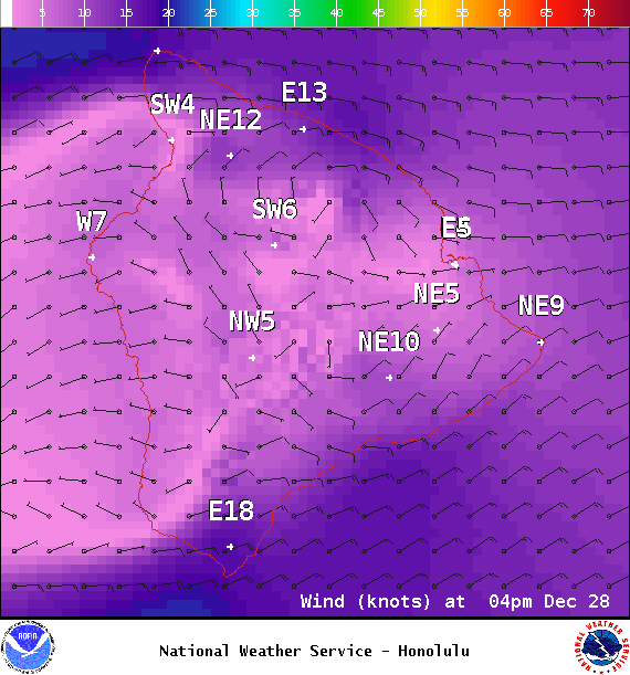
Image: NOAA / NWS
Image: NOAA / NWS
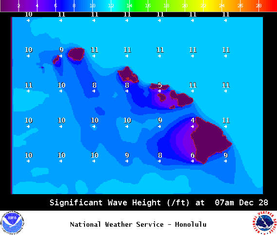
Image: NOAA / NWS
Sponsored Content


