

Hot, Humid, Hazy Conditions Continue Today
Alerts
There are no weather alerts posted at this time.
Check our breaking news section for any urgent weather alerts.
**Click directly on the images below to make them larger. Charts include: Big Island high/low forecasted temperatures, projected winds, chance of cloud cover, projected localized weather conditions, vog/SO2 forecast and expected wave heights.**
Looking Ahead
Light winds will again allow local land and sea breezes to control the forecast Monday. Trade winds are expected to return by midweek and continue through the weekend. Windward and mauka showers are expected when the trade winds return to the state. Humidity levels will also decrease at that time.
Today
Today mostly sunny skies are expected with partly cloudy skies in the afternoon and isolated showers for windward spots. The Kona side is expected to get mostly cloudy skies in the afternoon as the sea breeze develops. Hazy skies are expected. High temperatures from 84° to 89°. Southeast winds are forecast up to 15 mph.
UV index at 8 (“very high” exposure level)
Tonight
East winds are expected in the evening around 15 mph. Low temperatures from 72° to 77°. Partly cloudy skies are expected in the evening with isolated showers for windward spots. Scattered showers are expected after midnight. Leeward spots should see isolated evening showers and clearing as the night goes on.
Our Big Island Now Weather homepage always includes daily: Sunrise | Sunset | Moonrise | Moonset | Moon Phase | Live Weather Cams | 5-day Forecast | Current Temperature & Conditions
**Click here for your detailed Big Island surf report.**
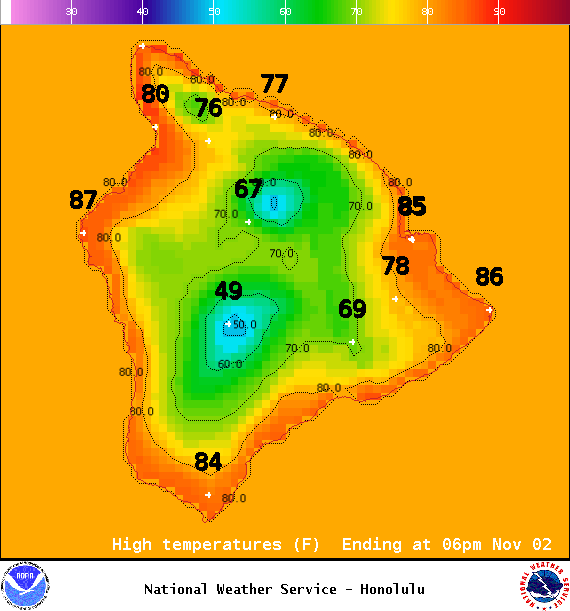
Image: NOAA / NWS

Image: NOAA / NWS
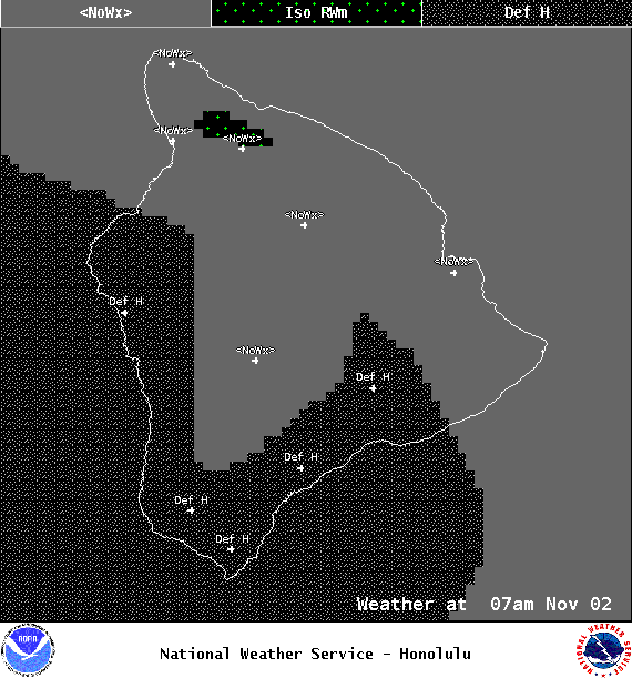
Image: NOAA / NWS
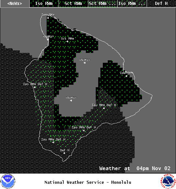
Image: NOAA / NWS

Image: NOAA / NWS
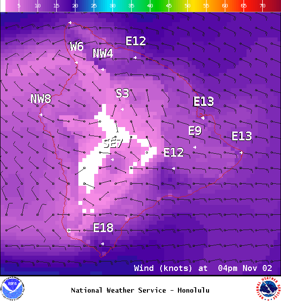
Image: NOAA / NWS
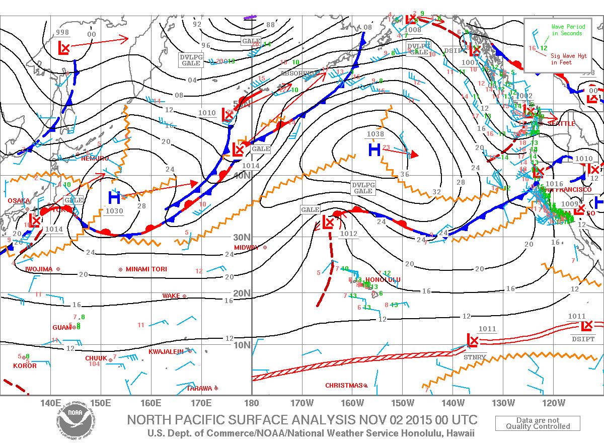
Image: NOAA / NWS
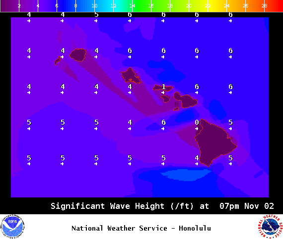
Image: NOAA / NWS
Sponsored Content


