

Cooler Trades Expected This Weekend
Alerts
A Small Craft Advisory is posted for the ʻAlenuihāhā channel as well as Big Island south and leeward waters. Winds of 20 to 25 knots out of the east are forecasted with rough seas up to 10 feet. This advisory is posted through 6:00 p.m. Sunday. Inexperienced mariners should avoid navigating in these conditions.
**Click directly on the images below to make them larger. Charts include: Big Island high/low forecasted temperatures, projected winds, chance of cloud cover, projected localized weather conditions, vog/SO2 forecast and expected wave heights.**
Weekend Days
We expect high temperatures from 84° to 89°. Cooler northeast winds are expected from 10 – 20 mph. Partly cloudy skies are forecasted with scattered showers in the morning for windward areas. Leeward spots are expected to be sunny to start with building cloud cover and afternoon upslope showers.
UV index at 13 (“extreme” exposure level)
Weekend Nights
Partly cloudy skies are expected with scattered showers for windward spots. Leeward spots should be partly cloudy with isolated showers. Northeast winds are forecasted from 10 to 20 mph. Low temperatures from 71° to 76° are expected.
Looking Ahead
Breezy trades are expected through the weekend, with trades slowly diminishing early next week. A few showers can be expected to ride in on the trades from time to time, affecting mainly windward and mauka areas during the nights and mornings. It is still too soon to say if hurricane Hilda, located far to the southeast of Hawaii, will have any effect on our weather toward the middle of next week.
Our Big Island Now Weather homepage always includes daily: Sunrise | Sunset | Moonrise | Moonset | Moon Phase | Live Weather Cams | 5-day Forecast | Current Temperature & Conditions
**Click here for your detailed Big Island surf report.**

Image: NOAA / NWS

Image: NOAA / NWS

Image: NOAA / NWS

Image: NOAA / NWS
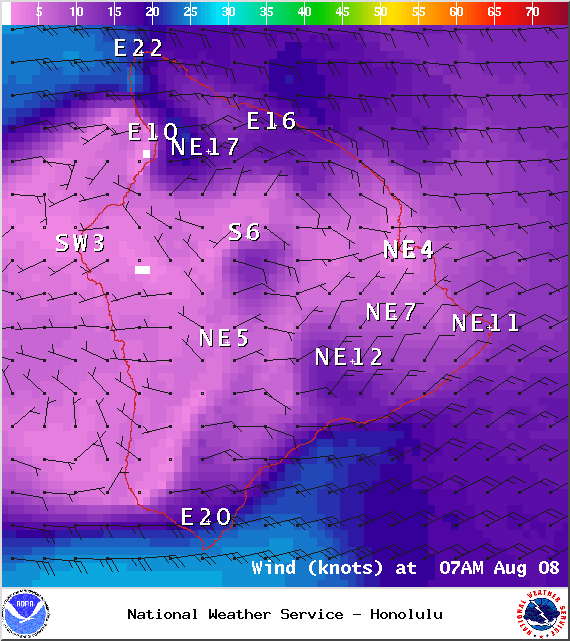
Image: NOAA / NWS
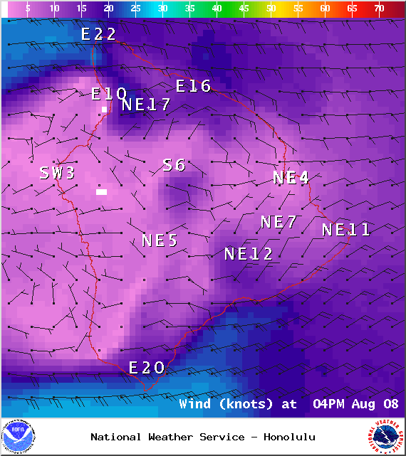
Image: NOAA / NWS
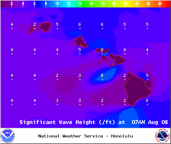
Image: NOAA / NWS
Sponsored Content


