

Marine Advisories Posted Due to High Winds
Alerts
A Small Craft Advisory is posted for all Big Island waters through 6:00 p.m. Thursday. East winds up to 30 knots are forecasted along with rough seas of 9 to 13 feet. Inexperienced mariners should avoid navigating in these conditions.
A High Surf Advisory is posted for our east facing shores through 6:00 a.m. Thursday. Surf is expected to reach 6 to 9 foot faces. Expect strong breaking waves, shore break and strong longshore and rip currents making swimming difficult and dangerous.
A Gale Warning is posted for the ʻAlenuihāhā channel through 6:00 p.m. Wednesday for northeast winds up to 35 knots with higher gusts and rough seas up to 15 feet.
**Click directly on the images below to make them larger. Charts include: Big Island projected winds, tides, swell direction & period and expected wave heights.**
 Big Island Surf Forecast
Hilo side: Head to overhead surf is expected today. Best exposures could see sets in the well overhead range early in the day.
Kona side: Wave heights of knee/thigh high are expected. Best breaks could reach waist high on the sets.
South: Wave heights knee/thigh high today with sets reaching about waist high.
A pulse out of the northwest is expected to fade through the middle of the week. The Kona side will largely blocked from this swell. Swell out of the north-northeast shifting more northeast expected to bring overhead sets Wednesday and chest to head high waves Thursday.
 This week is looking pretty quite out of the southern hemisphere although a small boost out of the south-southwest is expected to fill in today and Thursday. A small boost is expected over the weekend out of the south-southeast. Next week we could see some activity around May 5th or 6th pending development of storms.
Keep in mind, surf heights are measured on the face of the wave from trough to crest. Heights vary from beach to beach, and at the same beach, from break to break.
**Click here for your detailed Big Island weather report.**

Image: NOAA / NWS

Image: NOAA / NWS

Image: NOAA / NWS

Image: NOAA / NWS
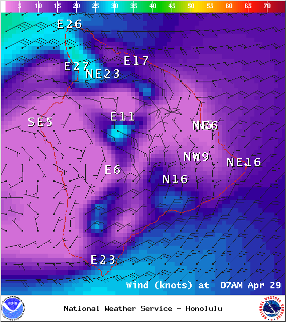
Image: NOAA / NWS
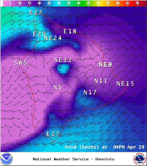
Image: NOAA / NWS
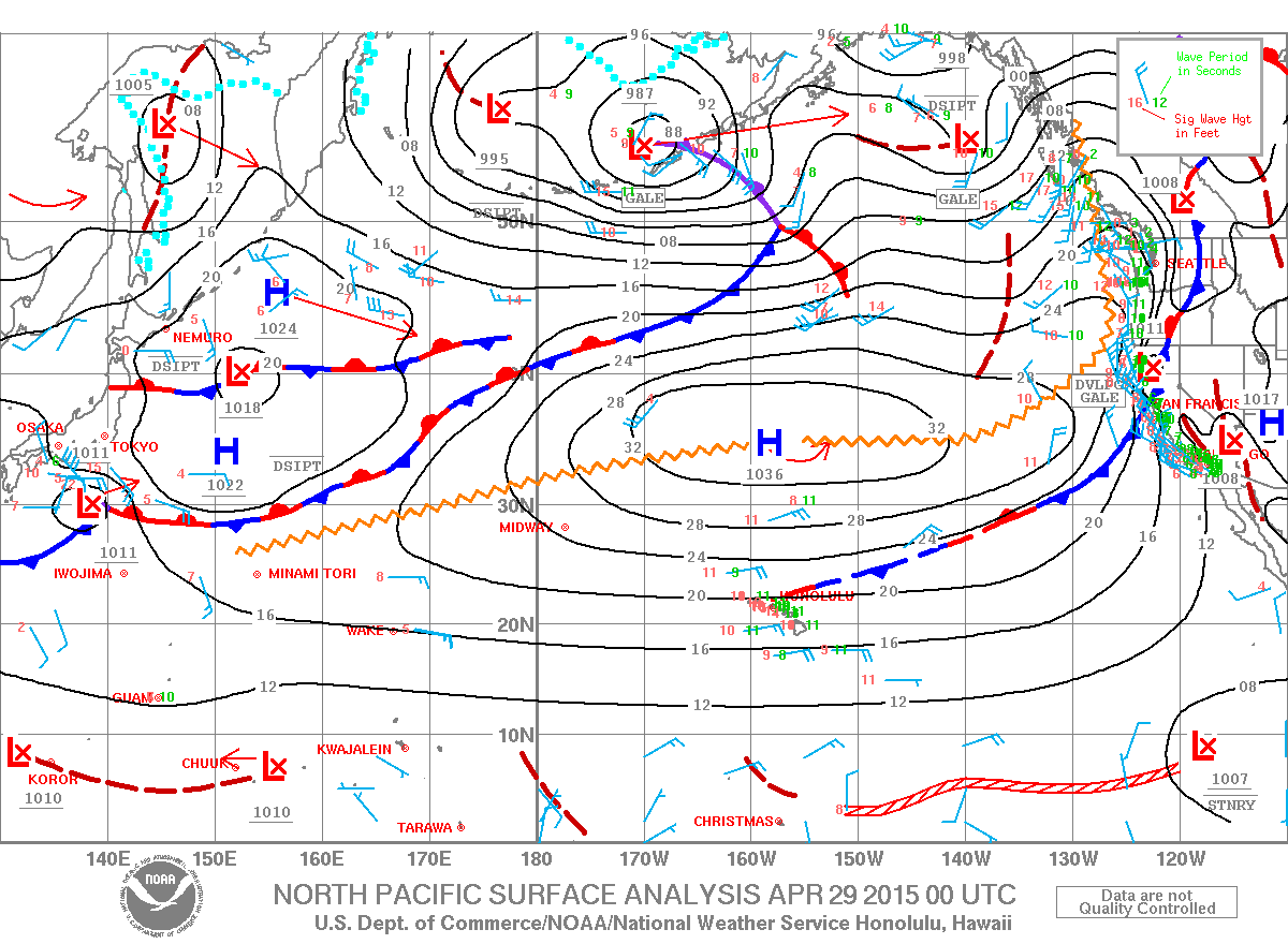
Image: NOAA / NWS
Sponsored Content


