

New Swell Builds Overnight For Friday
Alerts
A High Surf Advisory will go into effect at 6 p.m. for north exposures of the Big Island. The advisory is posted through Friday at 6 p.m. Surf heights from 12 to 16 feet are expected. Expect strong breaking waves, shore break and strong longshore and rip currents making swimming difficult and dangerous.
A Small Craft Advisory is posted for all island waters from 6 p.m. Wednesday through 6 p.m. Friday. North winds up to 25 knots are expected along with rough seas of 9 to 16 feet. Inexperienced mariners should avoid navigating in these conditions.
**Click directly on the images below to make them larger. Charts include: Big Island projected winds, tides, swell direction & period and expected wave heights.**
 Big Island Surf Forecast
Hilo side: Wave heights from chest to head high are expected, the best breaks could be slightly bigger.
Kona side: Wave heights from ankle to knee high are expected. The best spots could get waist high waves on the sets.
South: Wave heights of ankle to knee high are expected. Standout spots could get up to waist or chest high on the sets.
Our current north swell is expected to continue to slowly fade.
 A strong storm over the Aleutians is expected to bring a solid north-northwest swell building overnight Thursday and peaking Friday afternoon. Most of the size will show for the northeast or Hilo coastline while the Kona side will be heavily shadowed from this swell.
A northwest pulse is expected late this weekend. A storm near Japan is expected to bring us a west-northwest swell early next week. Will keep an eye on these.
Mix of energy out of the south will linger through Thursday. A slightly bigger swell is expected to build late Thursday and peak late Friday. This swell was generated by a storm in the Tasman Sea.
Keep in mind, surf heights are measured on the face of the wave from trough to crest. Heights vary from beach to beach, and at the same beach, from break to break.
**Click here for your detailed Big Island weather report.**
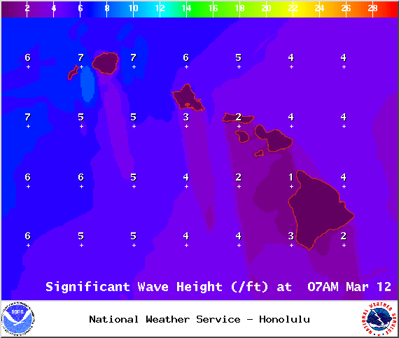
Image: NOAA / NWS

Image: NOAA / NWS

Image: NOAA / NWS
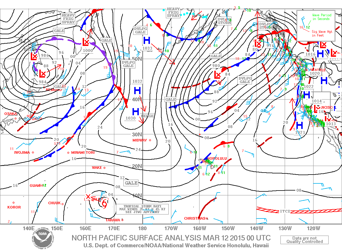
Image: NOAA / NWS
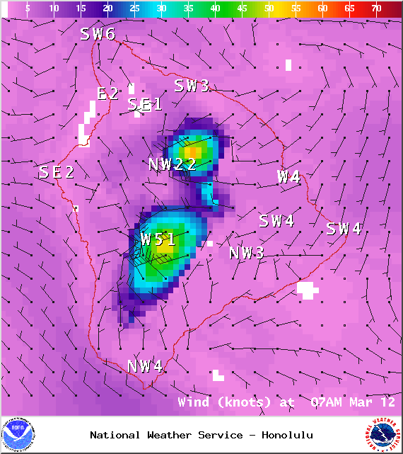
Image: NOAA / NWS
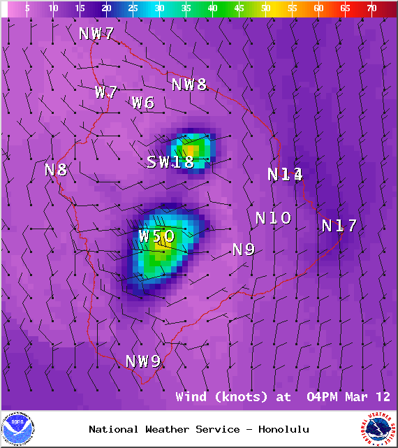
Image: NOAA / NWS
Sponsored Content


