

Showers Expected Today, Blizzard Warning Posted
Alerts
A Blizzard Warning is in effect through Thursday afternoon. Additional snowfall of 5 to 8 inches is expected with strong winds (45 to 65 mph, gusting to 80 mph) and freezing fog. The road to the summit is closed at last check.
**Click directly on the images below to make them larger. Charts include: Big Island high/low forecasted temperatures, projected winds, chance of cloud cover, projected localized weather conditions, vog/SO2 forecast and expected wave heights.**
Today
Cloudy skies are expected today with showers likely for the Kona side and scattered showers on the Hilo side. Southwest winds are forecasted around 15 mph. Cooler than normal temperatures are expected with high temperatures from 73° to 78°.
UV index at 5 (“moderate” exposure level)
Tonight
Mostly cloudy skies are expected with scattered showers. Southwest winds are forecasted from 10 to 15 mph. Low temperatures from 66° to 71° are expected.
Looking Ahead
Light northerly winds are expected to increase Wednesday as scattered showers form over the smaller islands. Deepening layered clouds over the Big Island are forecasted to spread to the north, bringing showers to the Big Island and Maui through Thursday, with blizzard conditions expected at the Big Island summits. Trade winds are expected to return late this week and last at least through the weekend.
Our Big Island Now Weather homepage always includes daily: Sunrise | Sunset | Moonrise | Moonset | Moon Phase | Live Weather Cams | 5-day Forecast | Current Temperature & Conditions
**Click here for your detailed Big Island surf report.**
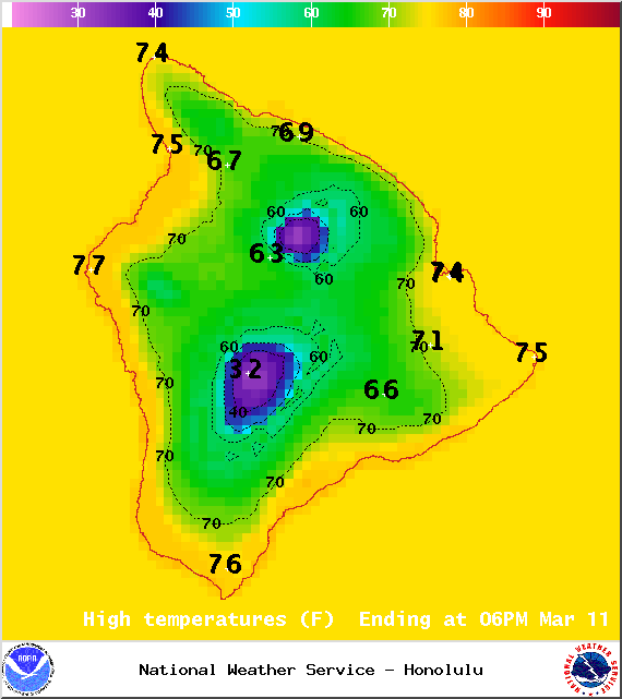
Image: NOAA / NWS
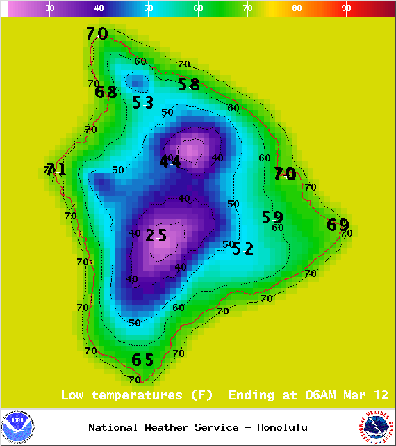
Image: NOAA / NWS
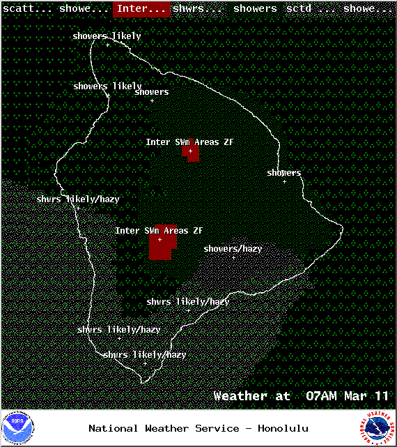
Image: NOAA / NWS

Image: NOAA / NWS
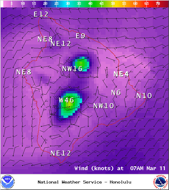
Image: NOAA / NWS
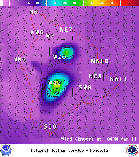
Image: NOAA / NWS
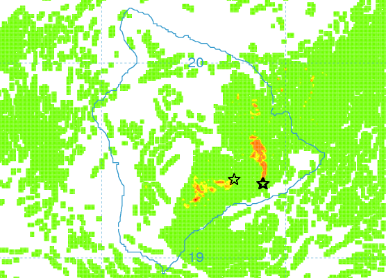
Image: UHSOEST
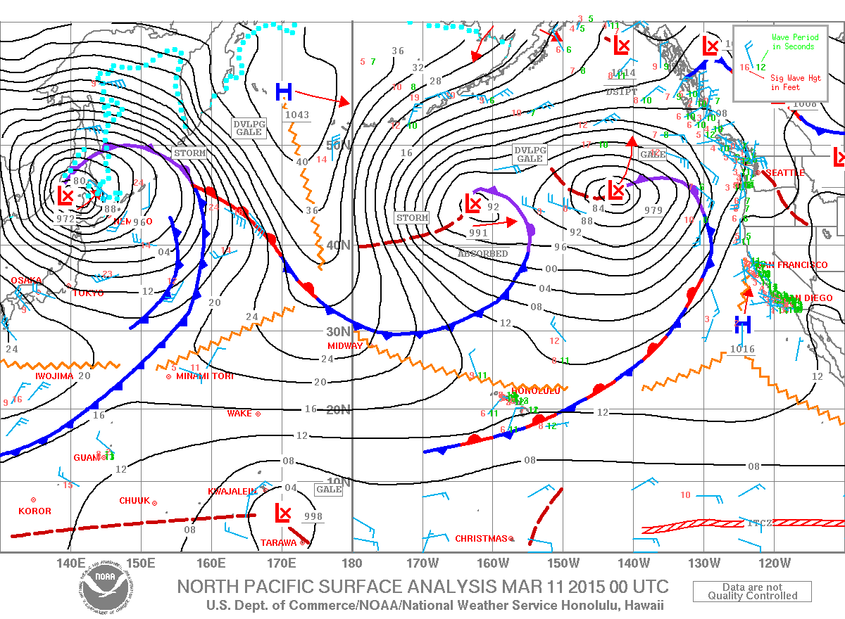
Image: NOAA / NWS
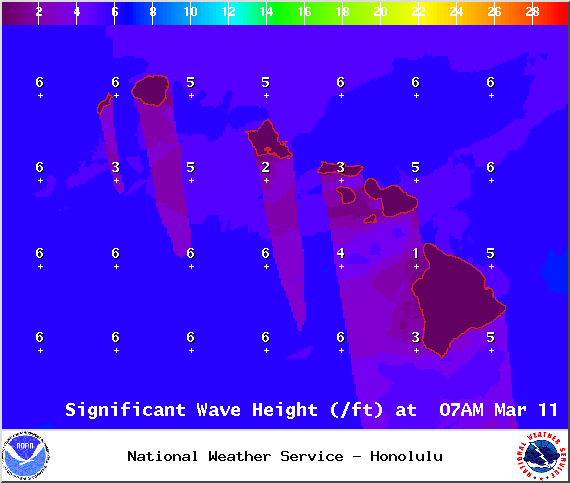
Image: NOAA / NWS
Sponsored Content


