

Land/Sea Breeze Pattern Expected Today
Alerts
A High Surf Advisory is posted for the west side from 6:00 a.m. Friday through 6:00 a.m. Saturday. Expect strong breaking waves, shore break and strong longshore and rip currents making swimming difficult and dangerous.
A Small Craft Advisory is in effect for Big Island windward waters and the Alenuihaha Channel through 6:00 a.m. Saturday. Inexperienced mariners should avoid navigating in these conditions.
**Click directly on the images below to make them larger. Charts include: Big Island high/low forecasted temperatures, projected winds, chance of cloud cover, projected localized weather conditions, vog/SO2 forecast and expected wave heights.**
Today
We expect mostly sunny skies with mostly cloudy skies and isolated showers building in the afternoon (for the leeward side). Hazy skies are expected (see UHSOEST vog model above). Variable winds are forecasted from 10 to 15 mph. High temperatures should fall in the range of 79° to 84°.
UV index at 9 (“very high” exposure level)
Tonight
Mostly cloudy skies are expected on the windward side with scattered showers. Leeward spots will get partly to mostly cloudy skies early on and clear as the night goes on. Northeast winds are forecasted from 10 to 15 mph. Low temperatures from 67° to 72° are expected.
Next New Moon: 1:47 p.m. on Feb. 18
Next Full Moon: 8:06 a.m. on Mar. 5
Looking Ahead
A dissipating front is expected to reach the Big Island Saturday, in the meantime a local land and sea breeze pattern is expected to continue. Models are indicating the winds will not be as intense as they were with our Valentine’s day front. However, conditions will get breezy. Localized heavy downpours are possible but we don’t expect any major flooding events. Lingering moisture is expected to bring periods of passing showers through the weekend. A short period of trade winds is expected over the weekend before another front makes it’s approach early next week.
Our Big Island Now Weather homepage always includes daily: Sunrise | Sunset | Moonrise | Moonset | Moon Phase | Live Weather Cams | 5-day Forecast | Current Temperature & Conditions
**Click here for your detailed Big Island surf report.**
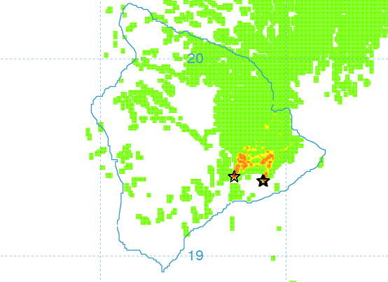
Image: UHSOEST
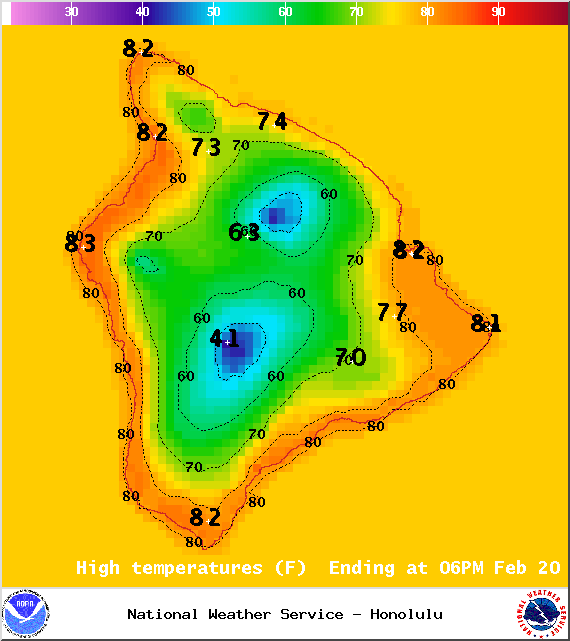
Image: NOAA / NWS
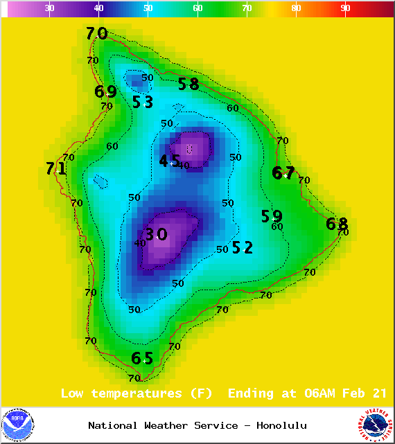
Image: NOAA / NWS
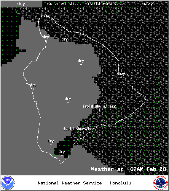
Image: NOAA / NWS
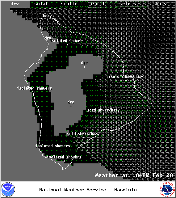
Image: NOAA / NWS
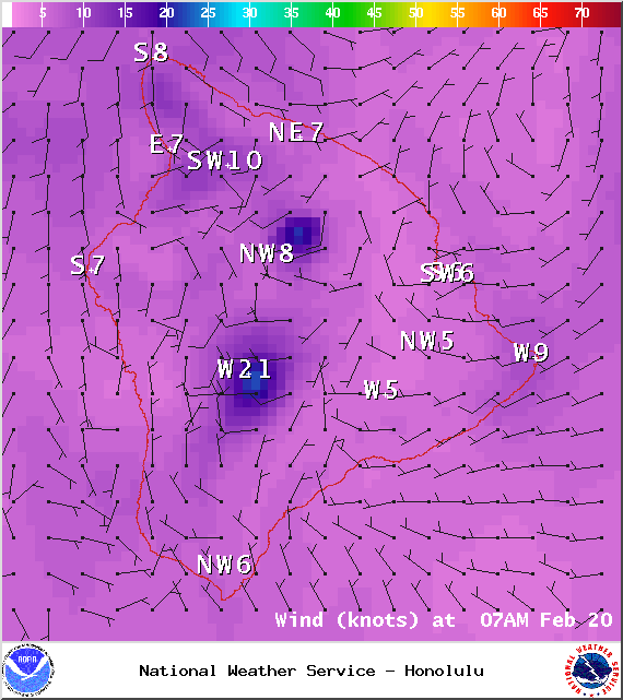
Image: NOAA / NWS
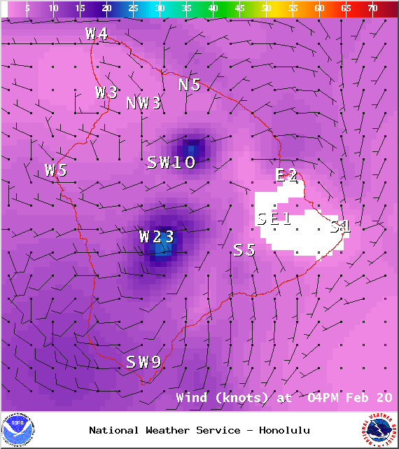
Image: NOAA / NWS
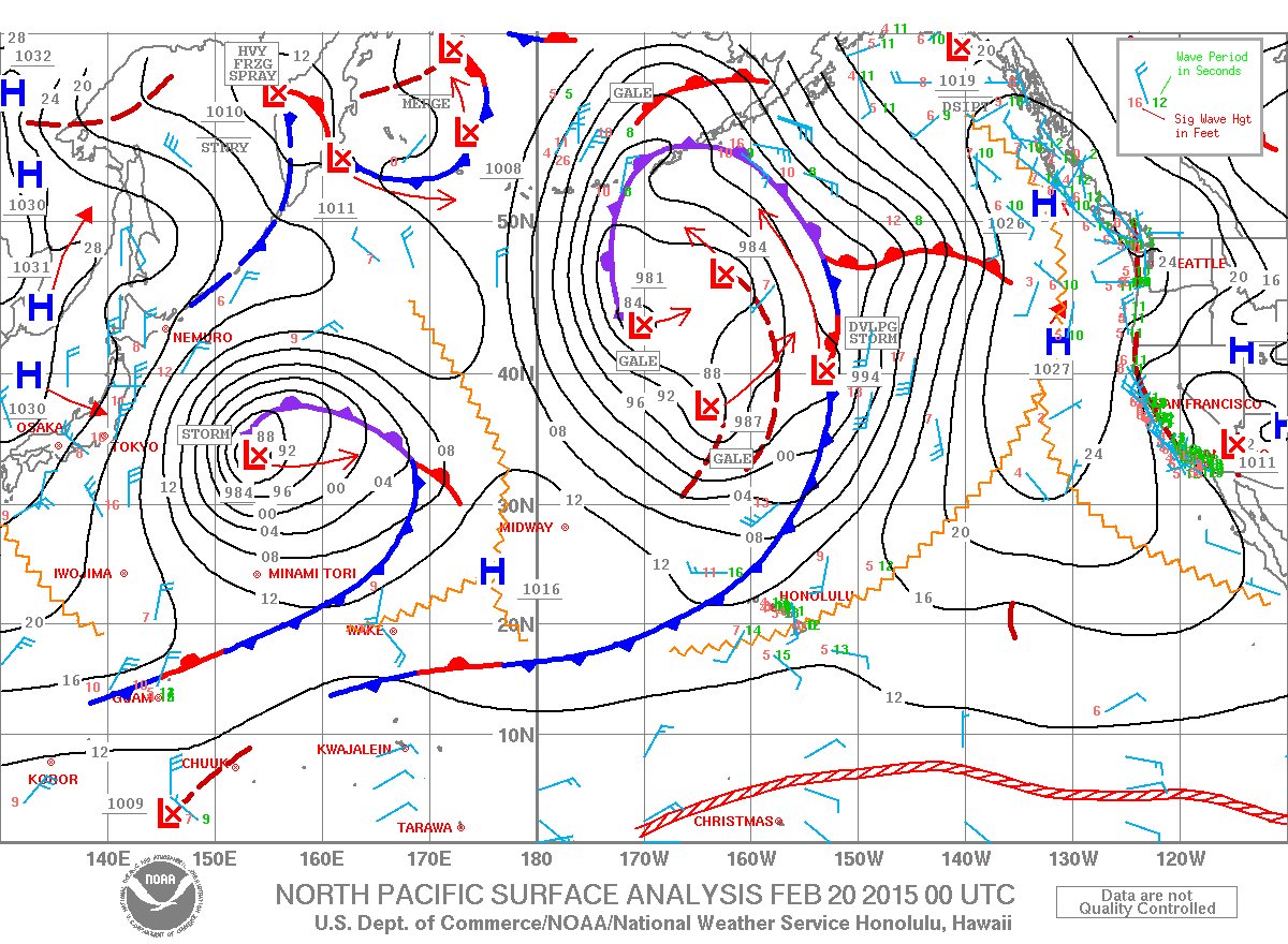
Image: NOAA / NWS
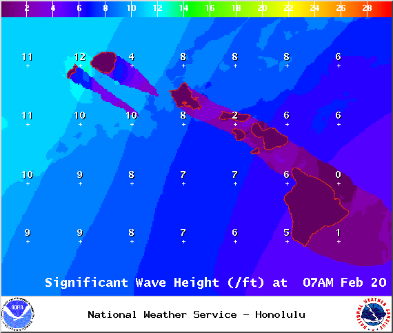
Image: NOAA / NWSLooking Ahead
Sponsored Content


