

Breezy West Winds, Gusts to 115 mph on Summits
Alerts
A High Wind Warning is posted for the summits of Mauna Kea and Mauna Loa through 6:00 p.m. Friday morning. West winds from 50 to 80 mph with gusts to 115 mph are expected. The National Weather Service advises that winds this strong can make walking and driving difficult. Travel to the summit should be delayed until winds subside.
A Small Craft Advisory is posted for windward and southeast Big Island waters along with the Alenuihaha channel through 6:00 p.m. Friday for southwest winds up to 25 knots and rough seas up to 14 feet. Inexperienced mariners should avoid navigating in these conditions.
**Click directly on the images below to make them larger. Charts include: Big Island high/low forecasted temperatures, projected winds, chance of cloud cover, projected localized weather conditions, vog/SO2 forecast and expected wave heights.**
Today
West winds of 15 to 20 mph, with possible higher gusts, are expected at lower elevations and could be higher at higher elevations. The summits of Mauna Kea and Mauna Loa are under a High Wind Warning at this time. We expect partly cloudy skies with scattered showers. High temperatures should fall in the range of 78° to 83°.
UV index at 8 (“very high” exposure level)
Tonight
Partly cloudy skies are expected with scattered showers. West winds are expected from 15 to 20 mph. Low temperatures are forecasted from 65° to 70°.
Next New Moon: 1:47 p.m. on Feb. 18
Next Full Moon: 8:06 a.m. on Mar. 5
Looking Ahead
A weak front will move down the island chain Thursday accompanied by some passing showers. Breezy west winds are expected through Friday with lighter winds on Saturday. Another front will approach the islands on Monday and move down the chain through Tuesday. Southwest winds are forecasted to increase out ahead of the front on Sunday.
Our Big Island Now Weather homepage always includes daily: Sunrise | Sunset | Moonrise | Moonset | Moon Phase | Live Weather Cams | 5-day Forecast | Current Temperature & Conditions
**Click here for your detailed Big Island surf report.**

Image: NOAA / NWS

Image: NOAA / NWS

Image: NOAA / NWS

Image: NOAA / NWS
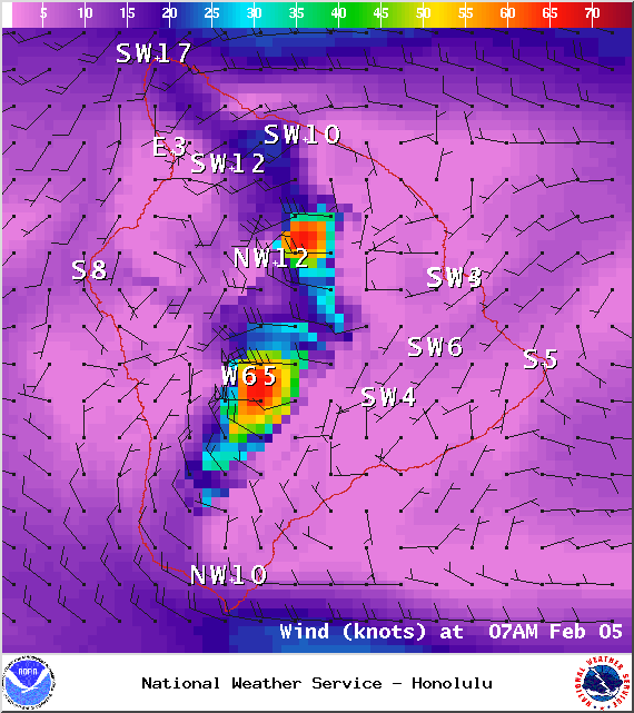
Image: NOAA / NWS
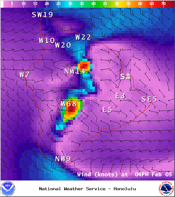
Image: NOAA / NWS

Image: UHSOEST
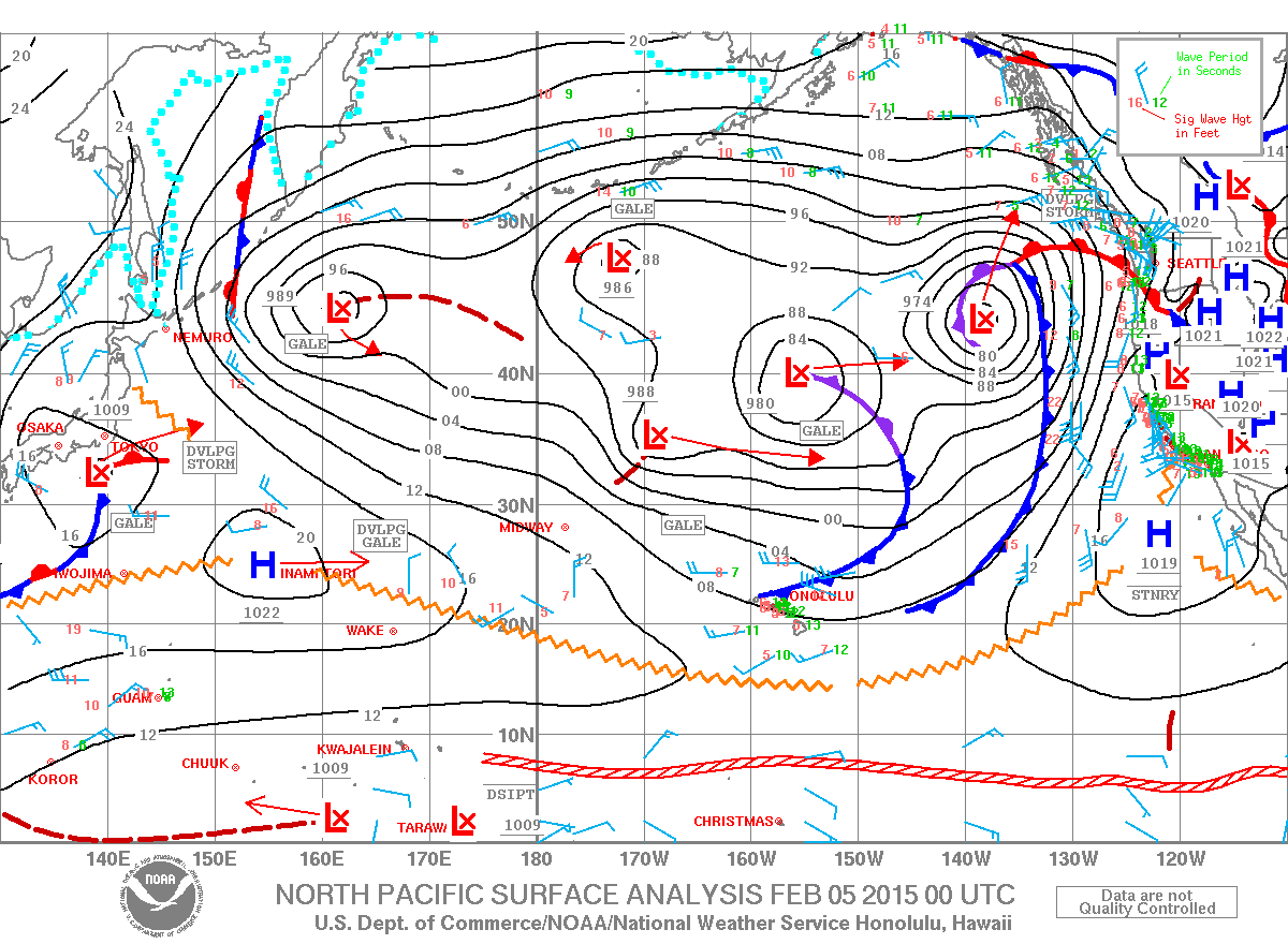
Image: NOAA / NWS
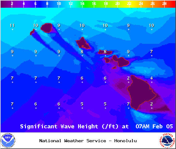
Image: NOAA / NWS
Sponsored Content


