

Trade Winds Slowly Weaken as Front Approaches
Alerts
A Small Craft Advisory has been issued for the ʻAlenuihāhā channel and Big Island southeast and leeward waters through 6:00 a.m. Tuesday for winds up to 25 knots and rough seas up to 12 feet.
**Click directly on the images below to make them larger. Charts include: Big Island high/low forecasted temperatures, projected winds, chance of cloud cover, projected localized weather conditions, vog/SO2 forecast and expected wave heights.**
Today
Windward and mauka areas are forecasted to get morning clouds and showers with afternoon clearing, meanwhile leeward spots will get mostly clear mornings and afternoon cloud cover. We expect northeast winds around 15 mph with higher gusts. High temperatures should fall in the range of 78° to 83°.
Sunrise: 6:57 a.m.
Sunset: 6:10 p.m.
UV index at 7 (“high” exposure level)
Tonight
Mostly cloudy skies are expected with scattered windward and mauka showers. Leeward spots will be cloudy to start but clear as the land breeze takes hold. Variable winds up to 10 mph are expected. Low temperatures are forecasted from 65° to 70°.
Moonrise: 12:34 a.m.
Moonset: 1:43 a.m. on Jan. 28
Next Full Moon: 1:09 p.m. on Feb. 3
Next New Moon: 1:47 p.m. on Feb. 18
Looking Ahead
Trade winds are expected to slowly weaken and become more southerly as a weak front approaches the state Tuesday. From Thursday into Friday, this front is forecasted to spread light rain and weak northwest winds across the state. Trade winds will return and conditions will slowly dry over the weekend. Another front may approach the islands early next week.
Almanac for Hilo Airport
Maximum Temperature for today:
Normal 79°
Record 91° / Set in 1997
Minimum Temperature for today:
Normal 64°
Record 58° / Set in 2007 and tied in 2009
**Click here for your detailed Big Island surf report.**
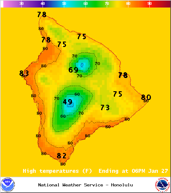
Image: NOAA / NWS
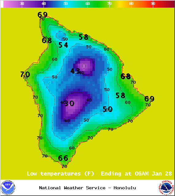
Image: NOAA / NWS
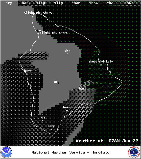
Image: NOAA / NWS
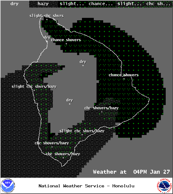
Image: NOAA / NWS
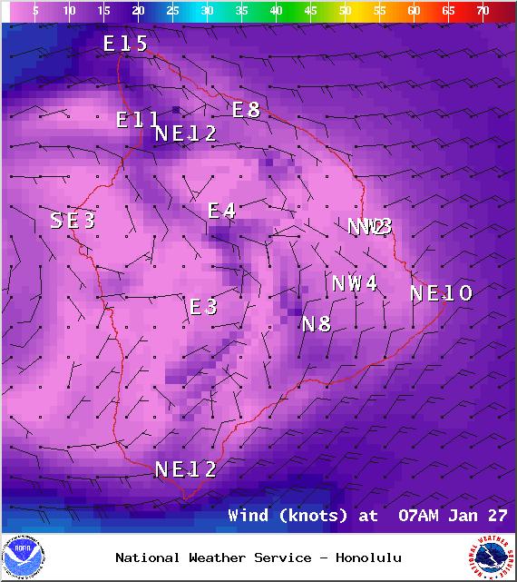
Image: NOAA / NWS
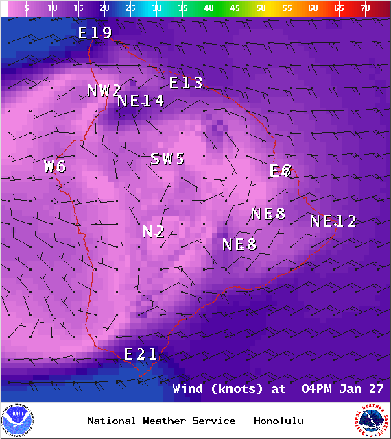
Image: NOAA / NWS
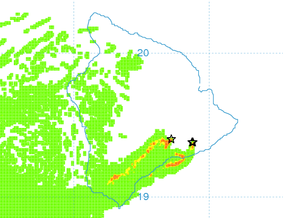
Image: UHSOEST
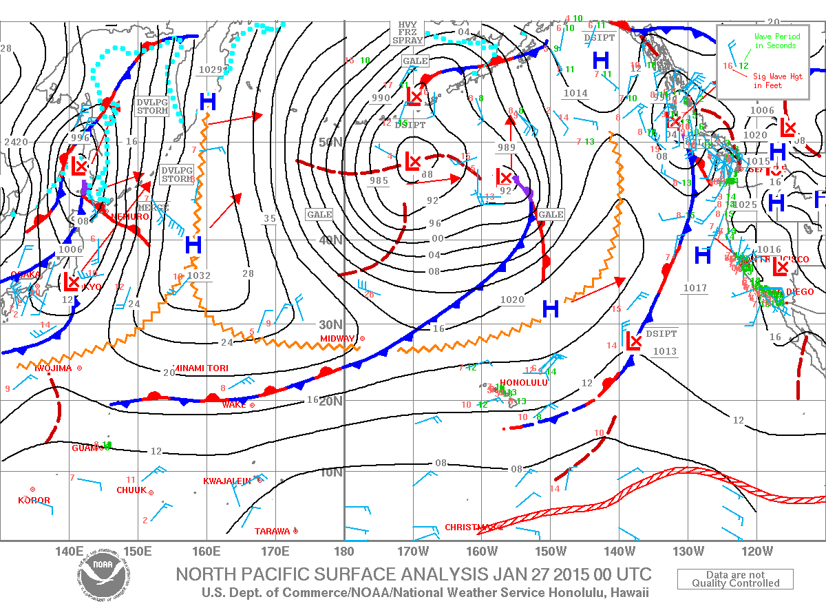
Image: NOAA / NWS
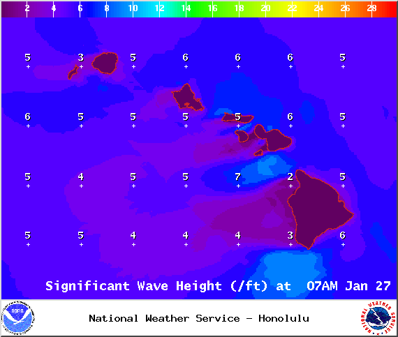
Image: NOAA / NWS
Sponsored Content


