A Marine Weather Statement has been issued by the National Weather Service for a very large west-northwest swell. The Weather Service in Honolulu says the very large swell will remain elevated into Saturday. They are warning of strong harbor surges and large breaking waves at harbor entrances exposed to the swell. Some locations that could expect such conditions are the Kawaihae and Honokohau harbors.
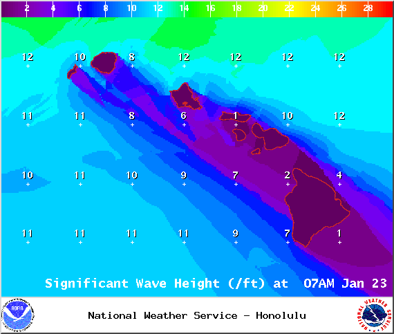
The High Surf Warning has been extended for the west side of the Big Island. The warning is posted through Saturday at 6:00 p.m. Wave heights of 10 to 15 foot faces are expected. Expect ocean water occasionally sweeping across portions of beaches, very strong breaking waves and strong longshore and rip currents. Breaking waves may occasionally impact harbors making navigating the harbor channel difficult. Large breaking surf, significant shore break and dangerous currents will make entering the water very hazardous. Boaters should be aware of an increased number of surfers in the water.
A Small Craft Advisory has been issued for all island waters through 6:00 p.m. Saturday for winds from 15 to 25 knots and rough seas of 7 to 17 feet.
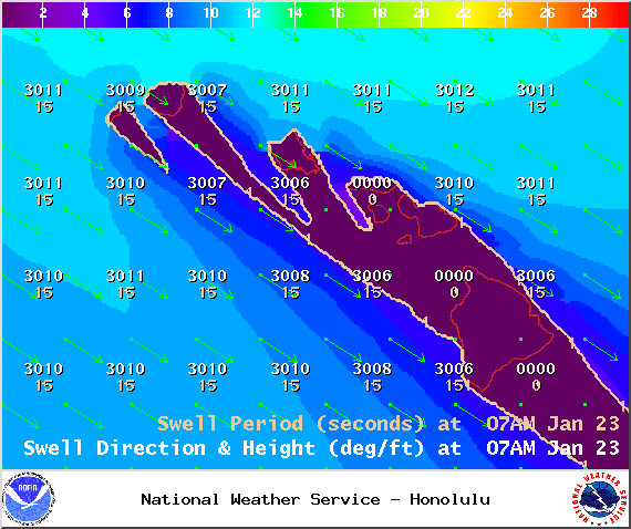
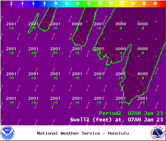
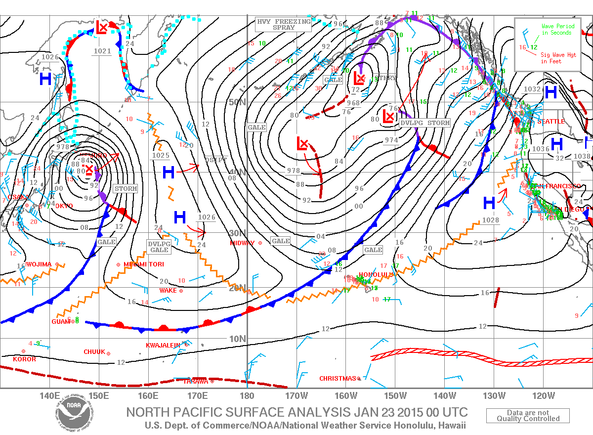
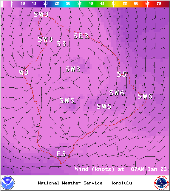
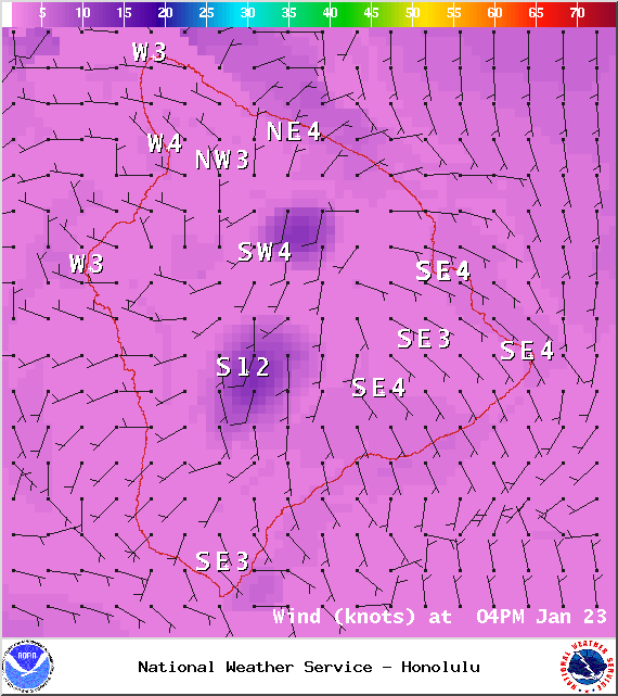
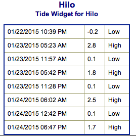
**Click directly on the images below to make them larger. Charts include: Big Island projected winds, tides, swell direction & period and expected wave heights.**
ARTICLE CONTINUES BELOW AD
ARTICLE CONTINUES BELOW AD
+
SWIPE LEFT OR RIGHT
Big Island Surf Forecast, Friday, January 23, 2015
Hilo side: Surf heights are expected waist to head high. The best breaks open to the swell could see occasional larger waves on the sets. Breaks open to the trade swell could see wave heights up to waist high as well.
ARTICLE CONTINUES BELOW AD
Kona side: Surf heights are forecasted to be head high to overhead – possibly a few feet overhead on the sets at select reefs that can handle the size.
South: Southerly spots open to the west-northwest swell could get waves wrapping up to overhead in height, maybe more on the sets. Breaks open to the trade swell could see knee to waist high waves.
Our current swell continues to fade but will still hold some good height today. Warning level surf is expected. The swell is partially blocked by other islands but the Kona side should still see significant swell up to a few feet overhead at the best breaks on the sets.
A reinforcement is expected to move in late Friday and begin to fade out on Sunday. Pending development we could see another solid west-northwest swell setting up for Wednesday and Thursday of next week.
ARTICLE CONTINUES BELOW AD
Small south-southwest brings knee to possibly thigh high waves at the best breaks.
Keep in mind, surf heights are measured on the face of the wave from trough to crest. Heights vary from beach to beach, and at the same beach, from break to break.
This comments section is a public community forum for the purpose of free expression. Although Big Island Now encourages respectful communication only, some content may be considered offensive. Please view at your own discretion. View Comments


 Big Island Surf Forecast, Friday, January 23, 2015
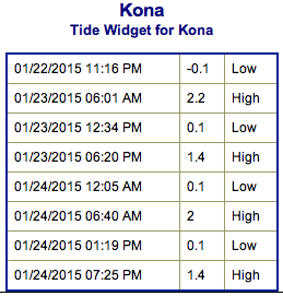 Our current swell continues to fade but will still hold some good height today. Warning level surf is expected. The swell is partially blocked by other islands but the Kona side should still see significant swell up to a few feet overhead at the best breaks on the sets.