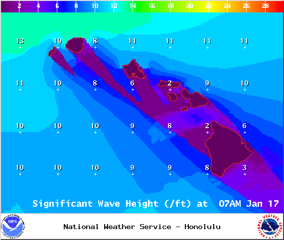
A High Surf Advisory is posted through 6:00 p.m. Sunday for west side of the Big Island. Surf from 6 to 10 feet is expected. Expect strong breaking waves, shore break and strong longshore and rip currents making swimming difficult and dangerous.
A Small Craft Advisory is posted for the Alenuihaha Channel through 6:00 a.m. Sunday for rough seas up to 13 feet. Inexperienced mariners should avoid navigating in these conditions.
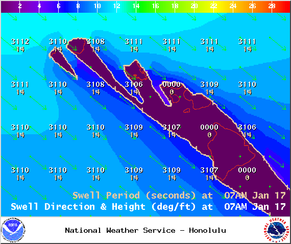
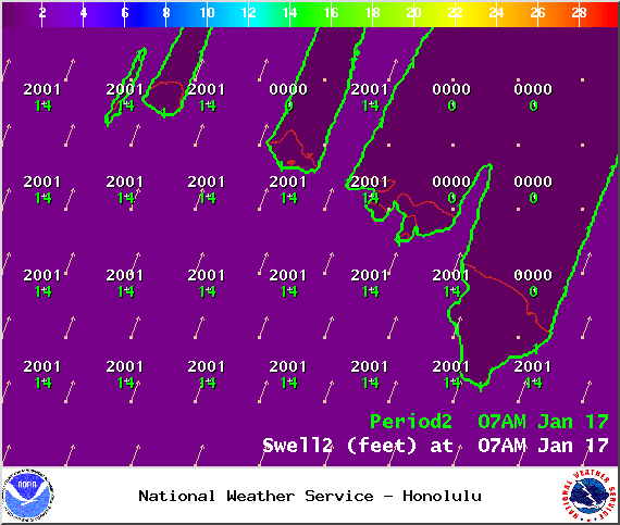
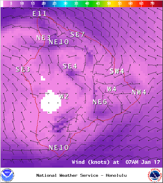
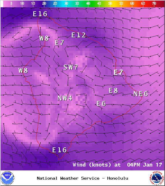
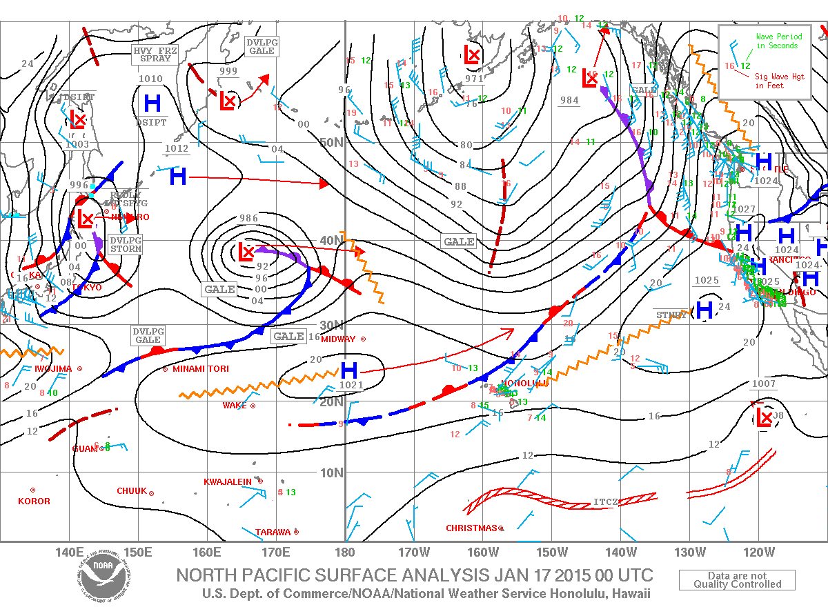
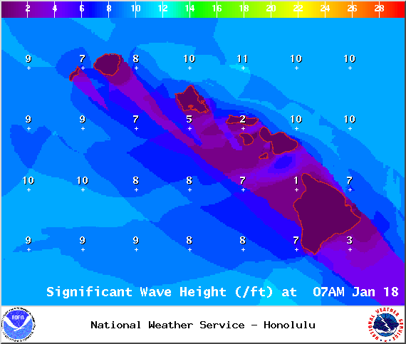
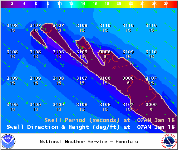
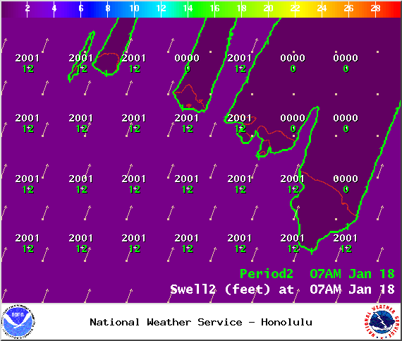
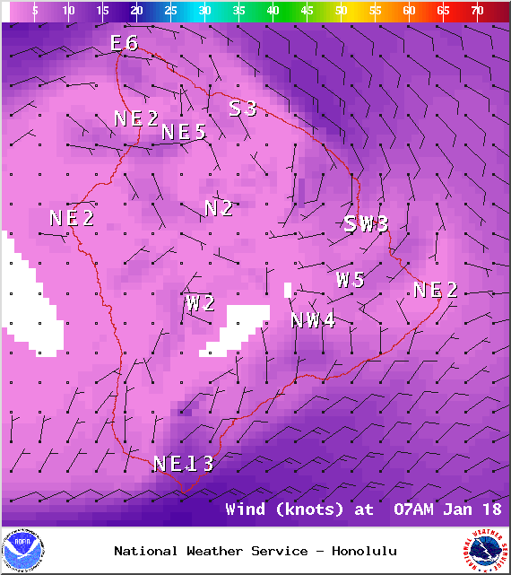
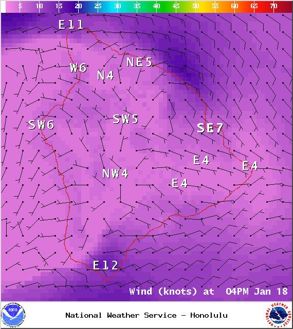
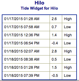
**Click directly on the images below to make them larger. Charts include: Big Island projected winds, tides, swell direction & period and expected wave heights.**
+
SWIPE LEFT OR RIGHT
ARTICLE CONTINUES BELOW AD
ARTICLE CONTINUES BELOW AD
Big Island Surf Forecast, Saturday, January 17, 2015
Hilo side: Surf heights are expected waist to head high. The best breaks open to the swell could see larger waves on the sets, especially late in the day.
Kona side: Surf heights are forecasted from shoulder to head high. Possibly a couple of feet overhead at the best exposures.
ARTICLE CONTINUES BELOW AD
South: Southerly spots are below waist high today. Exposures open to the west-northwest wrap are forecasted to get chest to head high surf, possible a bit overhead on the sets at the best exposures.
Our current advisory level west-northwest swell is expected to continue to fade as a new west-northwest builds. Some of this swell will even wrap into some spots on the Hilo side of the island.
Another west-northwest is on tap for Tuesday.
Pending development, models are predicting a much larger west-northwest swell arriving around the middle of next week, producing surf well above warning levels. Will keep an eye on it.
ARTICLE CONTINUES BELOW AD
Nothing of note out of the SPAC to get excited about.
Keep in mind, surf heights are measured on the face of the wave from trough to crest. Heights vary from beach to beach, and at the same beach, from break to break.
This comments section is a public community forum for the purpose of free expression. Although Big Island Now encourages respectful communication only, some content may be considered offensive. Please view at your own discretion. View Comments


 Big Island Surf Forecast, Saturday, January 17, 2015
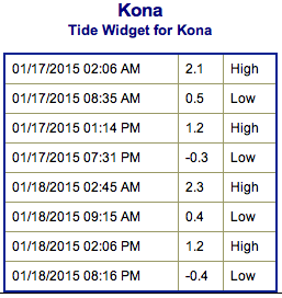 Our current advisory level west-northwest swell is expected to continue to fade as a new west-northwest builds. Some of this swell will even wrap into some spots on the Hilo side of the island.