

More Hazy Skies, Trades For Weekend
Alerts
A High Surf Advisory is posted through 6:00 p.m. Saturday for west side of the Big Island. Surf from 6 to 8 feet is expected. Expect strong breaking waves, shore break and strong longshore and rip currents making swimming difficult and dangerous.
A Small Craft Advisory is posted for the Alenuihaha Channel through 6:00 p.m. Saturday for rough seas of 6 to 13 feet. Inexperienced mariners should avoid navigating in these conditions.
**Click directly on the images below to make them larger. Charts include: Big Island high/low forecasted temperatures, projected winds, chance of cloud cover, projected localized weather conditions, vog/SO2 forecast and expected wave heights.**
Today, Friday, January 16, 2015
Partly cloudy skies are expected today. Light and variable winds are also expected up to 15 mph. As the land heats up, sea breezes are expected to develop which will lead to afternoon cloud cover and possible isolated showers. Hazy skies are expected for much of the Big Island (see UHSOEST vog model above). High temperatures should fall in the range of 80° to 85°.
Sunrise: 6:58 a.m.
Sunset: 6:03 p.m.
UV index at 7 (“high” exposure level)
Tonight
Mostly clear skies are expected. Leeward spots may be cloudy to start but are expected to clear as the land breeze takes hold. Variable winds up to 15 mph are expected. Low temperatures are forecasted from 66° to 71° degrees.
Moonrise: 3:10 a.m.
Moonset: 2:42 p.m.
Next New Moon: Jan. 20 at 3:14 a.m.
Next Full Moon: 1:09 p.m. on Feb. 3
Looking Ahead
A weak front that is expected to bring light showers to Kauai, is expected to block our trade winds for another couple of days. A ridge building northeast of the islands will bring gentle trade winds to the islands Saturday night and push the front back to the west. The ridge will move over the islands by the middle of next week bringing light south winds and more vog. Another front is expected to move over the islands late next week.
Almanac for Hilo Airport
Maximum Temperature for today:
Normal 79°
Record 89° / Set in 1977
Minimum Temperature for today:
Normal 64°
Record 57° / Set in 1985
**Click here for your detailed Big Island surf report.**
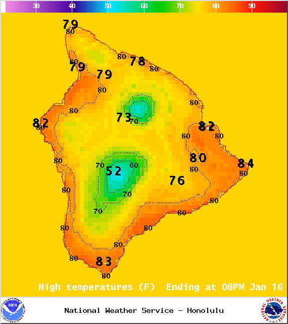
Image: NOAA / NWS
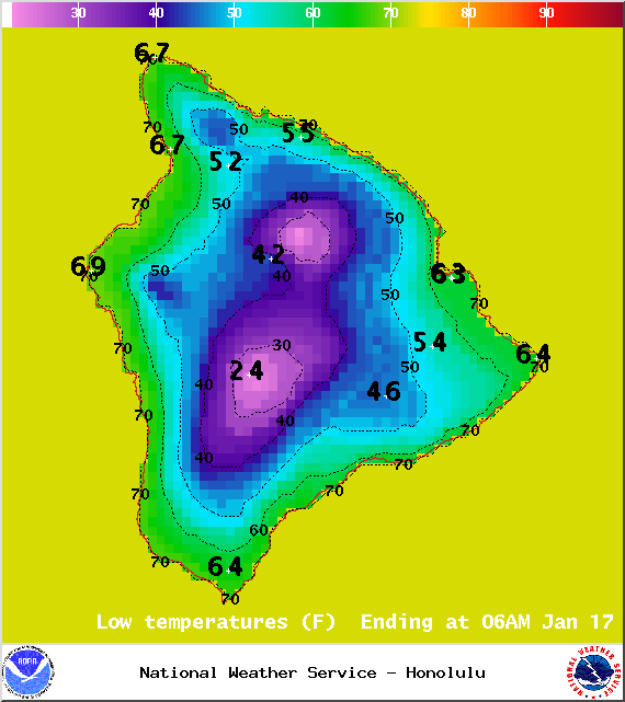
Image: NOAA / NWS
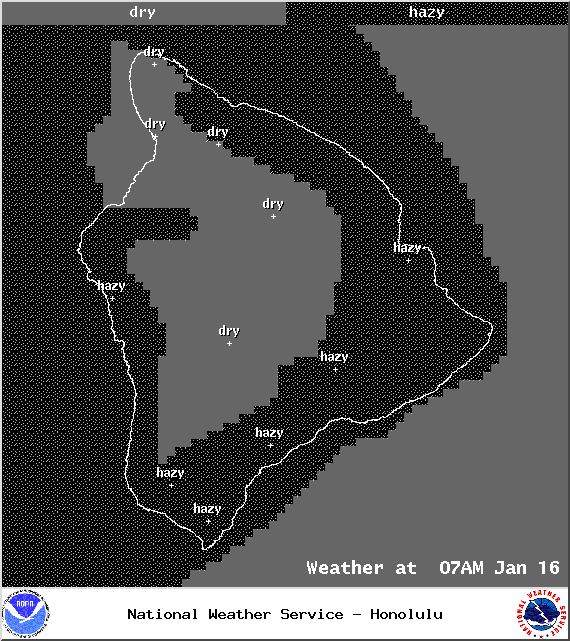
Image: NOAA / NWS
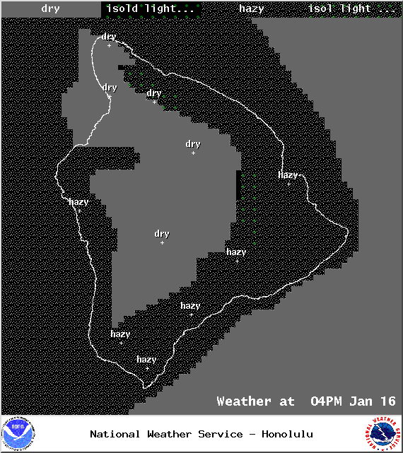
Image: NOAA / NWS
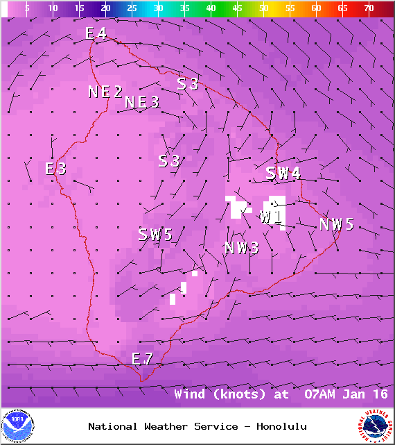
Image: NOAA / NWS

Image: NOAA / NWS
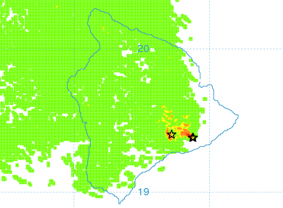
Image: UHSOEST
Image: NOAA / NWS
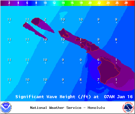
Image: NOAA / NWS
Sponsored Content


