

WEEKEND SURF: Series of Swells Expected
Alerts
There are no ocean alerts posted at this time.
**Click directly on the images below to make them larger. Charts include: Big Island projected winds, tides, swell direction & period and expected wave heights.**
 Big Island Surf Forecast, Saturday, January 10, 2015
Hilo side: Surf heights are expected head high to slightly overhead at the best breaks open to the swell.
Kona side: Surf heights are forecasted from knee to about waist high. Possibly chest high at the best exposures.
South: Southerly spots are below waist high today. Exposures open to the east-southeast are forecasted to get knee to shoulder high surf.
Our current west-northwest is expected over the weekend, building on Saturday. This swell will possibly produce advisory level surf along north and west facing shores. The swell will gradually subside through the weekend.
 Pending development of storms, another shot of energy is expected early next week as well, with surf likely well above the advisory level along north and west facing shores. That swell will slowly subside through midweek. A northwest swell arriving next midweek may be larger still when it peaks next Thursday.
Nothing of note out of the SPAC to get excited about.
Keep in mind, surf heights are measured on the face of the wave from trough to crest. Heights vary from beach to beach, and at the same beach, from break to break.
**Click here for your detailed Big Island weather report.**
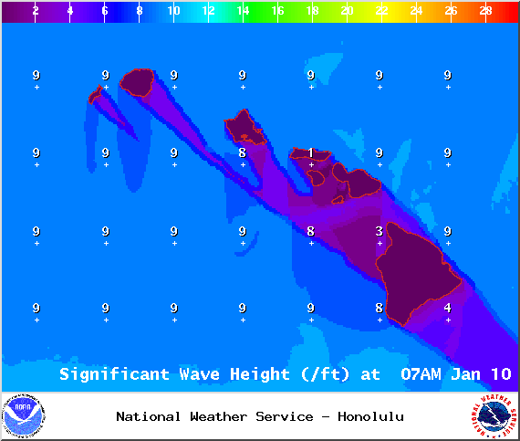
Image: NOAA / NWS

Image: NOAA / NWS

Image: NOAA / NWS

Image: NOAA / NWS

Image: NOAA / NWS
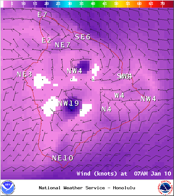
Image: NOAA / NWS
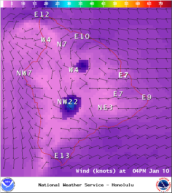
Image: NOAA / NWS
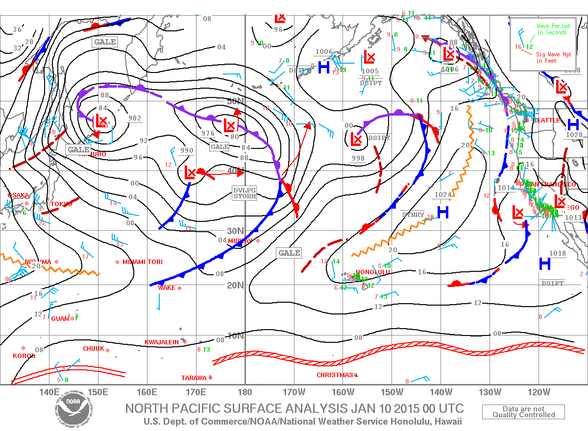
Image: NOAA / NWS
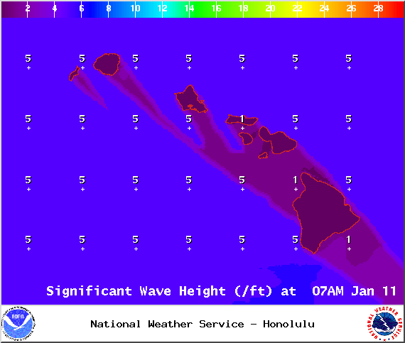
Image: NOAA / NWS

Image: NOAA / NWS

Image: NOAA / NWS
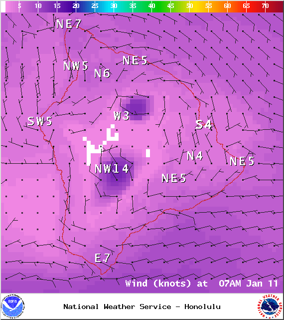
Image: NOAA / NWS
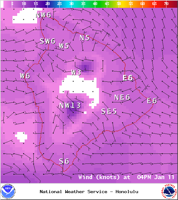
Image: NOAA / NWS
Sponsored Content


