

Calm Morning Conditions, Advisory Level Swell
Alerts
A Small Craft Advisory is posted for all Big Island waters through 6:00 a.m. Thursday for north winds up to 25 knots with higher gusts. Rough seas up to 14 feet are also forecasted through Thursday morning. Inexperienced mariners should avoid navigating in these conditions.
A High Surf Advisory is posted for north facing shores through 6:00 p.m. Thursday. Expect strong breaking waves, shore break and strong longshore and rip currents making swimming difficult and dangerous.
**Click directly on the images below to make them larger. Charts include: Big Island projected winds, tides, swell direction & period and expected wave heights.**
 Big Island Surf Forecast, Thursday, January 8, 2015
Hilo side: Surf heights are expected at well overhead to double overhead. The best breaks open to the swell could reach triple overhead early in the day.
Kona side: Surf heights are forecasted from waist to about shoulder high. Largest in earlier in the day.
South: Southerly spots are below waist high today.
Our current north-northwest (330-360) swell is expected to hold up to double (maybe triple) overhead at the best exposures early in the day. This swell is expected to fade Thursday into Friday. The Kona side is shadowed from this swell but some fun waves are still expected to sneak in out of the west-northwest.
 Another west-northwest is expected over the weekend, building on Saturday. Pending development of storms, another shot of energy expected early next week as well.
Nothing of note out of the SPAC to get excited about.
Keep in mind, surf heights are measured on the face of the wave from trough to crest. Heights vary from beach to beach, and at the same beach, from break to break.
**Click here for your detailed Big Island weather report.**
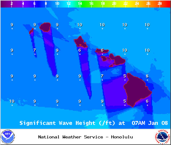
Image: NOAA / NWS

Image: NOAA / NWS

Image: NOAA / NWS

Image: NOAA / NWS

Image: NOAA / NWS
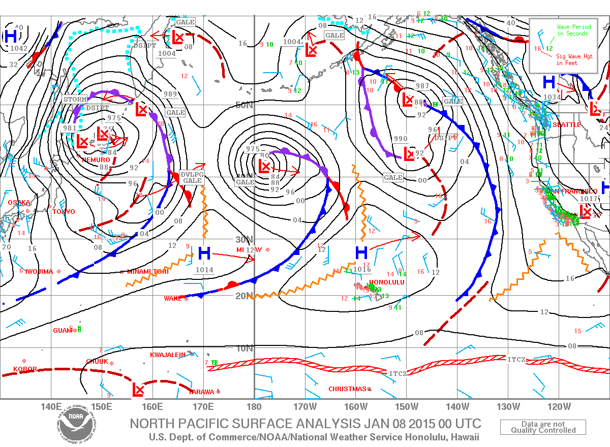
Image: NOAA / NWS
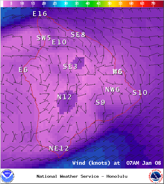
Image: NOAA / NWS
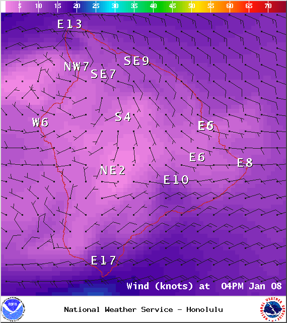
Image: NOAA / NWS
Sponsored Content


