


Big Island western shores now under high surf advisory; flood watch extended
Meanwhile, all other high surf warnings, watches and advisories throughout the state were canceled as the southwest swell generated by Hurricane Lowell continues to drop off quickly while the storm keeps moving north and away from the state.
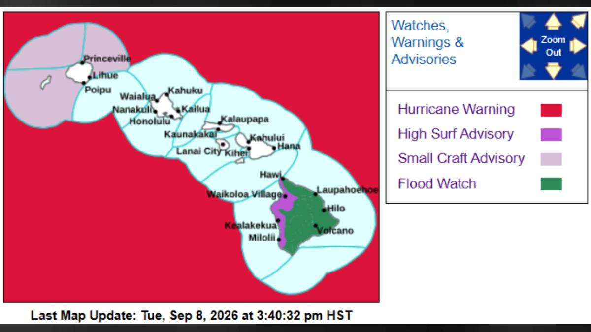
Updated at 3:51 p.m. Sept. 8
The high surf warning previously in effect for western shores of the Big Island was canceled and replace with a high surf advisory until midnight Wednesday.
Meanwhile, all other high surf warnings and advisories throughout the state were canceled.
National Weather Service forecasters in Honolulu say a southwest swell from Hurricane Lowell will linger tonight for west-facing shores, continuing to bring the chance for damaging surf, damage to coastal properties and beach runup.
This could continue bringing damaging surf, damage to coastal properties, and beach runup until late tonight.
Large breaking waves of 6 to 8 feet are still possible, but declining to 4 to 6 feet by later Wednesday morning
Those strong breaking waves accompanied by strong currents will continue to make swimming and other ocean recreation dangerous.
Members of the public are reminded to heed all advice from ocean safety officials; when in doubt, don’t go out.
Forecasters report that as Hurricane Lowell moved north of Hawaiian coastal waters, southwest swell generated by the storm dropped quickly, below warning and advisory criteria along south and east shorelines.
Hawaiʻi County announced early Saturday afternoon that several county park and recreation facilities were closed because of high surf conditions.
The following parks and facilities are closed:
- Hōnaunau Boat Ramp, 84-5571 Hōnaunau Beach Road, Hōnaunau.
- Hoʻokena Beach Park, 86-4322 Māmalahoa Highway, Captain Cook.
- Kahaluʻu Beach Park, 78-6702 Aliʻi Drive, Kaulia-Kona.
- Laʻaloa Beach Park, 77-6474 Aliʻi Drive, Kailua-Kona.
- Old Kona Airport Beach Park Strip, 75-5500 Kuakini Highway, Kailua-Kona.
- Kohanaiki Beach Park, Kohanaiki Golf Club, Kailua-Kona.
- Māhukona Wharf, 57-2001 Māhukona Park Road, Māhukona.
For more information, please Visit the Hawaiʻi County Hazard Impact Map
A flood watch also is now in effect through Wednesday afternoon for the Big Island as a previous watch that was supposed to expire at 6 p.m. today was extended.
Trailing moisture along the eastern flank of Hurricane Lowell is expected to bring periods of heavy rainfall through this afternoon. Then, a weak band of moisture just east of the island is forecast to move east Wednesday and could produce flooding during the afternoon.
Flood-prone roads and other low-lying areas could be closed because of elevated runoff and overflowing streams. Urban areas could receive more significant flooding and property damage because of rapid runoff.
The public is reminded to monitor later forecasts and be prepared to take action should flash flood warnings be issued.






