

Stunning New Video Footage of 2018 Kīlauea Eruption Released
On May 3, 2018, the Kīlauea volcano eruption opened up its first fissure underneath the Leilani Estates Subdivision in Puna.
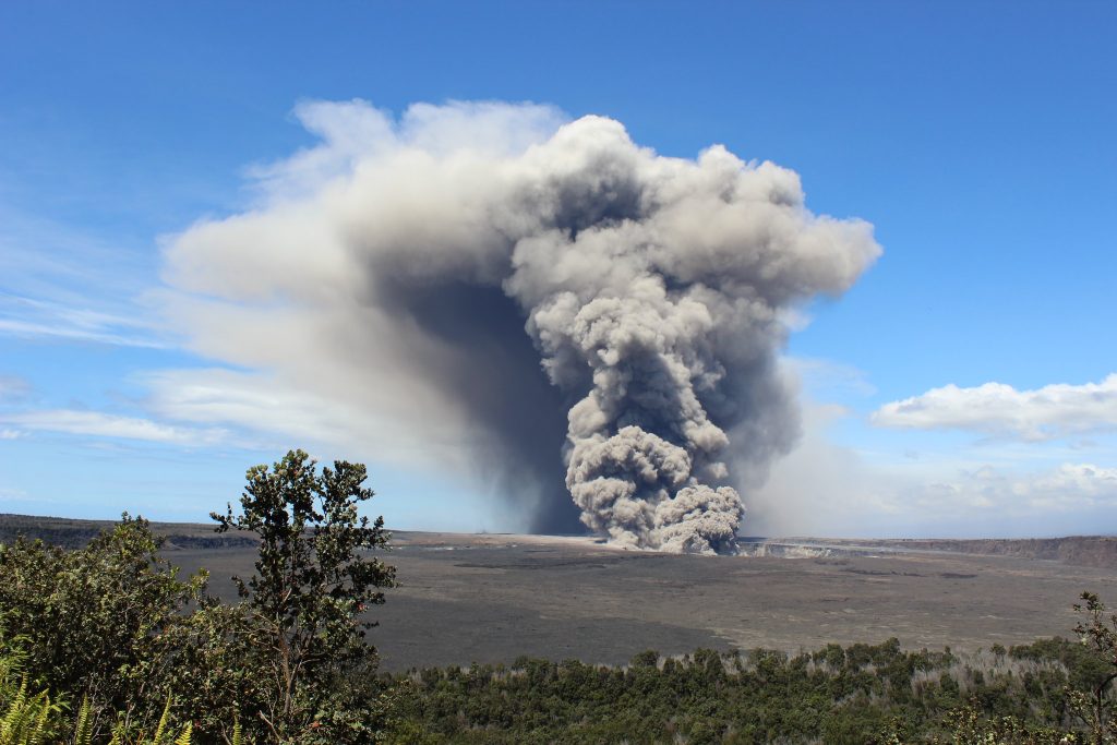
The most active volcano in the world, Kīlauea had been erupting for decades, but the next several months would be characterized by the volcano’s most explosive activity in centuries.
Much of the footage in the following video ⚊ including images from Leilani Estates, the Lower East Rift Zone, and Highway 132 ⚊ has never before been released to the public.
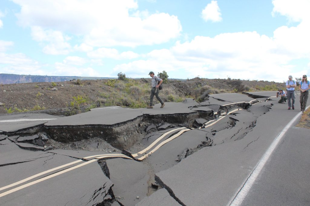
More than 60,000 earthquakes were recorded over the approximately four-month eruption, and a total of nearly 14 square miles of land in the Puna District was inundated by lava before activity began to quell in August and September of 2018. The volcano released a total of 1 billion cubic yards of erupted lava over that time, which also covered around 30 miles of Big Island road.
More than 700 structures were lost to the eruption, many of them homes, and substantial relief efforts to help those displaced by the disaster remain ongoing almost three years later.
 This ‘a‘ā flow erupted from fissure 8 on Kīlauea Volcano’s lower East Rift Zone on June 1, 2018, shows how the interior of a lava flow remains incandescently hot even though surface cooling forms a crust of solid rubble. Based on studies of lava flow cooling rates, it will take more than 130 days for a flow this thick (about 4.5 m, or 15 ft) to cool to a temperature of about 200 degrees Celsius (290 degrees Fahrenheit).PC: USGS photo by A. Lerner.
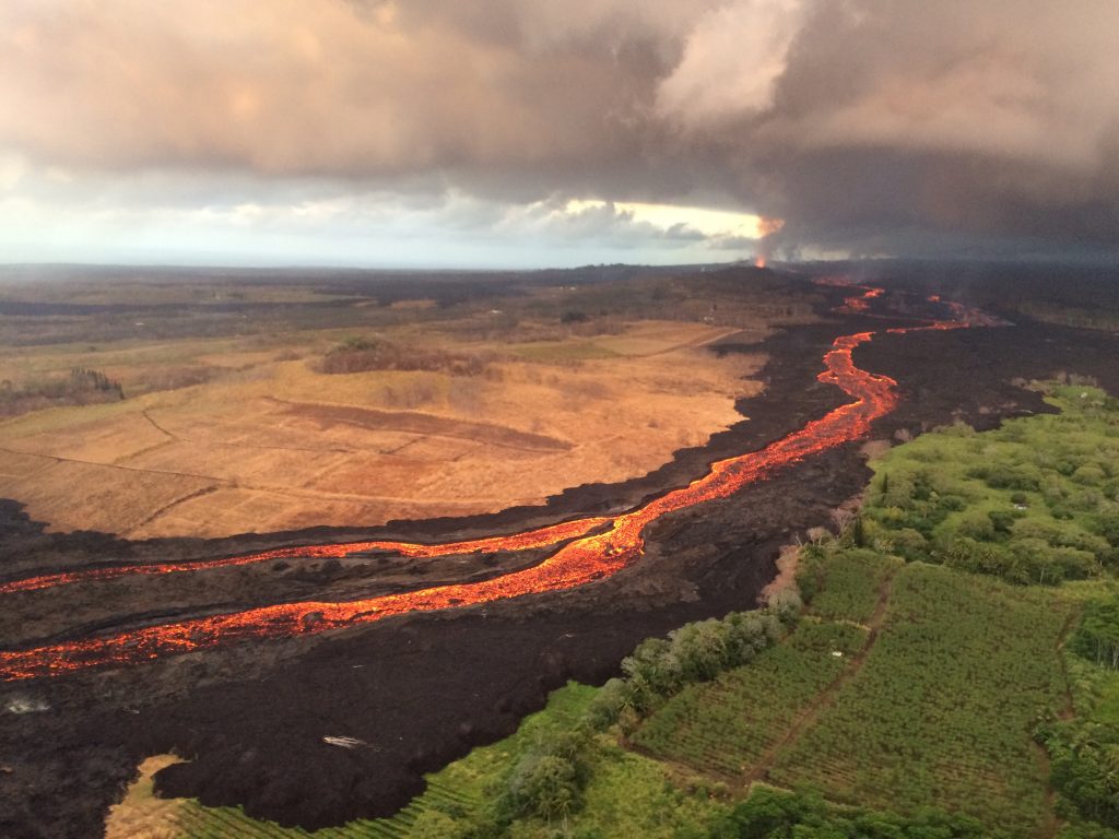
- During the first two weeks of Kīlauea Volcano’s 2018 lower East Rift Zone eruption, fissures were characterized by low eruption rates and small flows. This was because the erupted lava originated from pockets of cooler, less fluid magma stored in the rift zone. Later fissures erupted hotter, more fluid magma, resulting in higher eruption rates and large, fast-moving lava flows, like that erupted from the fissure 8 cone (lower right), shown here on July 29, 2018. PC: USGS photo by M. Patrick.
- Park managers to recap success and work ahead a year after Kīlauea caldera’s summit collapse. (April 2019) PC: HVNP
- Park managers to recap success and work ahead a year after Kīlauea caldera’s summit collapse. (April 2019) PC: HVNP
- Left: This wide angle view from the helicopter overflight shows the deepest part of the Kīlauea caldera with the lower flanks of Mauna Loa visible in the background. The water pond is visible at the bottom of the crater (center of image). USGS photo by C. Parcheta, 08-22-2019. Right: A closer aerial view of the water pond in Halema‘uma‘u. USGS photo by C. Parcheta, 08-22-2019.
- A view from above shows the catastrophic force of a fast-moving lava flow from Hawaii’s Kilauea volcano, seen here on May 19. The eruption destroyed nearly 700 homes and displaced thousands. Bruce Omori—Paradise Helicopters/EPA-EFE/Shutterstock
- The fissure 8 vent (far distance, upper right) continues to feed an active lava channel on Kīlauea Volcano’s lower East Rift Zone, shown here on July 26, 2018. Based on several monitoring techniques, the USGS recently estimated that lava is erupting from fissure 8 at a rate of 50 to 150 cubic meters per second (65–196 cubic yards per second), or roughly, 1.1 to 3.4 billion gallons per day. USGS photo by L. DeSmither.
- Kīlauea Volcano’s lower East Rift Zone on July 23, 2018. Click to enlarge. PC: USGS
- Kīlauea Volcano’s lower East Rift Zone on July 21, 2018. Click to enlarge. PC: USGS


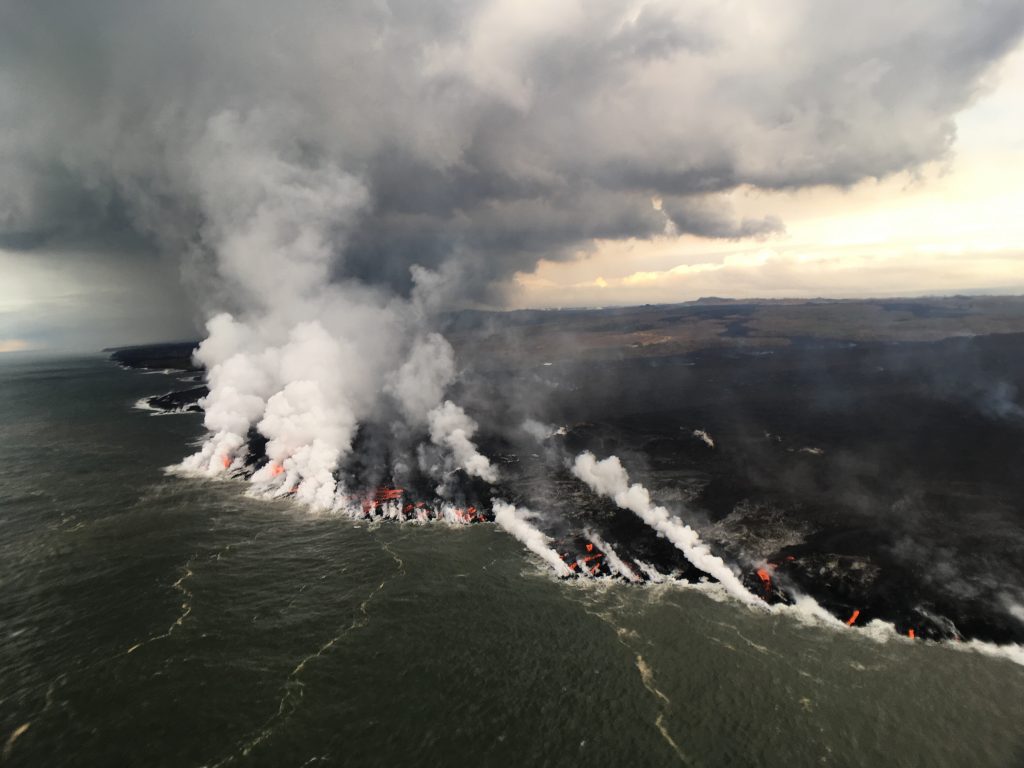


The destruction, however, also brought creation, as 875 acres of new land developed in East Hawai´i due to lava entering the ocean.
After more than two vog-free years of relative calm, Kīlauea reawakened on Dec. 20, 2020, as fissures in the side of Halemaʻumaʻu crater burst opened and began to replenish the lava lake there.
For the full zip files of newly released Volcano Science Center footage, visit the United States Geological Survey website.
Sponsored Content

_1770333123096.webp)

