

HVO UPDATE: Kīlauea Remains an Active Volcano
Hawaiian Volcano Observatory released an update on Tuesday, May 14, 2019.
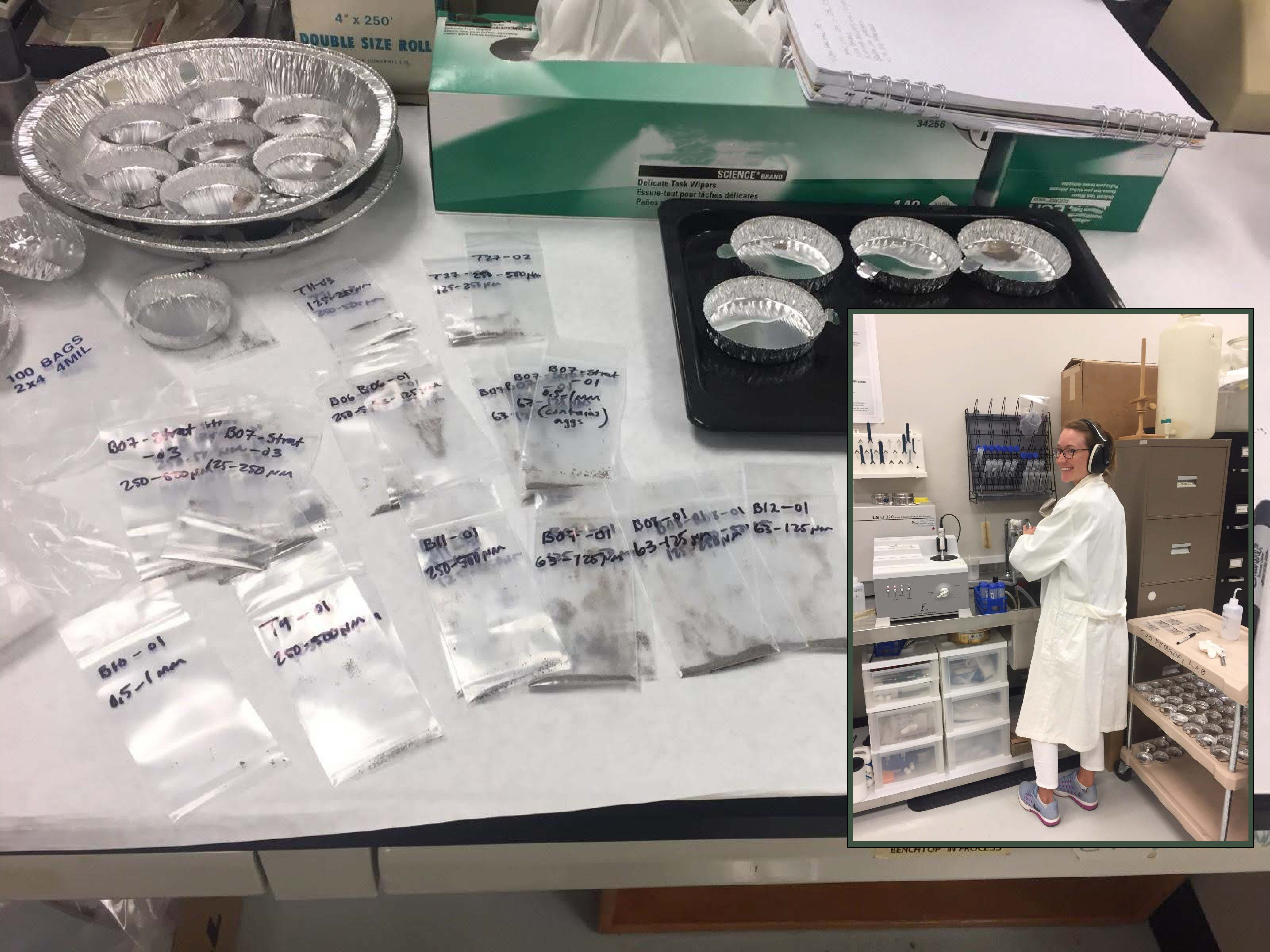
Scientists use a laser diffraction particle size analyzer to examine fine ash from the 2018 Kīlauea summit explosions. The researcher examines fine ash (grains 1 mm to 1 micrometer) and investigates the processes of eruption, fragmentation, and respiratory health hazards (PM10, PM2.5) on May 7, 2019. PC: USGS image by A. Van Eaton
Kīlauea Volcano is not erupting. Monitoring data over the past nine months have shown relatively low rates of seismicity, deformation, and sulfur dioxide emissions at the summit and East Rift Zone, including the area of the 2018 eruption.
As of March 26, Kīlauea Volcano is at NORMAL/GREEN. For definitions of USGS Volcano Alert Levels and Aviation Color Codes, go online.
Despite this classification, Kīlauea remains an active volcano, and it will erupt again. Although we expect clear signs prior to a return to eruption, the time frame of warning may be short. Island of Hawaiʻi residents should be familiar with the long-term hazard map for Kīlauea Volcano and should stay informed about Kīlauea activity.
Observations: Monitoring data have revealed no significant changes in volcanic activity over the past week. Generally low seismicity continues across the volcano, with earthquakes occurring primarily in the summit and south flank regions. The largest Kīlauea earthquake over the past week was a M2.9 event near Keanakākoʻi Crater on May 11, at a depth of 1.9 miles below ground level. USGS received 6 felt-reports following this event.
Since early March, tiltmeters at the Kīlauea summit have recorded modest inflationary tilt. Over about the same time period, a GPS station within the 2018 collapse area has recorded approximately 3 inches of uplift. Satellite radar data (InSAR) show deformation consistent with inflation of the shallow Halemaʻumaʻu source, confirming the trends noted by both tiltmeters and GPS. One possible interpretation is that magma has begun to slowly accumulate within the shallow portion of the Kīlauea summit magma system, approximately 1 mile below ground level. However, gas measurements have yet to indicate significant shallowing of large volumes of melt. HVO continues to carefully monitor gas output at the Kīlauea summit and East Rift Zone for important changes.
Further east, GPS stations and tiltmeters continue to show motions consistent with refilling of the deep East Rift Zone magmatic reservoir in the broad region between Puʻu ʻŌʻō and Highway 130. This trend has been observed since the end of the 2018 eruption, and while its significance is unclear, monitoring data do not suggest any imminent change in volcanic hazard for this area.
Hazards remain in the lower East Rift Zone eruption area and at the Kīlauea summit. Residents and visitors near the 2018 fissures, lava flows, and summit collapse area should heed Hawai‘i County Civil Defense and National Park warnings. Hawai‘i County Civil Defense advises that lava flows and features created by the 2018 eruption are primarily on private property and persons are asked to be respectful and not enter or park on private property.
The Hawaiian Volcano Observatory (HVO) continues to closely monitor seismicity, deformation, and gas emissions for any sign of increased activity at Kīlauea. HVO maintains visual surveillance of the volcano with web cameras and occasional field visits. HVO will continue to issue a weekly update (every Tuesday) until further notice, and will issue additional messages as warranted by changing activity.
Sponsored Content


