

HVO UPDATE: Low Rates of Seismicity
The U.S. Geological Survey released the Hawai‘i Volcano Observatory Weekly Update on Tuesday, Nov. 13, 2018.
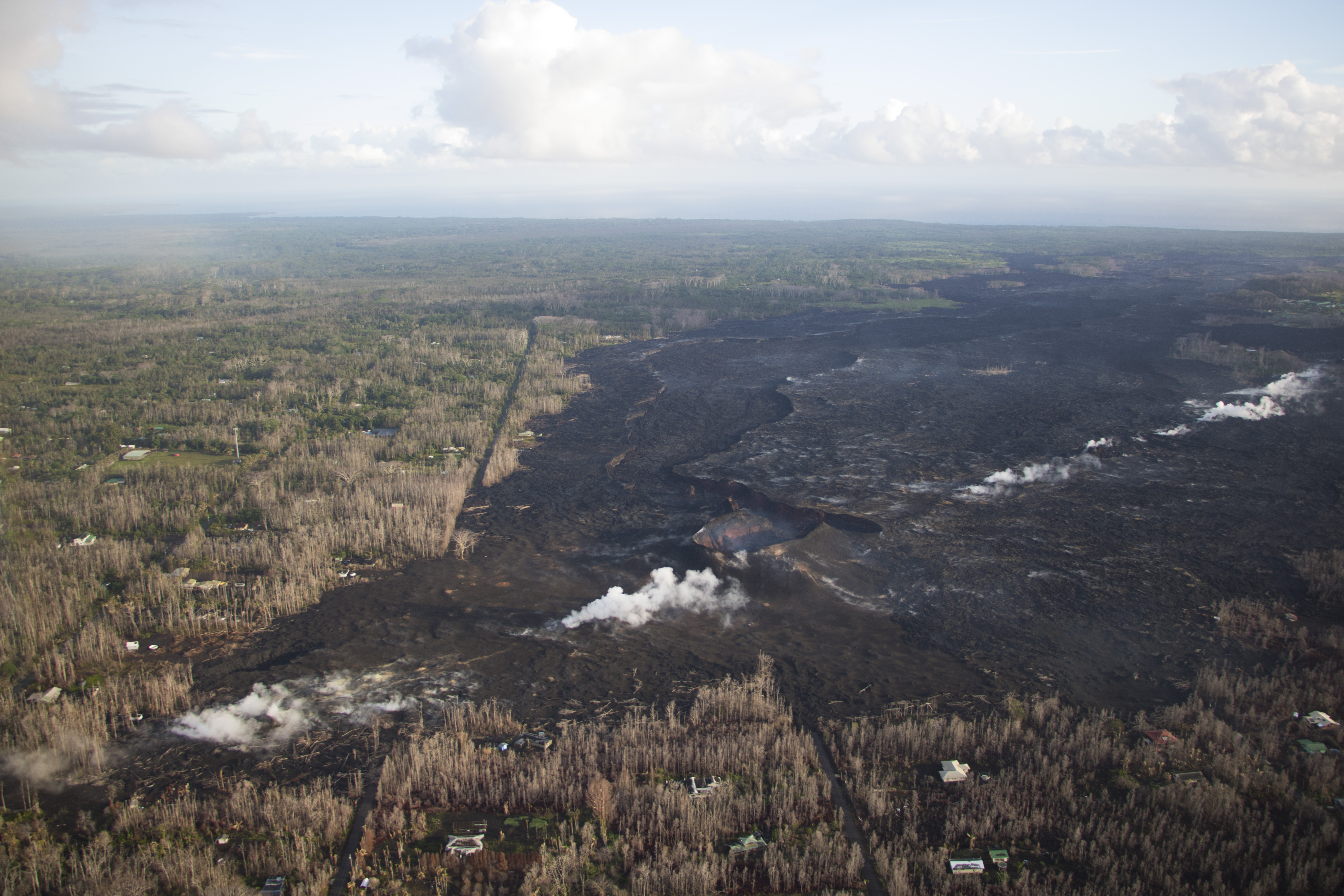
No significant changes were observed on today’s overflight of the Lower East Rift Zone. This photo, looking north, shows the eastern portion of Leilani Estates subdivision, now covered by lava. The Fissure 8 cone, which was active for two months, is visible near the center of the photo, with its large drained channel extending north. White steam originates from residual heat in the fissure system. Click to enlarge. PC: USGS
Activity Summary: Kīlauea Volcano is not erupting. Rates of seismicity, deformation and gas release have not changed significantly over the past week. Deformation signals are consistent with refilling of the middle East Rift Zone.
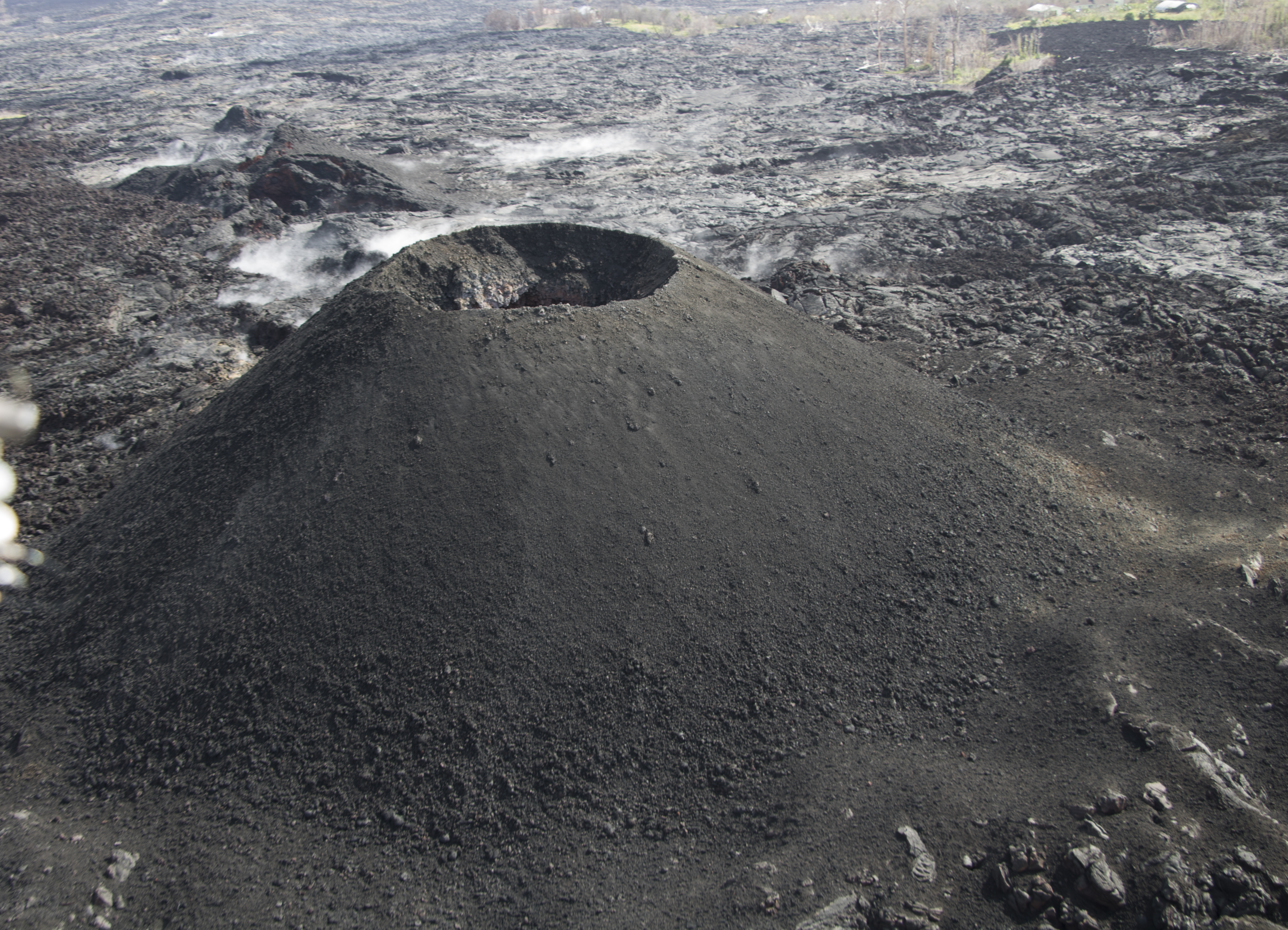
Fissure 22 was active in late May near Lanipuna Gardens subdivision, which is now mostly buried by lava flows. During the later stages of Fissure 22 activity, small strombolian-style explosions built a symmetric cinder cone over the vent. Click to enlarge. PC: USGS
Observations: HVO monitoring during the past week shows low rates of seismicity at the summit and East Rift Zone (ERZ). Earthquakes continue to occur primarily at Kīlauea’s summit area and south flank, with continued small aftershocks of the magnitude-6.9 quake on May 4, 2018. Seismicity remains low in the Lower ERZ.
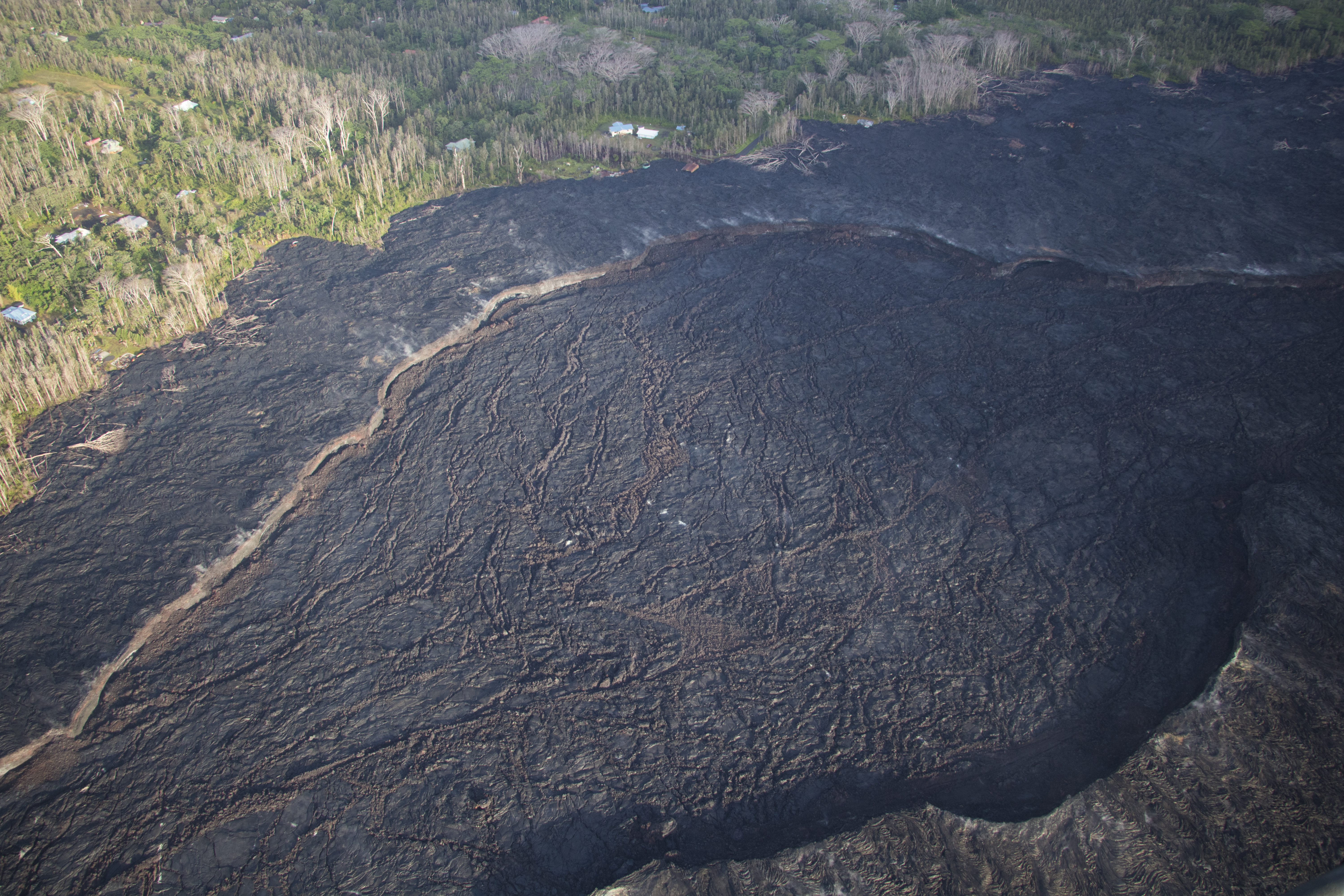
This photo shows the widest portion of the Fissure 8 channel, at roughly 0.26 miles across. Click to enlarge. PC: USGS
In the ERZ, tiltmeters near Puʻu ʻŌʻō and farther east reveal no change over the last week. At the summit, tiltmeters have also shown little change this week, with the exception of a small DI (deflation-inflation) event.
Sulfur dioxide gas emissions at the summit averaged 50 tonnes/day as reported on Oct. 24, and 75 tonnes/day at Puʻu ʻŌʻō on Oct. 23. There was no sulfur dioxide detected by our instruments in the Lower ERZ.
Hazards are still present in the lower East Rift Zone (LERZ) eruption area and at the Kīlauea summit. Residents and visitors near recently active fissures and lava flows should stay informed, heed Hawai‘i County Civil Defense and National Park warnings, and be prepared, if necessary, to self-evacuate in the unlikely event of renewed activity. Note that Hawai‘i County maintains a closure of the entire flow field and the vents and prohibits access to the area unless authorized through Civil Defense.

A large black sand beach remains in front of the Pohoiki boat ramp. Roadway construction over the recent lava flows can be seen at the top of the image. Click to enlarge. PC: USGS
The Hawaiian Volcano Observatory (HVO) continues to closely monitor Kīlauea’s seismicity, deformation, and gas emissions for any sign of reactivation, and maintains visual surveillance of the summit and the East Rift Zone. HVO will continue to issue a weekly update (every Tuesday) and additional messages as warranted by changing activity.
Sponsored Content


