


Civil Defense Announces Last Kīlauea Update, Unless Activity Changes
The Hawai‘i County Civil Defense reports that Hawaiian Volcano Observatory states that activity on the lower east rift zone of Kīlauea Volcano has diminished and remained quiet for over a week. The only surface activity is a small, crusted lava pond inside the Fissure 8 cone, and a few areas along the coast where lava is entering the ocean. Sulfur dioxide emission rates are also drastically reduced. While eruptive activity is minimal at this time, hazards remain.
It is common for eruptions to go through periods of diminished output, or to pause completely, only to reactivate days, weeks, or even months later. Re-activation could occur at any time, with little to no warning. Residents should remain informed and heed Hawai‘i County Civil Defense messages and warnings. The Hawaiian Volcano Observatory will continue to release daily status updates, found here.
At this time, the following access policies and restrictions are in effect:
- The entire flow field, including all fissures and lava features, is extremely dangerous and remains off limits.
- Highway 137 roadblock near MacKenzie State Park and Highway 132 roadblock between Nanawale and Lava Tree State Park remains closed to the public.
- Properties not destroyed, but isolated by lava on E. Pohoiki Road, Malama Ki Place, Halekamahina Road, and E. Pāhoa-Kapoho Road are accessible to residents with Civil Defense authorization only.
- Leilani Estates access is limited to residents. A Civil Defense Access Placard is required to enter Leilani Estates. Property on, and east of Pomaikai Street is in the mandatory evacuation area. For access to this area, residents must make an appointment with Civil Defense for an escort.
- Access to Papaya Farms Road, Noni Farms Road, Railroad Avenue, the Mail Box area, and Cinder Road is limited to residents. A Civil Defense Access Placard is required for these areas.
- Placards are available Monday through Friday at the Civil Defense office in Hilo, located at 920 Ululani St. from 8 a.m to 4 p.m.
Civil Defense continues to monitor the situation. However, this will is there final daily Kīlauea Eruption Update unless activity significantly changes.
This thermal map shows the fissure system and lava flows as of 6 a.m. on Wednesday, Aug. 15, 2018. Residual lava in the Fissure 8 flow continues to drain, feeding numerous small ocean entries.
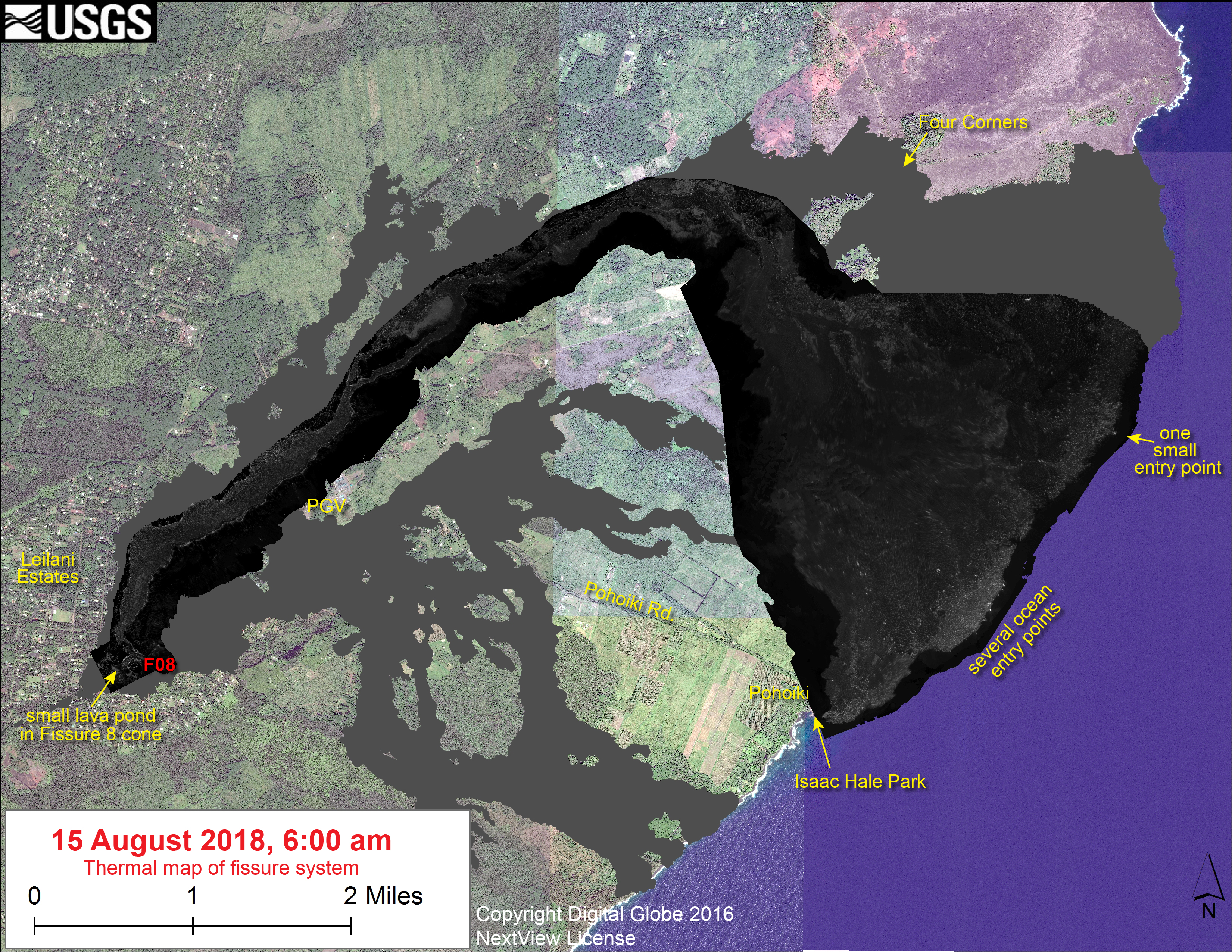
Thermal Map of the East Rift Zone on Aug. 15, 2018. Click to enlarge. PC: USGS
In the Fissure 8 cone there was a single, small lava pond. The black and white area is the extent of the thermal map. Temperature in the thermal image is displayed as gray-scale values, with the brightest pixels indicating the hottest areas. The thermal map was constructed by stitching many overlapping oblique thermal images collected by a handheld thermal camera during a helicopter overflight of the flow field. The base is a copyrighted color satellite image (used with permission) provided by Digital Globe.
Sponsored Content


