


PHOTOS: Activity Much Less Vigorous
The U.S. Geological Survey released these photos of the East Rift Zone on Sunday, Aug. 5, 2018.
Kīlauea lower East Rift Zone
View of the Fissure 8 cone and spillway from HVO’s overflight early this morning, during which geologists observed eruptive activity that was much less vigorous than in past days.
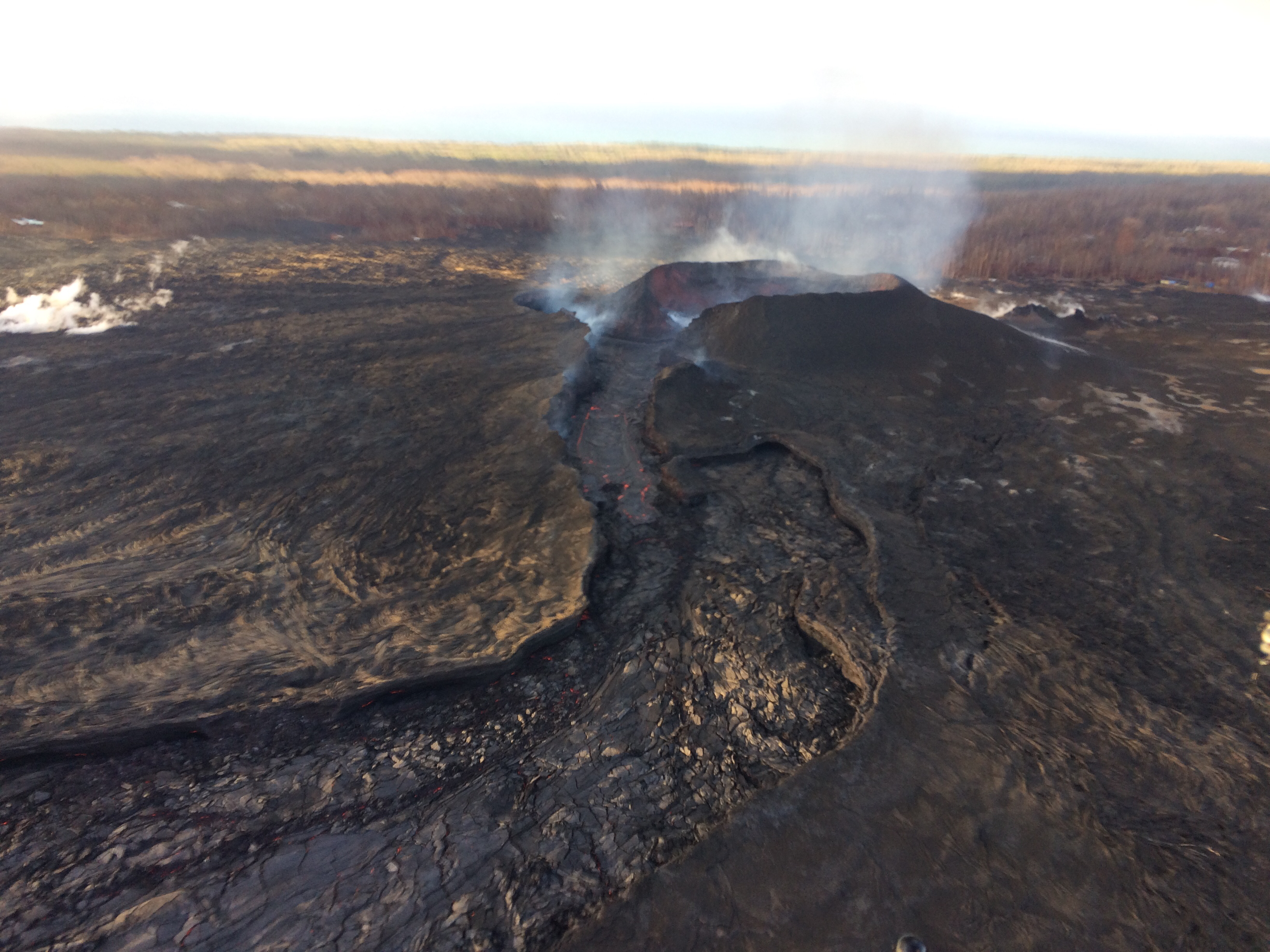
Fissure 8 on Aug. 5, 2018. Click to enlarge. PC: USGS
Looking more directly into the Fissure 8 vent this morning, the inner walls of the cone and lava surface could be seen.
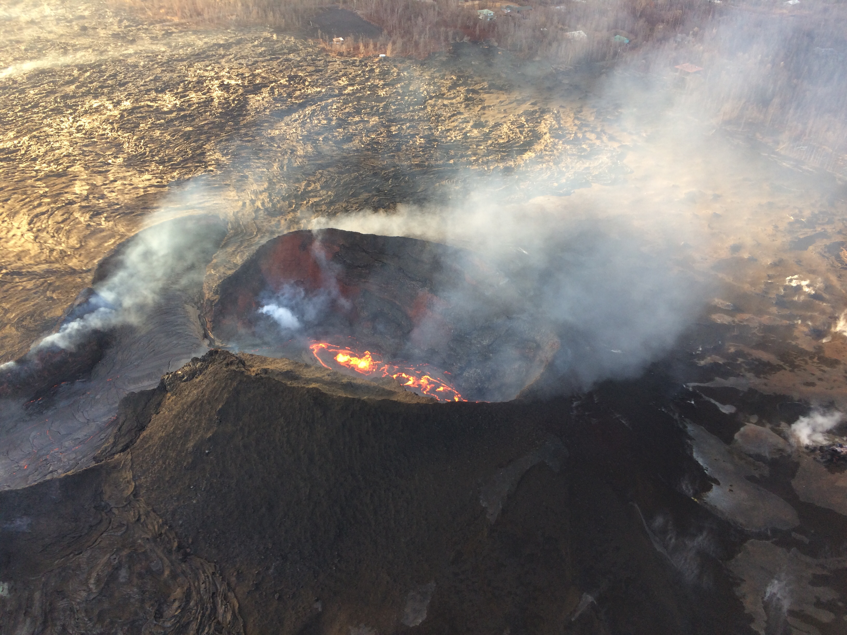
View inside of the cone of Fissure 8. Click to enlarge. PC: USGS
The level of lava within the vent and spillway (left) were down compared to yesterday. A dark crust, which forms as the lava surface cools, had formed on the lava with the spillway.
An ‘a‘ā flow on the western flank of Halekamahina, a cone west of Kapoho Crater.
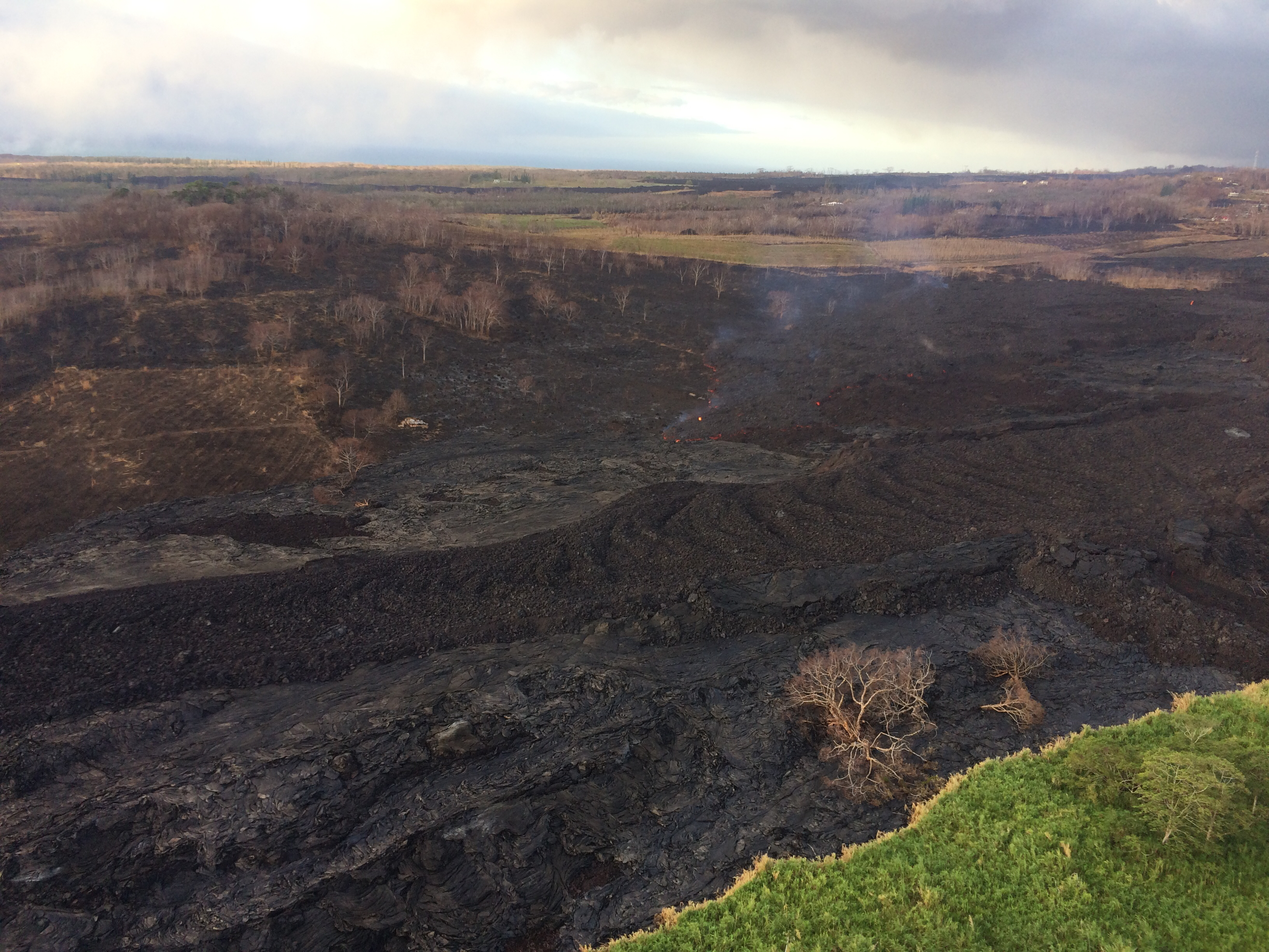
Lower East Rift Zone on Aug. 5, 2018. Click to enlarge. PC: USGS
Lava breakouts on the north and east sides of Kapoho Crater (upper right) were also observed during this morning’s overflight.
This view is from the north side of the crater; Government Beach Road visible at far left. Click to enlarge. PC: USGS
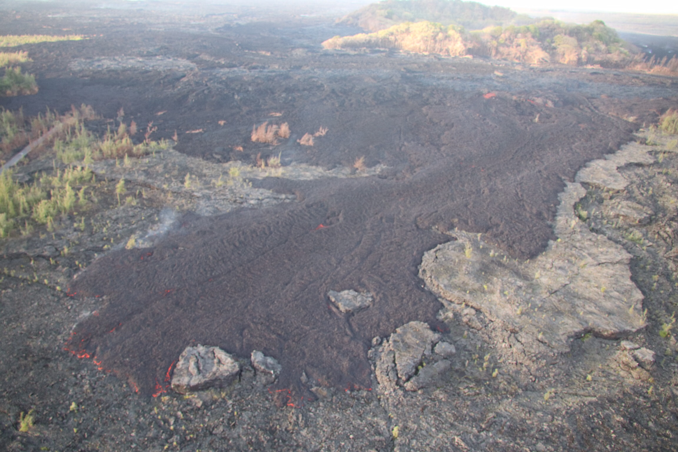
Incandescent lava remained visible in a section of the Fissure 8 channel west of Kapoho Crater (just visible at far left).
This view is looking south toward the ocean; the laze plume rising from the ocean entry can be seen in the far distance. Click to enlarge. PC: USGS
Closer view of the open channel west of Kapoho Crater.
Closer view. Click to enlarge. PC: USGS
According to geologists flying over the area, the flow appeared be the result of draining from the upslope channel; no discernible movement was observed.
A diffuse laze plume afforded a clear view of Isaac Hale Beach Park and the ocean entry, which was being fed across a broad front by viscous pāhoehoe.
Pohoiki on Aug. 5, 2018. Click to enlarge. PC: USGS
Lava was oozing laterally, but was still about 230 feet southeast of the Pohoiki boat ramp as of this morning.
Closer view of the viscous pāhoehoe flow entering the ocean near Isaac Hale Beach Park this morning.

Ocean entry on Aug. 5, 2018. Click to enlarge. PC: USGS
Kīlauea summit
Here’s another “then and now” look at Halema‘uma‘u (view is to north). At left, Halema‘uma‘u, as we once knew it, and the active lava lake within the crater are visible on April 13, 2018.
Then, April 13, 2018, and Now, July 28, 2018. Click to enlarge. PC: USGS
At right is a comparable viewshed captured on July 28, 2018, following recent collapses of the crater. The Hawai‘i Volcanoes National Park Jaggar Museum and USGS-HVO can be seen perched on the caldera rim (middle right) with the slopes of Mauna Loa in the background.
Sponsored Content


