Photos, Videos: Kīlauea Volcano Lower East Rift Zone
The U.S. Geological Survey released these photos and a video on Sunday, June 17, 2018, and announces that the Lower East Rift Zone (LERZ) eruption in Leilani Estates continues with little change.
(function(d, s, id) { var js, fjs = d.getElementsByTagName(s)[0]; if (d.getElementById(id)) return; js = d.createElement(s); js.id = id; js.src = ‘https://connect.facebook.net/en_US/sdk.js#xfbml=1&version=v3.0’; fjs.parentNode.insertBefore(js, fjs);}(document, ‘script’, ‘facebook-jssdk’));
Live at the river of lava coming off of Fissure 8 from the Kapoho cinder pits off of Gov. Beach Road. For more information go to www.BigIslandNow.com
Posted by BigIslandNow.com on Sunday, June 17, 2018
VC: Crystal Richards
Fountains as high as 165 feet rise from the Fissure 8 spatter cone and continue to feed lava into the well-established channel that flows to the ocean at Kapoho. Occasionally, minor amounts of lava briefly spill over the channel levees. The ocean entry remained fairly broad with laze blown onshore. Fissures 16/18 continue to ooze lava. Incandescence (visible in PGcam to the left of fissure 8 most nights) and mild spattering were observed from Fissure 6. The flow field is relatively stable with little change to its size and shape for the past few days.
ADVERTISEMENT
ad_queue.push(“14||28||49”);
ad_queue.push(“14||28||50”);
ad_queue.push(“14||28||75”);
var mobile_text_ad_hide = function(){ if(jQuery(window).width() > 600) { jQuery(“.mobile_text_ads”).hide(); } }; jquery_queue.push(“mobile_text_ad_hide();”);
(function(d, s, id) { var js, fjs = d.getElementsByTagName(s)[0]; if (d.getElementById(id)) return; js = d.createElement(s); js.id = id; js.src = ‘https://connect.facebook.net/en_US/sdk.js#xfbml=1&version=v3.0’; fjs.parentNode.insertBefore(js, fjs);}(document, ‘script’, ‘facebook-jssdk’));
ARTICLE CONTINUES BELOW ADJust Released: Mesmerizing Lava River Video
Mesmerizing NEW USGS VIDEO of the fast-moving flow from #Fissure8 – Civil Defense says 5,914 acres or 9.24 square miles of land have now been impacted. With their official count at 533 homes destroyed... Mayor Kim believes it to be 600-700 or higher when you factor in unpermitted structures and homes. The latest USGS update explains that from fissure 8, lava flows freely over small cascades (rapids) into a well-established channel. Near the vent, lava is traveling about 15 miles per hour. Lava slows to about 1.5 miles per hour near the ocean entry at Kapoho. It’s pretty amazing.
Posted by BigIslandNow.com on Sunday, June 17, 2018
VC: Malika Dudley
Pele’s hair and other lightweight volcanic glass fragments from the lava fountain at Fissure 8 continue to fall downwind of the fissure, dusting the ground within a few hundred yards of the vent. High winds may waft lighter particles to greater distances. Residents are urged to minimize exposure to these volcanic particles, which can cause skin and eye irritation similar to volcanic ash.
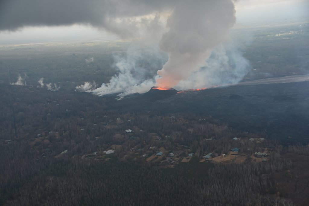
Morning overflight of Kīlauea Volcano’s lower East Rift Zone by the Civil Air Patrol provides context for the location of the fissure 8 fountain and lava channel within the lower Puna District.
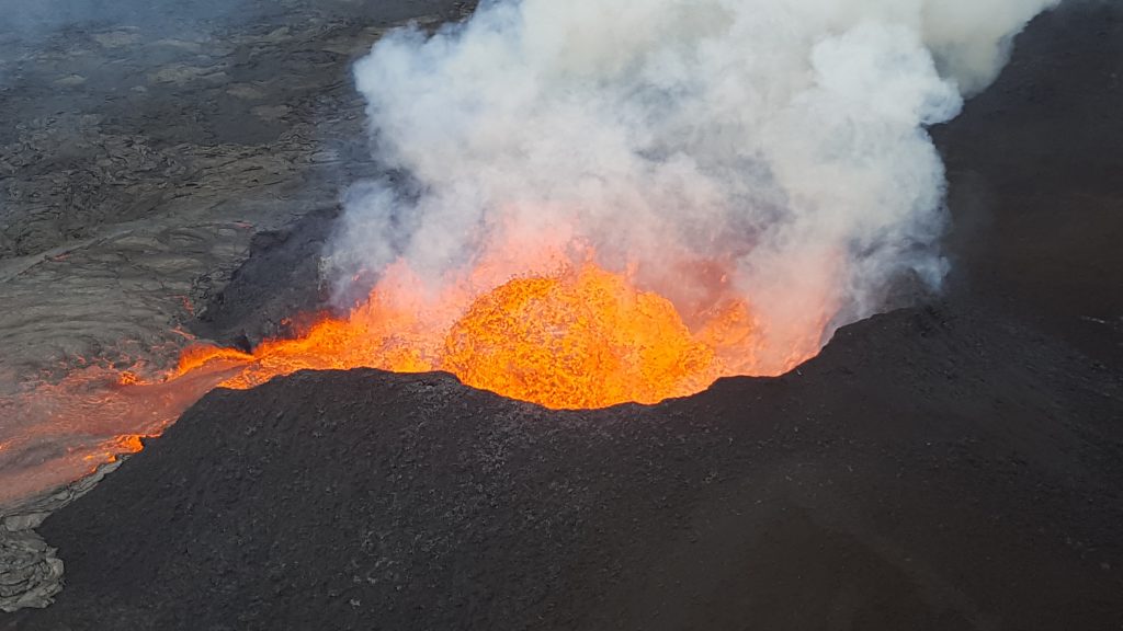
The fissure 8 lava fountain pulses to heights of 165 feet within a cinder spatter cone.
In this video taken from the Leilani Estates subdivision, lava at fissure 8 pulses above the cinder cone adding fragments of lava (spatter) that build the cone higher.
From fissure 8, lava flows freely over small cascades (rapids) into a well-established channel. Near the vent, lava is traveling about 15 miles per hour. Lava slows to about 1.5 miles per hour near the ocean entry at Kapoho.
Occasionally, minor amounts of lava briefly spill over the lava channel levees. The spill overs are the shiny gray lobes along the channel margins.
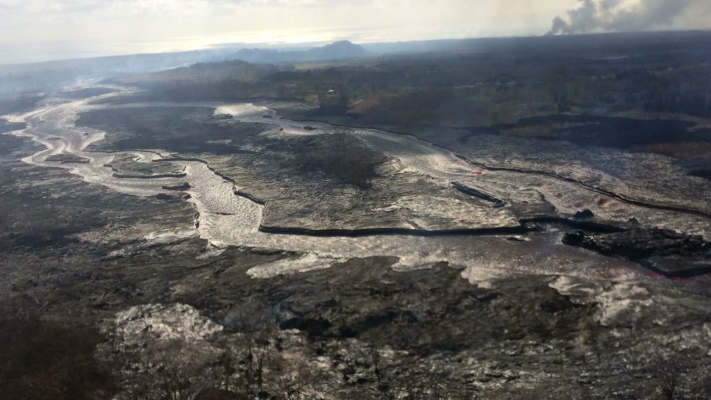
View to the east, with the plume in the upper right showing the location of the ocean entry. Click to enlarge.
The lava flow field has been relatively stable with little change to its size and shape over the past few days.
Lava enters the ocean entry in the vicinity of Vacationland, producing a vigorous laze plume.
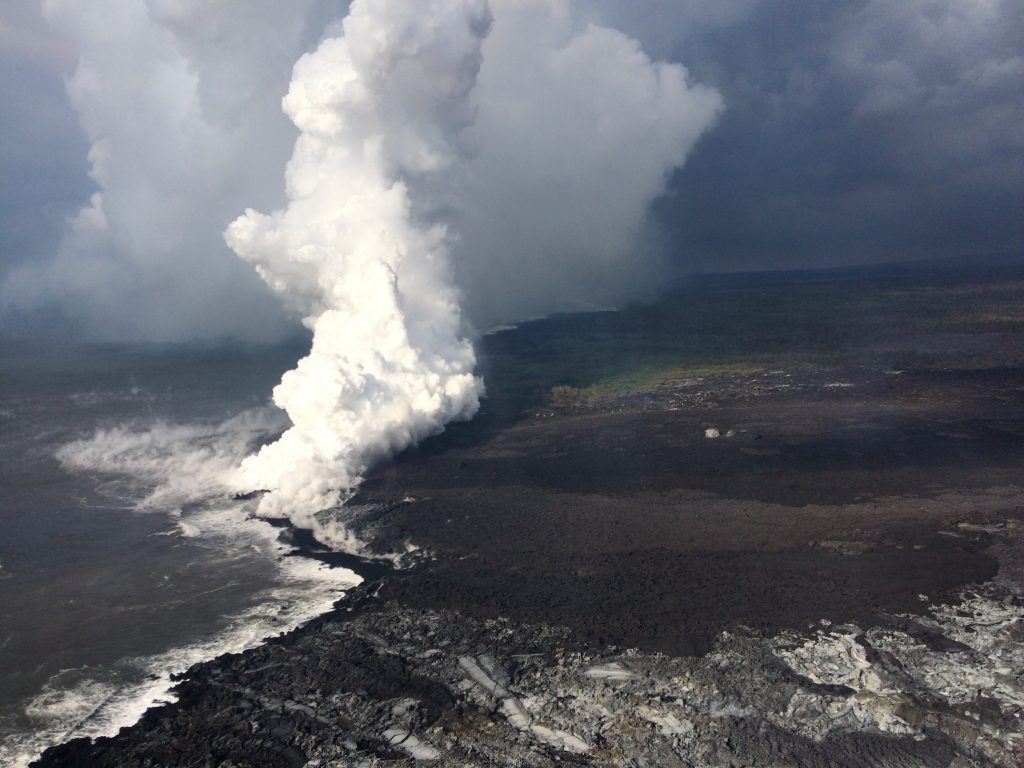
Lava flowing into the ocean has built a delta of flows, rock rubble and black sand, which is over 320 acres in size. Click to enlarge.
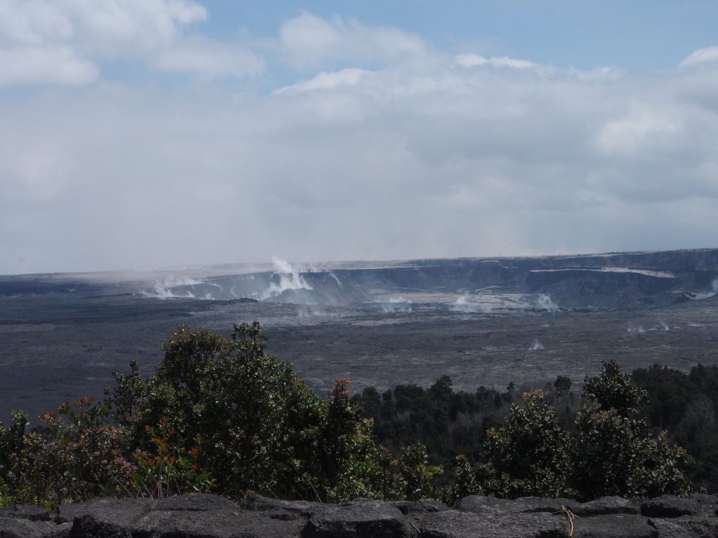
Inward slumping of the rim and walls of Halema‘uma‘u continues in response to ongoing subsidence at the summit. Sulfur dioxide emissions from the volcano’s summit have dropped to levels that are about half those measured prior to the onset of the current episode of eruptive activity.
This gas and very minor amounts of ash are being transported downwind, with small bursts of ash and gas accompanying intermittent explosive activity.


