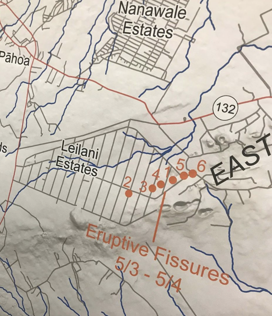
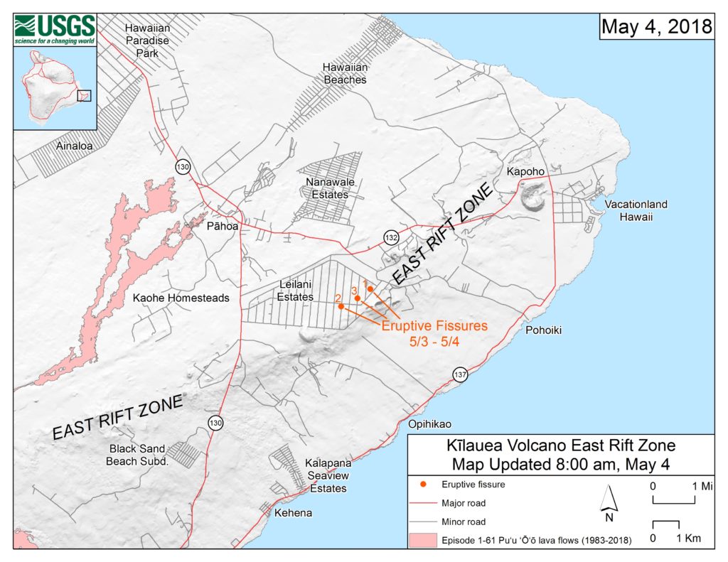
USGS Map Shows Location of Fissures
It has been reported that as of 6 p.m. Friday, May 4, 2018, there are now six fissures open in the Leilani Estates area of the Big Island.
The following was released by the USGS this morning and changes have since occurred:
The United States Geological Survey (USGS) released this this map that shows the locations, mapped by USGS-HVO scientists, of the eruptive fissures in the order that they occurred in the Leilani Estates Subdivision as of 8 a.m. on Friday, May 4, 2018.
The fissures are jetting copious amounts of sulfur dioxide gas, which should be avoided. Spatter is also being emitted, but lava flows are not extending far from the active fissures. The eruption remains dynamic, which means that changes could occur with little notice.
Updated maps will be posted as new information becomes available.
Sponsored Content
Comments


