

April 21, 2018 Surf Forecast
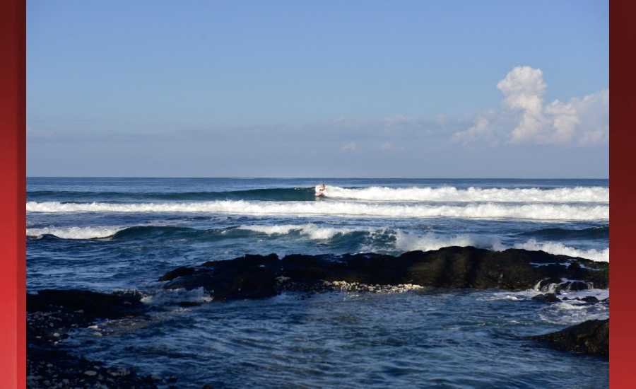
Photo: James Grenz
Swell Summary
Outlook through Friday April 27: The current northwest swell will boost surf along north and west facing shores Saturday. A slightly larger swell will peak Sunday and another moderate swell is possible next Thursday. A series of small swells from the southern hemisphere will maintain modest surf along south facing shores chain through this weekend. Lows in the southern hemisphere may strengthen and shift east enough to produce some bigger surf along south facing shores by the end of next week. Rough surf will persist along east facing shores through Sunday night due to the locally strong trade winds, but heights will remain moderate through the weekend. As trade winds strengthen early next week, surf may approach the High Surf Advisory threshold along east facing shores.
Surf heights are forecast heights of the face, or front, of waves. The surf forecast is based on the significant wave height, the average height of the one third largest waves, at the locations of the largest breakers. Some waves may be more than twice as high as the significant wave height. Expect to encounter rip currents in or near any surf zone.
North East
am ![]()
![]() pm
pm ![]()
![]()
Surf: Waist to stomach high E short period wind swell for the morning with occasional chest sets. This builds to stomach to shoulder high for the afternoon.
Conditions: Sideshore texture/chop with SSE winds 10-15mph in the morning increasing to 15-20mph in the afternoon.
North West
am ![]()
![]() pm
pm ![]()
![]()
Surf: Ankle to knee high WNW ground swell for the morning going more SSW during the day.
Conditions: Semi glassy in the morning with SSW winds less than 5mph. Bumpy/semi bumpy conditions for the afternoon with the winds shifting W 5-10mph.
West
am ![]()
![]() pm
pm ![]()
![]()
Surf: Knee high NW ground swell with occasional thigh high sets.
Conditions: Semi glassy in the morning with SSE winds less than 5mph. Semi glassy/semi bumpy conditions for the afternoon with the winds shifting W 5-10mph. Glassy conditions are expected for the late day with WSW winds less than 5mph.
South East
am ![]()
![]() pm
pm ![]()
![]()
Surf: Waist to stomach high E short period wind swell for the morning with occasional chest sets. This builds to stomach to shoulder high for the afternoon.
Conditions: Fairly clean in the morning with N winds 5-10mph. Light sideshore texture conditions for the afternoon with the winds shifting to the NNE.

Image: NOAA

Image: NOAA

Image: NOAA

Image: NOAA

Image: NOAA

Image: NOAA
**Click directly on the images below to make them larger. Charts include: Hawaii County projected winds, tides, swell direction & period and expected wave heights.**
Data Courtesy of NOAA.gov and SwellInfo.com
Sponsored Content


