

Today’s Surf Report: High Winds & Elevated Surf
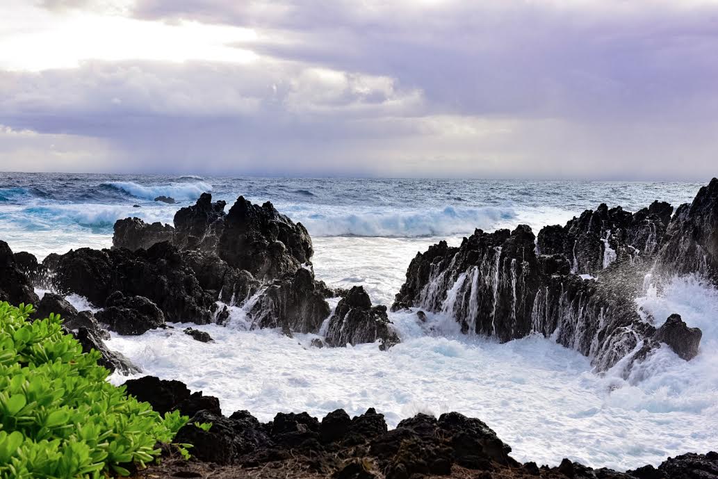
Image: James Grenz
Marine Alerts (as of 1:00 a.m.)
Flash Flood Watch: Maui and the Big Island through Tuesday afternoon. The highest chance of flooding will be over windward and interior areas.
Wind Advisory: Northeast winds up to 20 to 35 mph with gusts up to 50 mph through early Monday morning.
High Surf Advisory: North and east facing shores of Big Island through 6 p.m. Tuesday.
Small Craft Advisory: Through 6 p.m. Monday for east winds up to 30 knots and seas from 8 to 14 feet.
Gale Warning: Posted through Monday at 6 a.m.
Winter Storm Watch: Heavy snow and accumulations up to 12 inches are possible. The snow might mix with or change to rain during the day Tuesday. Big Island summits above 12,000 feet from Monday morning through Tuesday afternoon.
Marine Weather Statement: A north swell is peaking today. This swell could produce surges in north facing harbors like Hilo and could produce large breaking waves near channel and harbor entrances. Mariners are asked to exercise extreme caution.
**Click directly on the images below to make them larger. Charts include: Big Island projected winds, tides, swell direction & period and expected wave heights.**
Big Island Surf Forecast
Hilo: Wave heights are expected to be double to triple overhead today.
Kona: Wave heights are expected to be waist high or less today. Wrap from the north swell could bring chest/head high waves (spots north of Kalaoa).
South: Wave heights are expected to be waist high or less today.
Our current north swell is forecast to peak Monday at advisory levels. A series of northerly swells are forecast to move through the state over the next week.
Another northwest swell and north swell are forecast to fill in Tuesday possibly bringing advisory level surf Tuesday night and Wednesday.
A large reinforcement is forecast for Thursday.
Keep in mind, surf heights are measured on the face of the wave from trough to crest. Heights vary from beach to beach, and at the same beach, from break to break.
**Click here for your detailed Big Island weather report.**

Image: NOAA

Image: NOAA

Image: NOAA

Image: NOAA

Image: NOAA

Image: NOAA

Image: NOAA

Image: NOAA
Sponsored Content


