

Trade Swell Continues, SSW Fading Today

Image: James Grenz
Alerts (as of 1:00 a.m.)
Small Craft Advisory: Through 6 p.m. Friday.
**Click directly on the images below to make them larger. Charts include: Big Island projected winds, tides, swell direction & period and expected wave heights.**
Big Island Surf Forecast
Hilo side: Surf heights are expected to be knee/waist/chest high today. The best spots could get up to head high on the sets.
Kona side: Wave heights are expected to be knee/thigh high today. Many spots will be flat.
South: Wave heights are expected to be knee/thigh high today. Many spots will be flat.
No storm activity is forecast out of the South Pacific for the near term.
Trade swell will keep knee/chest high waves at the best exposures on the Hilo side. Some spots could get up to head high on the sets.
There isn’t anything on the radar out of the North Pacific.
Keep in mind, surf heights are measured on the face of the wave from trough to crest. Heights vary from beach to beach, and at the same beach, from break to break.
**Click here for your detailed Big Island weather report.**
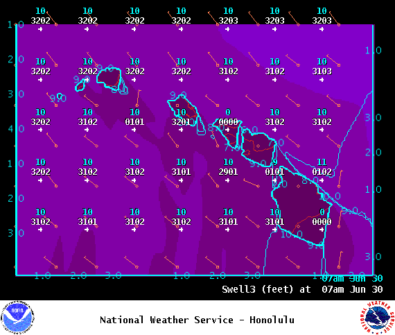
Image: NOAA
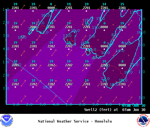
Image: NOAA
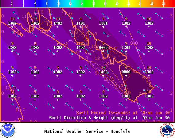
Image: NOAA
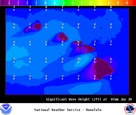
Image: NOAA
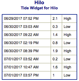
Image: NOAA
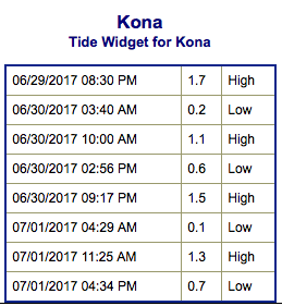
Image: NOAA
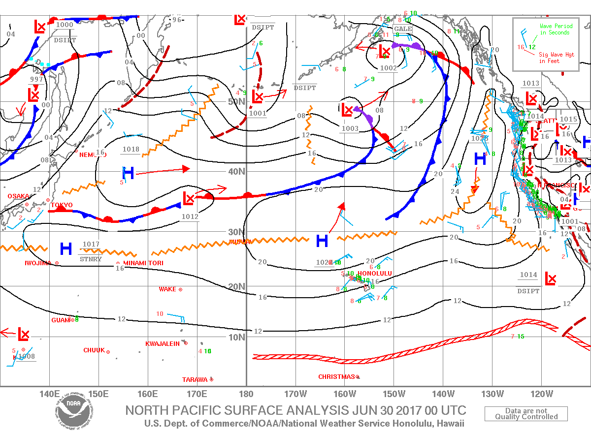
Image: NOAA
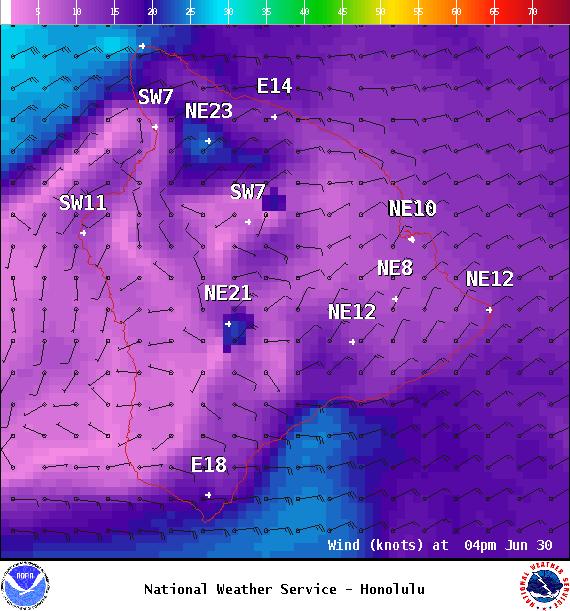
Image: NOAA
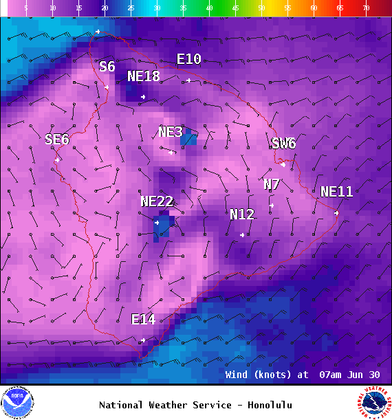
Image: NOAA
Sponsored Content


