

Weekend Surf: Spring Tides Continue, SSW Swell Holds

Image: James Grenz
Alerts (as of 1:00 a.m.)
Special Weather Statement: King tides are possible each day into the upcoming weekend, especially for south facing shores. The best chance for coastal flooding impacts is in the afternoon and during peak tides.
**Click directly on the images below to make them larger. Charts include: Big Island projected winds, tides, swell direction & period and expected wave heights.**
Big Island Surf Forecast
Hilo side: Surf heights are expected to be knee/waist high at the best breaks open to the swell.
Kona side: Wave heights are expected to be knee/waist/chest high today.
South: Wave heights are expected to be knee/waist/chest high today.
A new reinforcing south-southwest swell peaked near advisory levels Friday and will keep surf on south shores elevated through the weekend below advisory levels. A couple more swells are expected for June 29th and July 3rd. Will keep an eye on it.
Tides have been running about a half a foot above predicted levels. These elevated tide levels will increase the risk for minor coastal flooding when combined with the above average south swell. See the latest Special Weather Statement above for details.
Nothing much is expected out of the North Pacific at this time.
Trade swell will be decreasing as winds decrease.
Keep in mind, surf heights are measured on the face of the wave from trough to crest. Heights vary from beach to beach, and at the same beach, from break to break.
**Click here for your detailed Big Island weather report.**
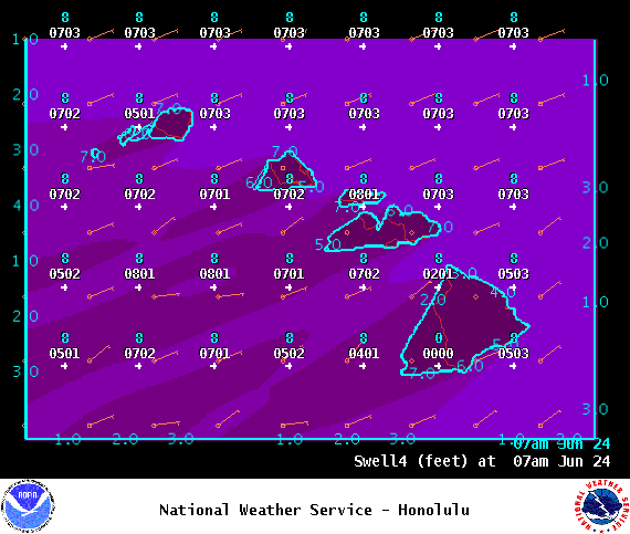
Image: NOAA
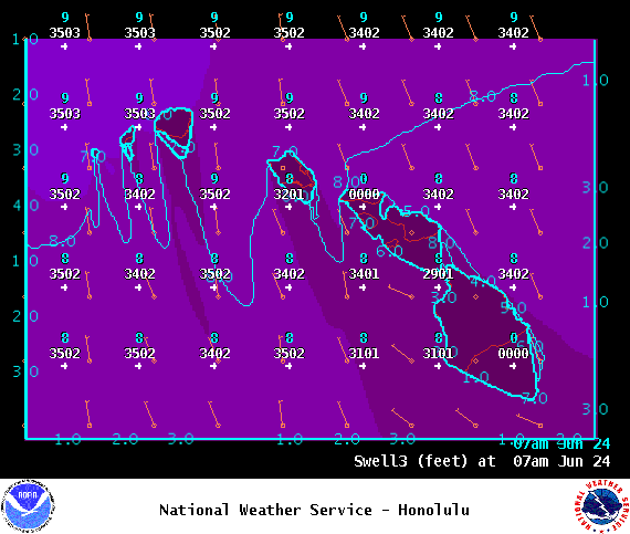
Image: NOAA
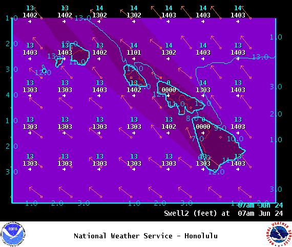
Image: NOAA
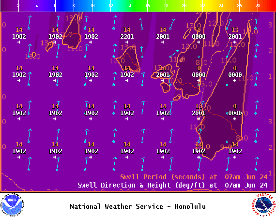
Image: NOAA
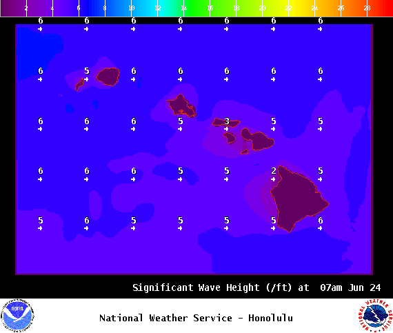
Image: NOAA

Image: NOAA
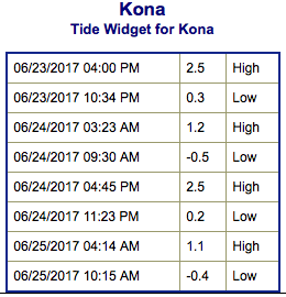
Image: NOAA
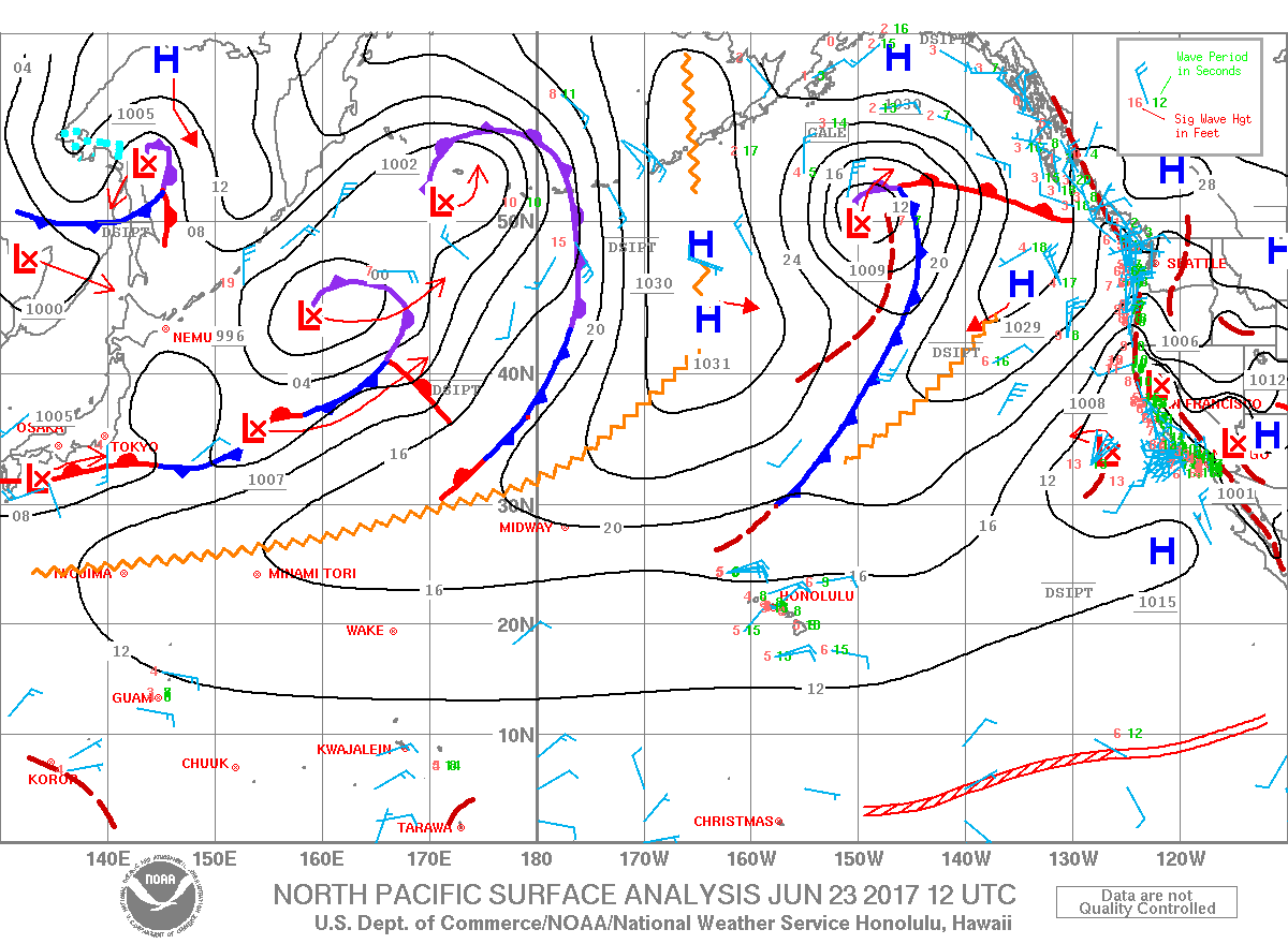
Image: NOAA
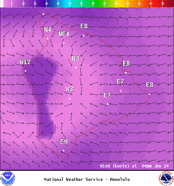
Image: NOAA
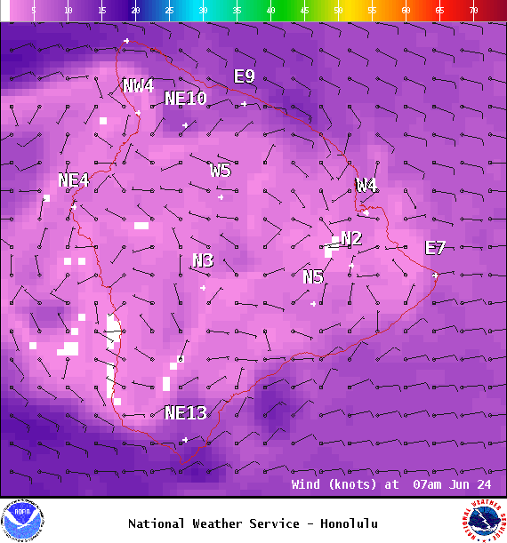
Image: NOAA
Sponsored Content


