

Thursday Morning Big Island Surf Report

Image: Malika Dudley
Alerts (as of 1:00 a.m.)
There are no weather alerts posted at this time.
**Click directly on the images below to make them larger. Charts include: Big Island projected winds, tides, swell direction & period and expected wave heights.**
Big Island Surf Forecast
Hilo side: Surf heights are expected to be ankle/waist high today or less.
Kona side: Wave heights are expected to be ankle/knee high.
South: Wave heights are expected to be ankle/knee high.
All shores should remain well below advisory level today. No significant south swells are expected through mid-month. Possibly a swell expected around the 17th, will keep an eye on the models.
Trade winds are easing so the east swell are easing as a result.
Nothing expected out of the north either.
Keep in mind, surf heights are measured on the face of the wave from trough to crest. Heights vary from beach to beach, and at the same beach, from break to break.
**Click here for your detailed Big Island weather report.**
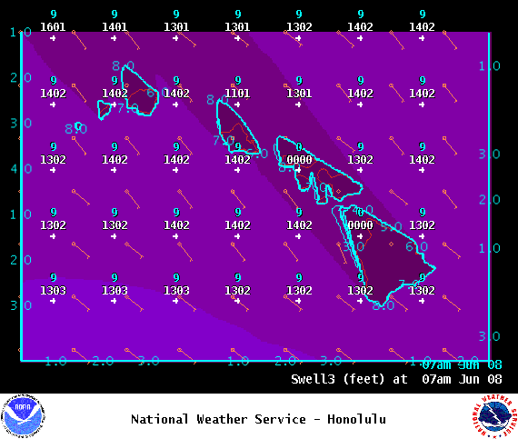
Image: NOAA
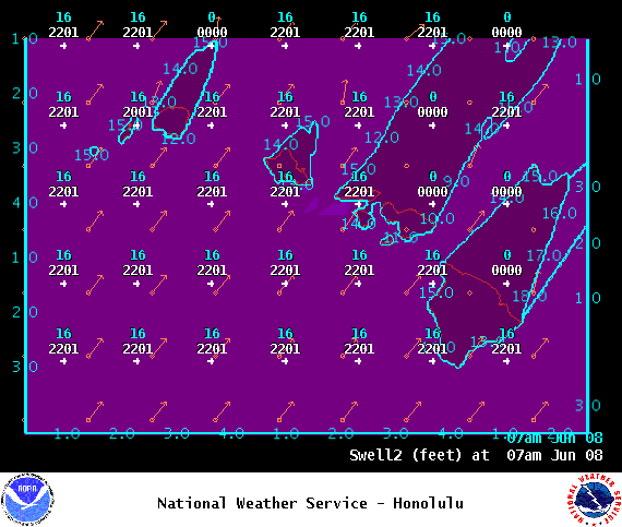
Image: NOAA
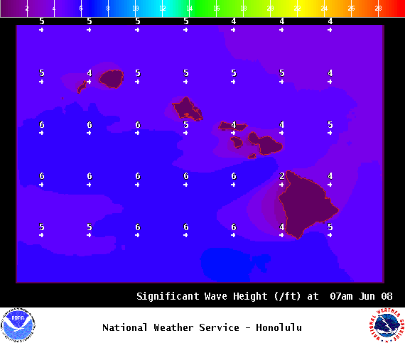
Image: NOAA
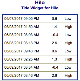
Image: NOAA
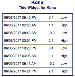
Image: NOAA
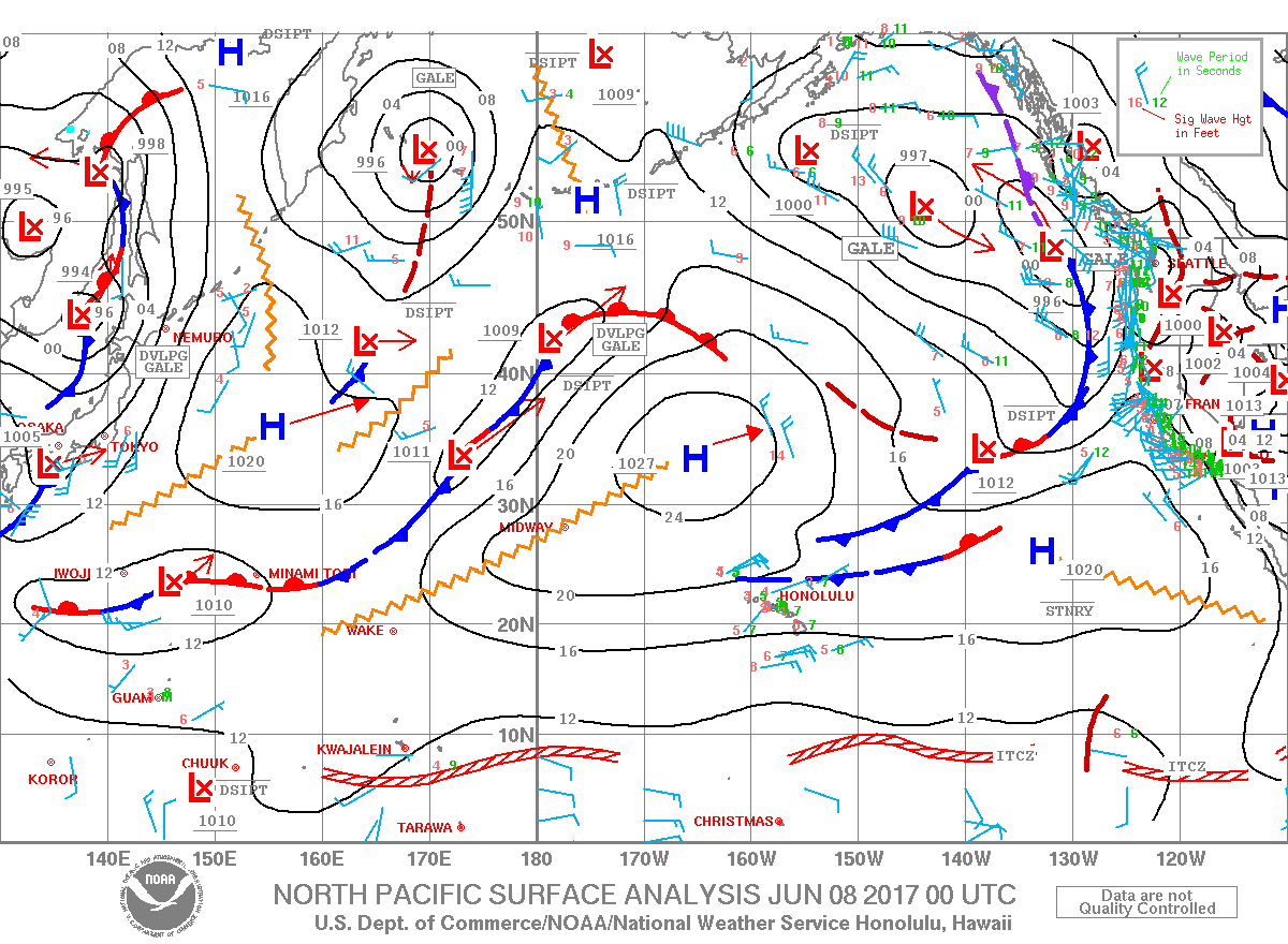
Image: NOAA

Image: NOAA
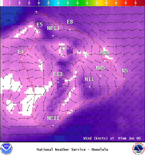
Image: NOAA
Sponsored Content


