

Late Season NW Swell Peaks Today

Image: James Grenz
Alerts (as of 1:00 a.m.)
There are no marine alerts posted at this time.
**Click directly on the images below to make them larger. Charts include: Big Island projected winds, tides, swell direction & period and expected wave heights.**
Big Island Surf Forecast
Hilo side: Wave heights are forecast to be head high to slightly overhead today.
Kona side: Wave heights are expected to be knee/thigh high today.
South: Wave heights are expected to be knee/thigh high today.
A longer-period late season northwest swell is expected to peak Monday and ease Wednesday.
Pretty quiet out of the South Pacific until about May 12th when we could see a little bump from storms that are expected near New Zealand the next few days. Will keep an eye on it.
Keep in mind, surf heights are measured on the face of the wave from trough to crest. Heights vary from beach to beach, and at the same beach, from break to break.
**Click here for your detailed Big Island weather report.**
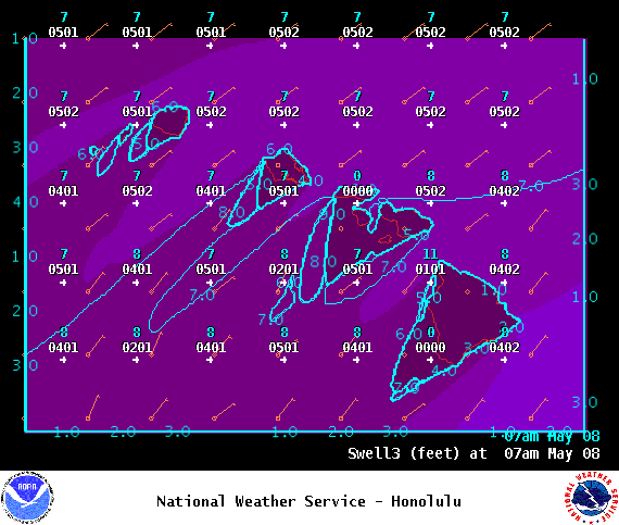
Image: NOAA

Image: NOAA
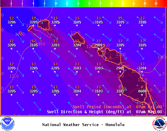
Image: NOAA
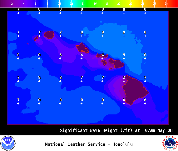
Image: NOAA

Image: NOAA
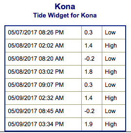
Image: NOAA
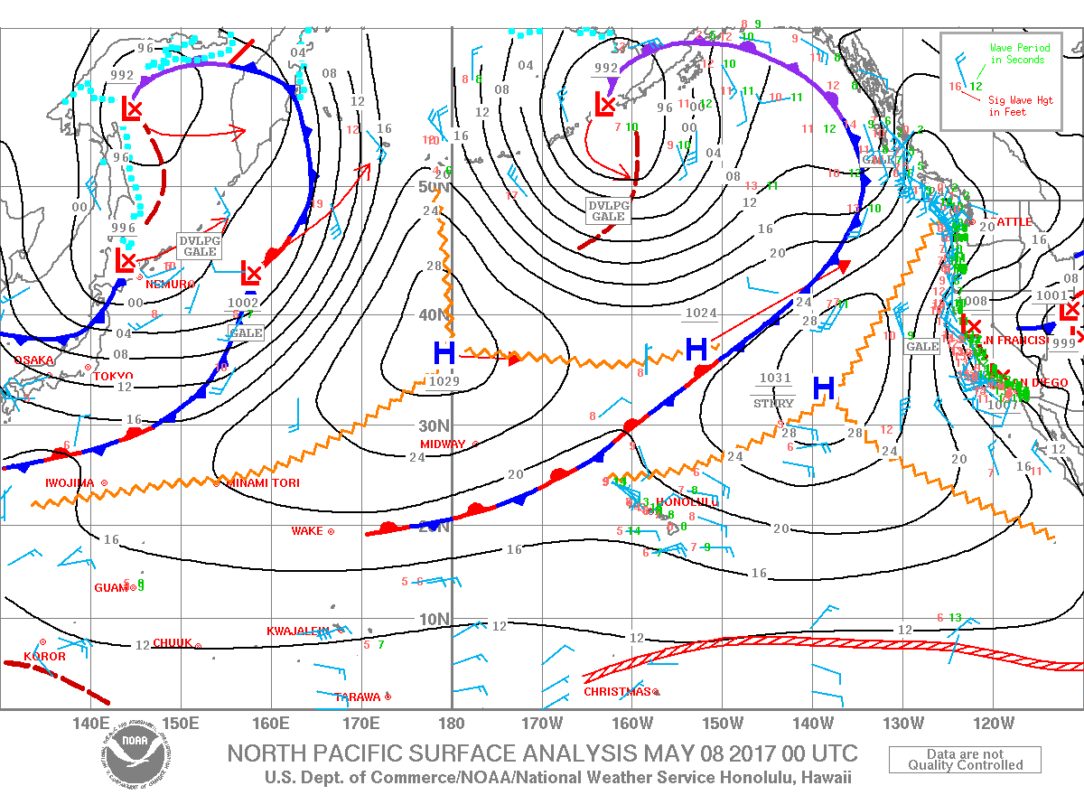
Image: NOAA
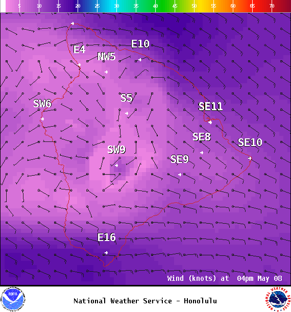
Image: NOAA

Image: NOAA
Sponsored Content


