

Hot, Hazy & Humid on Big Island Today

Image: James Grenz
Alerts (as of 1:00 a.m.)
There are no weather alerts posted at this time.
**Click directly on the images below to make them larger. Charts include: Big Island high/low forecasted temperatures, projected winds, chance of cloud cover, projected localized weather conditions, vog/SO2 forecast and expected wave heights.**
Looking Ahead
A front north of the state is expected to block trade winds which will result in light southeast winds through Monday. Breezier trades are forecast for Tuesday as the front moves away from the islands with a wetter than usual trade wind pattern for the rest of the week.
Today
We expect southeast winds around 10 to 15 mph with afternoon sea breezes. High temperatures are forecast from 80° to 85°. Partly sunny skies with with scattered windward showers. For the Kona side, sunshine in the morning with building clouds in the afternoon and showers likely during that time. Haze is expected throughout the day.
UV index at 13 (“extreme” exposure level)
Tonight
Variable winds are forecast around 10 to 15 mph with nighttime land breezes. Mostly cloudy skies with scattered windward showers and clearing for the Kona side. Low temperatures from 70° to 75°.
Our Big Island Now Weather homepage always includes daily: Sunrise | Sunset | Moonrise | Moonset | Moon Phase | Live Weather Cams | 5-day Forecast | Current Temperature & Conditions
**Click here for your detailed Big Island surf report.**

Image: NOAA

Image: NOAA

Image: NOAA

Image: NOAA
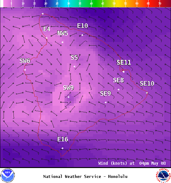
Image: NOAA

Image: NOAA
Image: NOAA
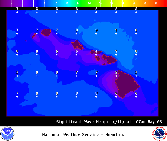
Image: NOAA
Sponsored Content


