

Weather Expected to Gradually Improve Through Midweek

Image: James Grenz
Alerts (as of 1:00 a.m.)
**Click directly on the images below to make them larger. Charts include: Big Island high/low forecasted temperatures, projected winds, chance of cloud cover, projected localized weather conditions, vog/SO2 forecast and expected wave heights.**
Looking Ahead
The upper level disturbance is forecast to weaken and slowly move away from the islands through the middle of the week. Meanwhile, a stationary front is forecast to weaken and push west as well. We should see a gradual improving trend in our weather through midweek.
A warm, moist, humid airmass near the Big Island is expected to spread up the chain, in contrast to the cool temperatures we had over the weekend.
Today
We expect southeast winds today around 10 to 20 mph. High temperatures are forecast from 79° to 84°. Mostly cloudy skies with showers likely during the day and a slight chance of thunderstorms.
UV index at 11 (“extreme” exposure level)
Tonight
Southeast winds are forecast around 15 to 20 mph. Mostly cloudy skies with scattered showers. Low temperatures from 69° to 74°.
Our Big Island Now Weather homepage always includes daily: Sunrise | Sunset | Moonrise | Moonset | Moon Phase | Live Weather Cams | 5-day Forecast | Current Temperature & Conditions
**Click here for your detailed Big Island surf report.**

Image: NOAA

Image: NOAA

Image: NOAA

Image: NOAA
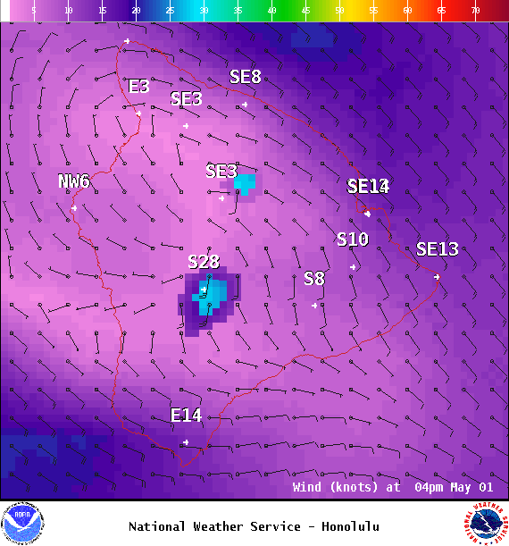
Image: NOAA

Image: NOAA

Image: NOAA

Image: NOAA
Sponsored Content


