

New SSW Swell Expected to Fill in Today
 Alerts (as of 1:00 a.m.)
**Click directly on the images below to make them larger. Charts include: Big Island projected winds, tides, swell direction & period and expected wave heights.**
Big Island Surf Forecast
Hilo side: Wave heights are forecast to be head high to overhead today.
Kona side: Wave heights are expected to be waist/chest high today. The best breaks could get up to shoulder high on the sets.
South: Wave heights are expected to be waist/chest high today. The best breaks could get up to shoulder high on the sets.
A longer-period late season northwest swell is expected to fill in May 8th. Pending development of the storm around May 3rd – 5th. Will keep an eye on it.
A reinforcing south-southwest swell is forecast to fill in Monday and Tuesday, and keep surf borderline for advisory conditions. This swell energy is forecast to ease Wednesday into the end of the week.
Keep in mind, surf heights are measured on the face of the wave from trough to crest. Heights vary from beach to beach, and at the same beach, from break to break.
**Click here for your detailed Big Island weather report.**
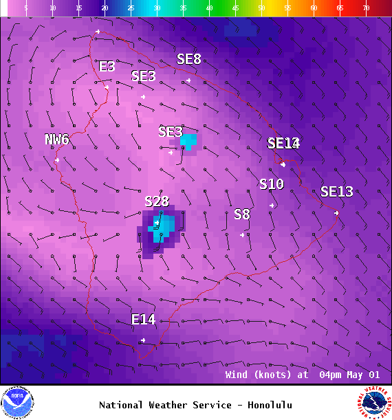
Image: NOAA

Image: NOAA

Image: NOAA
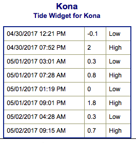
Image: NOAA

Image: NOAA

Image: NOAA
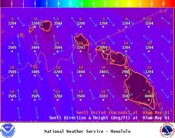
Image: NOAA

Image: NOAA
Sponsored Content


